- Home
- :
- All Communities
- :
- Developers
- :
- Native Maps SDKs
- :
- .NET Maps SDK Questions
- :
- Re: Zooming beyond native resolution
- Subscribe to RSS Feed
- Mark Topic as New
- Mark Topic as Read
- Float this Topic for Current User
- Bookmark
- Subscribe
- Mute
- Printer Friendly Page
Zooming beyond native resolution
- Mark as New
- Bookmark
- Subscribe
- Mute
- Subscribe to RSS Feed
- Permalink
- Report Inappropriate Content
Is this not something ArcGIS can do?
For example, USA Topo Maps has a native resolution up to level 15.
Suppose you want to zoom into 17 or 19.
But it won't let you zoom any farther than 15.
Are there other properties I am missing?
There are a few good reasons why we'd want to do this:
-Vector layers will have more resolution to zoom in.
-Offline tiled maps are likely to have a limited range of scale.
-Its better to see a stretched image than nothing at all, or not being allowed to zoom in.
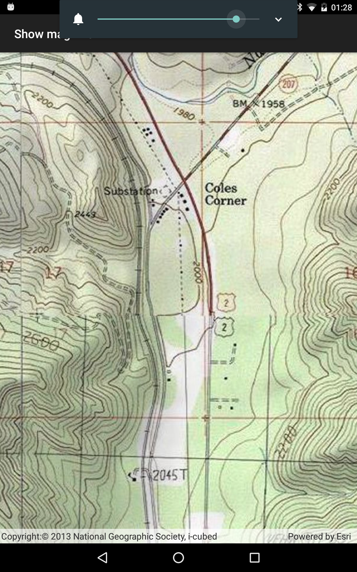
This is what the map looks like at 15

Here is what the map looks like at 19. Doesn't look different, does it? That's because it didn't let us zoom that far.
Then we run across the example of the min and max scale.
We thought we'd be smart and set min=1 and max=400000.
Now we can zoom in. And see nothing.

ArcGIS.com seems to have the same limitations:
http://www.arcgis.com/home/webmap/viewer.html?webmap=931d892ac7a843d7ba29d085e0433465
- Mark as New
- Bookmark
- Subscribe
- Mute
- Subscribe to RSS Feed
- Permalink
- Report Inappropriate Content
Hi Nathan,
I believe you could use ArcGISTiledLayer.NoDataTileBehavior to resample the tile layer where the LODs aren't available.
ArcGISTiledLayer Class --> NoDataTileBehavior
ImageTiledLayer.NoDataTileBehavior Property
Hope that helps.
Nagma
- Mark as New
- Bookmark
- Subscribe
- Mute
- Subscribe to RSS Feed
- Permalink
- Report Inappropriate Content
That is what I am looking for.