- Home
- :
- All Communities
- :
- Developers
- :
- Native Maps SDKs
- :
- .NET Maps SDK Questions
- :
- Re: Scale Dependent Symbology for FeatureLayers
- Subscribe to RSS Feed
- Mark Topic as New
- Mark Topic as Read
- Float this Topic for Current User
- Bookmark
- Subscribe
- Mute
- Printer Friendly Page
Scale Dependent Symbology for FeatureLayers
- Mark as New
- Bookmark
- Subscribe
- Mute
- Subscribe to RSS Feed
- Permalink
- Report Inappropriate Content
Hello,
I'm looking for some information on Scale Dependent Symbology for FeatureLayers. For example, as the user zooms in or out, the symbol size is drawn relative to the view scale and it basically gets bigger or smaller in these cases. Now, when I load a map and zoom in or out, the symbol stays the same size on the map.
Is it possible to setup this type of scale dependent symbol rendering?
Thanks,
Mike...
- Mark as New
- Bookmark
- Subscribe
- Mute
- Subscribe to RSS Feed
- Permalink
- Report Inappropriate Content
Hey Michael Hamsa, I don't think we support that workaround for text. The examples I've seen have different layers for labeling defined at different scale ranges. Sorry I don't have a better answer for you!
Nick
- Mark as New
- Bookmark
- Subscribe
- Mute
- Subscribe to RSS Feed
- Permalink
- Report Inappropriate Content
Nick,
I really appreciate the information – I figured that was the case. I think we will just need to want until the Runtime supports reference scale capabilities.
Any ideas on the timing? I’ve taken a look at 100.4 and it does not look like that made it in this release. This is something that’s pretty important for us right now.
Thanks again,
Mike Hamsa
Chief Technology Officer - GeoSpatial Innovations, Inc.
P: 512-982-6735
- Mark as New
- Bookmark
- Subscribe
- Mute
- Subscribe to RSS Feed
- Permalink
- Report Inappropriate Content
Appreciate your patience Michael Hamsa,
My reply above still stands: we're gunning for the next release of Runtime, in Q1/Q2 timeframe next year.
Cheers,
Nick.
- Mark as New
- Bookmark
- Subscribe
- Mute
- Subscribe to RSS Feed
- Permalink
- Report Inappropriate Content
Hi Nick,
Has there been any progress on this? I am trying to publish a mobile map package for offline use. All the point features display correctly and will scale with the map, but the lines and polygons are only drawn at the initial extent they turn on in the map then blur. I've tried both setting a map scale and using arcade for the symbology. Any help would be appreciated.
Thanks,
Gavin Runyon
GIS Specialist
Helix Water District
- Mark as New
- Bookmark
- Subscribe
- Mute
- Subscribe to RSS Feed
- Permalink
- Report Inappropriate Content
Hi Gavin,
Runtime 100.5 introduced Reference Scale. You should be able to set the map's reference scale and Runtime will read and honor that when working with an MMPK created using that map. See Map reference scales—Properties of maps | ArcGIS Desktop. There should no longer be any need to use the Arcade simulation of reference scale.
There are also APIs on FeatureLayer and on the Map to control reference scale programatically.
A line should certainly not blur, although if the layer is set to render in static mode it will blur while you zoom, but as soon as you release the map and stop interacting, it will redraw appropriately.
Which version of Runtime are you using?
Nick.
- Mark as New
- Bookmark
- Subscribe
- Mute
- Subscribe to RSS Feed
- Permalink
- Report Inappropriate Content
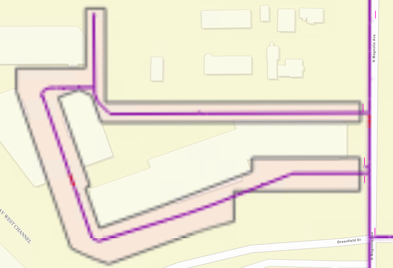
I am using Explorer for ArcGIS Beta 19.1.293 on Windows. I thought it ran on 100.5. Here's what it looks like after zooming in a couple of extents from when the layer first displays.
- Mark as New
- Bookmark
- Subscribe
- Mute
- Subscribe to RSS Feed
- Permalink
- Report Inappropriate Content
Interesting. Let me pass that on to the Explorer team to confirm versions. We had a bug like that where the rendering pipeline would hang under certain conditions though it was fixed.
- Mark as New
- Bookmark
- Subscribe
- Mute
- Subscribe to RSS Feed
- Permalink
- Report Inappropriate Content
Thanks Nick, appreciate the help and quick responses.
- « Previous
-
- 1
- 2
- Next »
- « Previous
-
- 1
- 2
- Next »