- Home
- :
- All Communities
- :
- Developers
- :
- Native Maps SDKs
- :
- .NET Maps SDK Questions
- :
- Re: How to remove labels / details from basemap
- Subscribe to RSS Feed
- Mark Topic as New
- Mark Topic as Read
- Float this Topic for Current User
- Bookmark
- Subscribe
- Mute
- Printer Friendly Page
How to remove labels / details from basemap
- Mark as New
- Bookmark
- Subscribe
- Mute
- Subscribe to RSS Feed
- Permalink
- Report Inappropriate Content
Hello, I'm using the latest SDK to create a simple UWP app in Visual Studio C# 2017.
What I would like is for the app to display a very basic map, just land in one colour and sea in another plus country boundaries. This is sort of achieved if I select, for example, CreateLightGrayCanvasVector as my basemap.
But, that still has a lot of things on it that I don't want, such as city and country labels and roads / build up areas.
Is there any way to remove these features using code and to just retain the basic map? I presume that this can be done with MyMap.Map.Basemap.ReferenceLayers but I'm unsure how it works.
Any help would be greatly appreciated.
- Mark as New
- Bookmark
- Subscribe
- Mute
- Subscribe to RSS Feed
- Permalink
- Report Inappropriate Content
If I open the basemap in Desktop I notice that the reference texts (most of the texts) are in a separate layer:
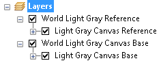
I guess you could switch that layer "World Light Gray Reference" off to get less details
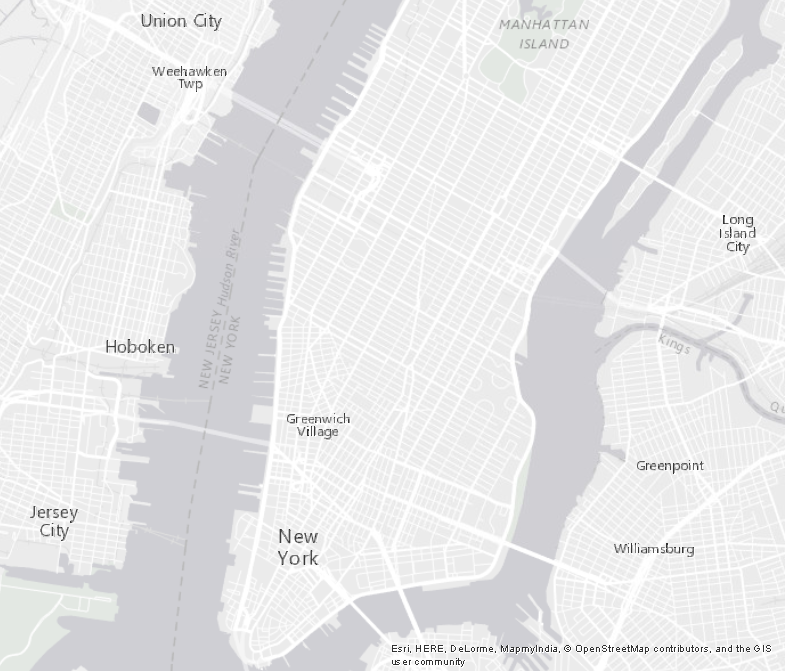
With reference:
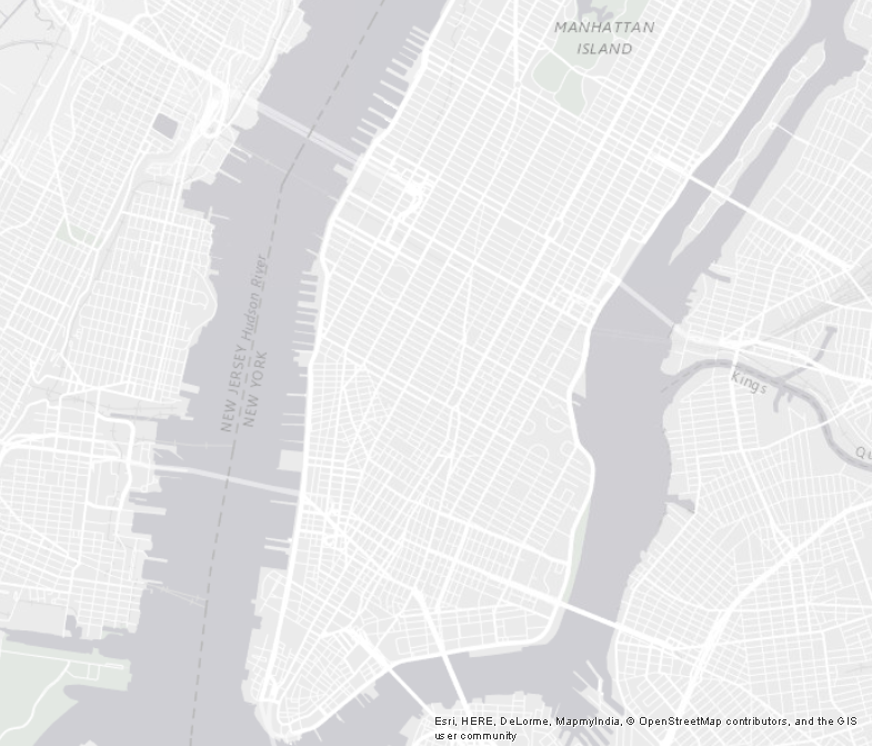
Without reference:
- Mark as New
- Bookmark
- Subscribe
- Mute
- Subscribe to RSS Feed
- Permalink
- Report Inappropriate Content
Thanks. I'm unsure how to disable the layer, though. Is there a guide to how to identify and switch off a layer in the basemap?
- Mark as New
- Bookmark
- Subscribe
- Mute
- Subscribe to RSS Feed
- Permalink
- Report Inappropriate Content
Sorry, not sue if I can help you with that, but if you are using WPF, maybe this would be a place to start: Basemap.ReferenceLayers Property which is a property of the Basemap Class
... and this is where the guides are: Developer's guide—ArcGIS Runtime SDK for .NET (WPF) | ArcGIS for Developers and this one is specific to using Basemaps: Use ArcGIS basemaps—ArcGIS Runtime SDK for .NET (WPF) | ArcGIS for Developers (although I don't see a part that switched a sublayer off).
Code samples can be found here: ArcGIS Runtime SDK for .NET Samples—ArcGIS Runtime SDK for .NET Samples | ArcGIS for Developers