- Home
- :
- All Communities
- :
- Developers
- :
- Native Maps SDKs
- :
- .NET Maps SDK Questions
- :
- Collision between TiledLayer and GraphicsLayer
- Subscribe to RSS Feed
- Mark Topic as New
- Mark Topic as Read
- Float this Topic for Current User
- Bookmark
- Subscribe
- Mute
- Printer Friendly Page
Collision between TiledLayer and GraphicsLayer
- Mark as New
- Bookmark
- Subscribe
- Mute
- Subscribe to RSS Feed
- Permalink
- Report Inappropriate Content
Hi.
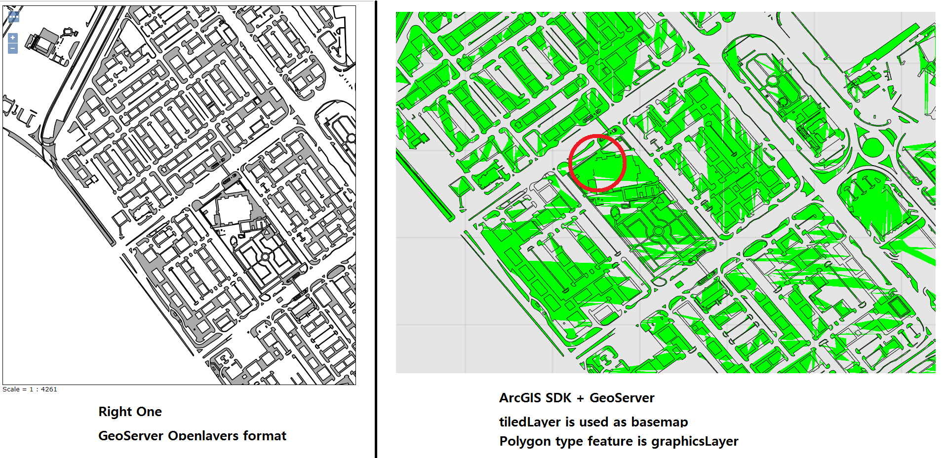
I want to use ArcGIS Runtime SDK v10.2.7 for .Net using GeoServer. But I have some problem.
my problem is collision between TiledLayer class and GraphicsLayer.
Below is my process.
First, I received WMTS from Geoserver and convert WmtsLayer to TiledLayer.
also, I added this Tiledlayer to MyMapView. TiledLayer is used in MyMapView as Basemap.
It works well.
Second, I received WFS from Geoserver, then I parse this service (WFS) to self-developed class.
I can receive coordinates(lat,long) and other information. it works well too.
Third, I converted Parsed class(self-developed class) to GraphicsLayer. after then, I add this GraphicsLayer to MyMapView. It also works good.
However, I think collision between TiledLayer and GraphicsLayer happens.
When I use Polygon type as GraphicsLayer, some coordinates don't work.
there were many trials for long time. Please reply answer about this problem.
p.s) I attach picture about right one and wrong one. some coordinates are not displayed in MapView.
Thanks,