- Home
- :
- All Communities
- :
- Products
- :
- ArcGIS Production Mapping
- :
- ArcGIS Production Mapping Questions
- :
- Does both Geographical Coordinate System and Proje...
- Subscribe to RSS Feed
- Mark Topic as New
- Mark Topic as Read
- Float this Topic for Current User
- Bookmark
- Subscribe
- Mute
- Printer Friendly Page
Does both Geographical Coordinate System and Projection Coordinate System displayed on ArcGIS layout Map without any Distortion of Map ?
- Mark as New
- Bookmark
- Subscribe
- Mute
- Subscribe to RSS Feed
- Permalink
- Report Inappropriate Content
Hi..! everyone Please stay a live without affected by COVID-19 !
I am Mujuni Desdery ,Cartographer at Geological Survey of Tanzania,
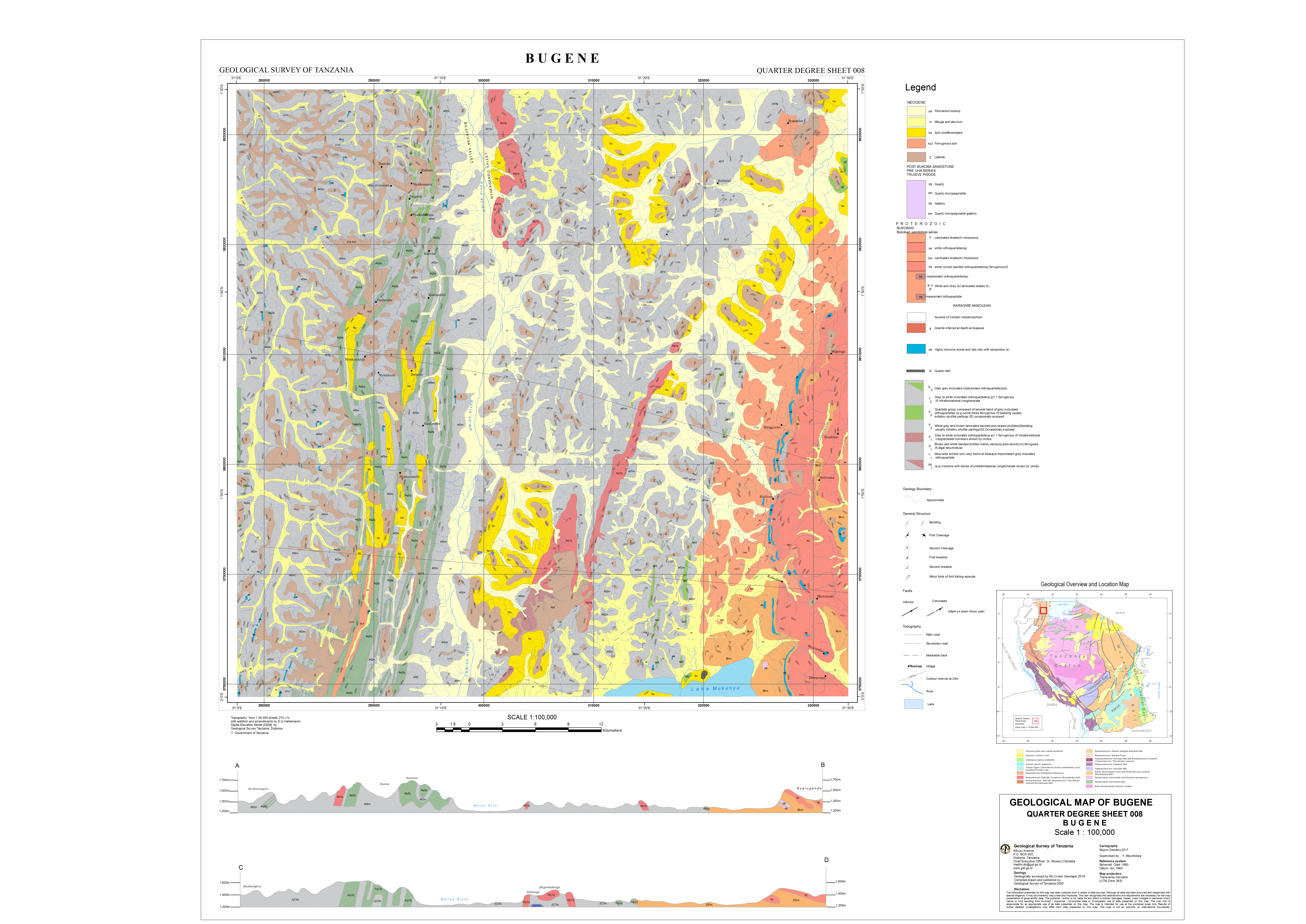
For many years I have been suffering how to display both GCS & PCS at ArcGIS Layout
Above Image show Both GCS & PCS at one corner of my Map,However there is error of Cartographic grammar in Geology Map ,(indicated a gap of number 1 ) in Geology Map there no need a gap at Neatline,due to the next adjacent Geology map, It should fixed in neat line at Layout
I fixed a gap by tightly a map with Neatline(margin line) .Ever look next image below whats happen
Labelled no 2 , GCS corner coordinate jumped/shift to other part of Map
Labelled no. 3 , cause to apply graphic or manual coordinate to place missing labelled GCS
Indicator line no 4, show a place missing GCS at its position to be .
However PCS looks okay
.....I am worry may be a ArcGIS Layout neatline is rectangular not curved as natural Latitude & Longtitudal line is curved in nature... graticule line..
I am using licenced ArcGIS Software version 10.7
GCS_Arc_1960
WKID: 4210 Authority: EPSG
and
Arc_1960_UTM_Zone_36S
WKID: 21036 Authority: EPSG
recommend in my Country(Tanzania)
Geological Map sheets in Tanzania are total of 322 both width & Length are 30 minutes
and all sheets has a common problem mention above
Please refer whole Geological Map and its 4 Corner point where problem occur

1st Corner Point before displayement of GCS occur but a gap to neatline appeared and its not needed in Geological map to allow adjacent next geology map to join & futhermore Geocoding Raster
Otherwise you can refer link for Vector data & its Mxd layout map ,http://www.arcgis.com/home/item.html?id=ab3406f7563d4b5cbae13c88fd098009
@https://www.esri.com/arcgis-blog/author/heat8324-2/
Aditya PeriAlexandra GajewskiAndrew RossAllen ThompsonEmily NortonJon FisknessHuailin wang ,Heather Smith
- Mark as New
- Bookmark
- Subscribe
- Mute
- Subscribe to RSS Feed
- Permalink
- Report Inappropriate Content
To be honest, I have a hard time understanding the problem from your explanation. For now, I would like to point out some of ESRI's Heather Smith's recent blog post about coordinate systems, that may be of some help in understanding differences between GCS and PCS etc.:
Geographic vs Projected Coordinate Systems