- Home
- :
- All Communities
- :
- Products
- :
- ArcGIS Pro
- :
- ArcGIS Pro Questions
- :
- Set Distance Unit to Degrees in Measure Tool (ArcG...
- Subscribe to RSS Feed
- Mark Topic as New
- Mark Topic as Read
- Float this Topic for Current User
- Bookmark
- Subscribe
- Mute
- Printer Friendly Page
Set Distance Unit to Degrees in Measure Tool (ArcGIS Pro)
- Mark as New
- Bookmark
- Subscribe
- Mute
- Subscribe to RSS Feed
- Permalink
- Report Inappropriate Content
Is it possible to set the distance unit in the measure tool to degrees/DMS?
As far as I know it isn't possible, but was wondering if anyone had managed to do this or found a workaround.
- Mark as New
- Bookmark
- Subscribe
- Mute
- Subscribe to RSS Feed
- Permalink
- Report Inappropriate Content
you can measure values as : geodesic, planar, loxodromic or great elliptic
with the units in variants of planar or Imperial (eg meters, feet etc)
as you have probably already surmised.
You are looking for differences in coordinates I guess.
The measure results will give you a net bearing but not a difference in the two locations in degrees or DMS
I can only guess that the possible reason it is excluded is so that people don't try to record "distance" or "area" degrees or degrees squared. Those are pretty useless measures since they don't represent the same physical property as you move poleward.
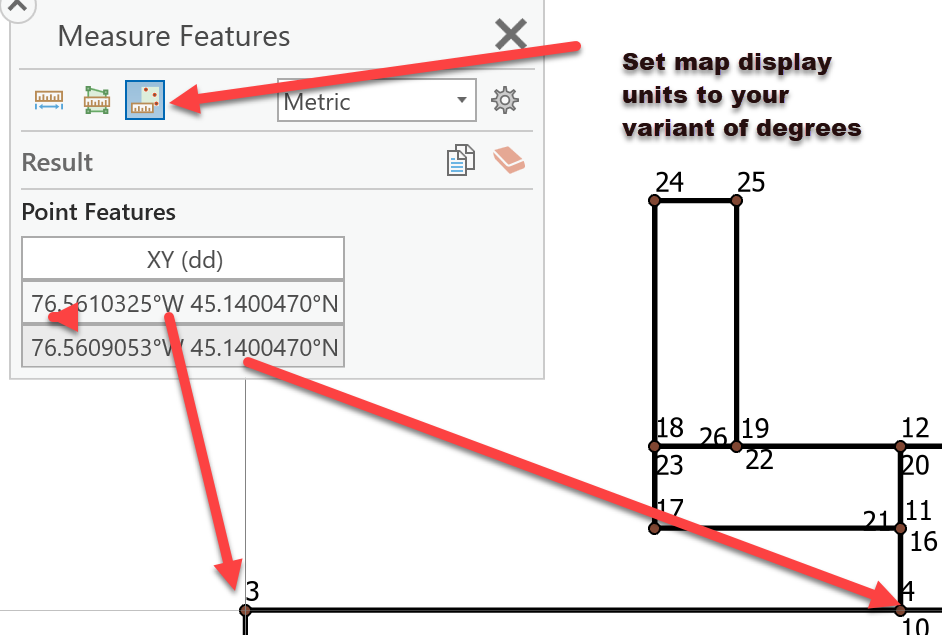
Addendum
You can use the Measure Features option rather than the measure length or area.
Below is an example where I set the display units of a planar map (MTM projection) to Decimal Degrees.
I clicked on two locations and the locational information is recorded.
If you want to :do the math" you can copy the results elsewhere