- Home
- :
- All Communities
- :
- Products
- :
- ArcGIS Pro
- :
- ArcGIS Pro Questions
- :
- Scale-based style change for a line
- Subscribe to RSS Feed
- Mark Topic as New
- Mark Topic as Read
- Float this Topic for Current User
- Bookmark
- Subscribe
- Mute
- Printer Friendly Page
Scale-based style change for a line
- Mark as New
- Bookmark
- Subscribe
- Mute
- Subscribe to RSS Feed
- Permalink
How can I change the style for a line lets say the colour changes for a road when the scale is changing in preparation for a multi-scale Vector Tile Map? Any help would be great.
Pierre
- Mark as New
- Bookmark
- Subscribe
- Mute
- Subscribe to RSS Feed
- Permalink
Pierre,
Check out almost at the bottom of this article:
Modify symbols—ArcGIS Pro | ArcGIS for Desktop
You can also reduce the size of symbols at smaller scales to reduce visible density when a map is viewed at smaller scales. To use scale-based sizing, check Enable scale-based sizing. A slider appears below the Size property for point symbols, the Line width property for line symbols, and the Outline width property for polygon symbols to control the size at different map scales.
Scale-based sizing is only available in maps. It is not available in scenes. To learn more about scale-based symbol sizing and authoring multiscale maps, see Author a multiscaled map
- Mark as New
- Bookmark
- Subscribe
- Mute
- Subscribe to RSS Feed
- Permalink
Adrian,
I'd like to change the colour of a line rather than changing the width. Unfortunately Esri's help does not cover that.
- Mark as New
- Bookmark
- Subscribe
- Mute
- Subscribe to RSS Feed
- Permalink
I would have created a Group layer consisting of multiple layers (of same feature class) visible at different scales and desired symbology for each layer.
Displaying layers at certain scales—Help | ArcGIS for Desktop
Think Location
- Mark as New
- Bookmark
- Subscribe
- Mute
- Subscribe to RSS Feed
- Permalink
Jayanta,
thanks for the help. It looks like I need to do it the old way like I did in ArcMap for our raster tile layer map in the past. I thought with ArcGIS Pro there is now a more elegant way.
Thanks
Pierre
- Mark as New
- Bookmark
- Subscribe
- Mute
- Subscribe to RSS Feed
- Permalink
In ArcGIS Pro there is Scale Range Symbology (see Refine the visible scale ranges for symbol classes), which I think would achieve what you want; but unfortunately, it doesn't apply to vector tile layers brought into Pro. Vector tiles are great, but Esri's implementation and adoption are still quite immature. I look forward to them continuing the expand both, hopefully.
- Mark as New
- Bookmark
- Subscribe
- Mute
- Subscribe to RSS Feed
- Permalink
I've discovered a workaround for this, but it's kind of hacky:
- Change the symbology to Unique Values (from Single Symbol, which I assume you're using here).
- For the value field, choose one that has the fewest possible values.
- Add all the values.
- Select all of them, and group into a single group.
This gives you access to the 'alternate symbol' feature. First switch to scale range view (using this button:  ). Then the alternate symbol button appears (
 ). It's straightforward from there, or you can read more details on this feature under the Show different symbols at different scales heading here: Scale-based symbol classes—ArcGIS Pro | ArcGIS Desktop
Once the vector tile layer is published, you can edit the JSON style file manually to do it the right way (symbolize a single layer using scale stops for color and size). More: Update vector tile layer style—ArcGIS Online Help | ArcGIS
- Mark as New
- Bookmark
- Subscribe
- Mute
- Subscribe to RSS Feed
- Permalink
Has there been any change to this in later versions of Pro? I'm still using 2.2 and have found no better way than Kate's hack to show a feature with one symbology upto scale X and then with another symbology. Having to create classes for that seems silly.
- Mark as New
- Bookmark
- Subscribe
- Mute
- Subscribe to RSS Feed
- Permalink
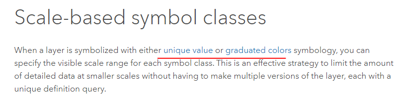
Scale-based symbol classes—ArcGIS Pro | Documentation still shows this as available only for unique value and graduated renderers:
I did find the following enhancement request which is "In Product Plan" but is not currently assigned to a release: [ENH-000123002: Allow users to set different symbology for the same layer at different map scales when using single symbol symbology.] It might be good to submit this specifically on ArcGIS Ideas to get a better gauge for demand (i.e. there is currently 1 customer interested in that enhancement + this thread...)
- Mark as New
- Bookmark
- Subscribe
- Mute
- Subscribe to RSS Feed
- Permalink
Any news with this enhancement? We need this with unique value symbology in ArcGIS Pro and to be able to publish it to ArcGIS Enterprise. Our need is for MapServices supporting WMS services. If it is possible for label classes, it should be possible for symbols. Remember this was something done with ol'ArcIMS (SCALEDEPENDENTRENDERER ). I surely can submit on ArcGIS Ideas if necessary.