- Home
- :
- All Communities
- :
- Products
- :
- ArcGIS Pro
- :
- ArcGIS Pro Questions
- :
- Raster layer in wrong place, but spatial reference...
- Subscribe to RSS Feed
- Mark Topic as New
- Mark Topic as Read
- Float this Topic for Current User
- Bookmark
- Subscribe
- Mute
- Printer Friendly Page
Raster layer in wrong place, but spatial reference is correct with other layers
- Mark as New
- Bookmark
- Subscribe
- Mute
- Subscribe to RSS Feed
- Permalink
I have two layers on my map, a grid layer and habitat model raster layer. Both have the exact same spatial reference but my Raster layer is across the county in the middle of the ocean. I projected the raster too two different projected coordinates system to double check it and its still in the wrong place.
- Mark as New
- Bookmark
- Subscribe
- Mute
- Subscribe to RSS Feed
- Permalink
If a raster or any other file, is given the wrong coordinate system using the Define Projection tool (or equivalent process), then it will never project correctly, no matter what projection you try.
How were the rasters created? from shapefile? featureclass? and what coordinate system were they in?
any other information to trace the legacy of what you have will help solve the problem
... sort of retired...
- Mark as New
- Bookmark
- Subscribe
- Mute
- Subscribe to RSS Feed
- Permalink
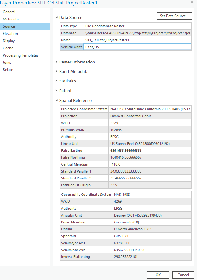
I don't know how the raster was created, if it was from shapefile or feature class. But our collaborator said the original coordinate system was NAD 1983 State Plane California V FIPS 0405 (US Feet) and the projection was Lambert Conformal Conic.
The odd thing was when I originally added the raster to a map it worked. I had downloaded it from a zipped file. Then I tried the raster projection tool to move into into our desired coordinate system and projection, and that's where it failed. So I started from scratch on a new map and added a reference shapefile with NAD 1983 State Plane California V FIPS 0405 (US Feet) and the projection was Lambert Conformal Conic, just to make sure the raster still worked. Then when I added the raster and it was in the ocean not working.
- Mark as New
- Bookmark
- Subscribe
- Mute
- Subscribe to RSS Feed
- Permalink
Ok I just re-downloaded the raster file. I have added to to a blank map and its projected coordinate system is undefined. our collaborators said to use NAD 1983 State Plane California V FIPS 0405 (US Feet) and the projection was Lambert Conformal Conic. However, we are use a grid that's in NAD 1983 (2011) Teal Albers projection.
Will it work using a raster projection tool to NAD 1983 Teal Albers?
- Mark as New
- Bookmark
- Subscribe
- Mute
- Subscribe to RSS Feed
- Permalink
Such a big shift of your dataset could be a result of wrongly defined coordinate system.
Could you share the screenshot of the Extent from the Raster Layer Properties?
Are you downloading the data from any public website? Is there a metadata available?
Think Location
- Mark as New
- Bookmark
- Subscribe
- Mute
- Subscribe to RSS Feed
- Permalink
If it has an undefined coordinate system in a blank map, you have to provide the coordinates of the raster and compare them to coordinates in a known projection for your area. For either of the coordinate systems you mention, it should be an easy task. Once you know what it is, then you can define it (Define Projection), then you can project it (Project Raster .... paying attention to raster projections details like
How the Cell Size Projection Method environment setting works—ArcGIS Pro | Documentation
... sort of retired...