- Home
- :
- All Communities
- :
- Products
- :
- ArcGIS Pro
- :
- ArcGIS Pro Questions
- :
- Proximity/near or One-to-Many-join? Best way to se...
- Subscribe to RSS Feed
- Mark Topic as New
- Mark Topic as Read
- Float this Topic for Current User
- Bookmark
- Subscribe
- Mute
- Printer Friendly Page
Proximity/near or One-to-Many-join? Best way to see closest number incidents to hospital
- Mark as New
- Bookmark
- Subscribe
- Mute
- Subscribe to RSS Feed
- Permalink
- Report Inappropriate Content
Hi, I am new to ArcGis Pro and I am struggling with the proximity/near analysis. I am trying to find the closest ambulance pick up from hospital. I have a layer with a 2k+ incidents and another with all UK's hospitals, I want to see which is the closest hospital to each incident. Something like the map below; any help/idea?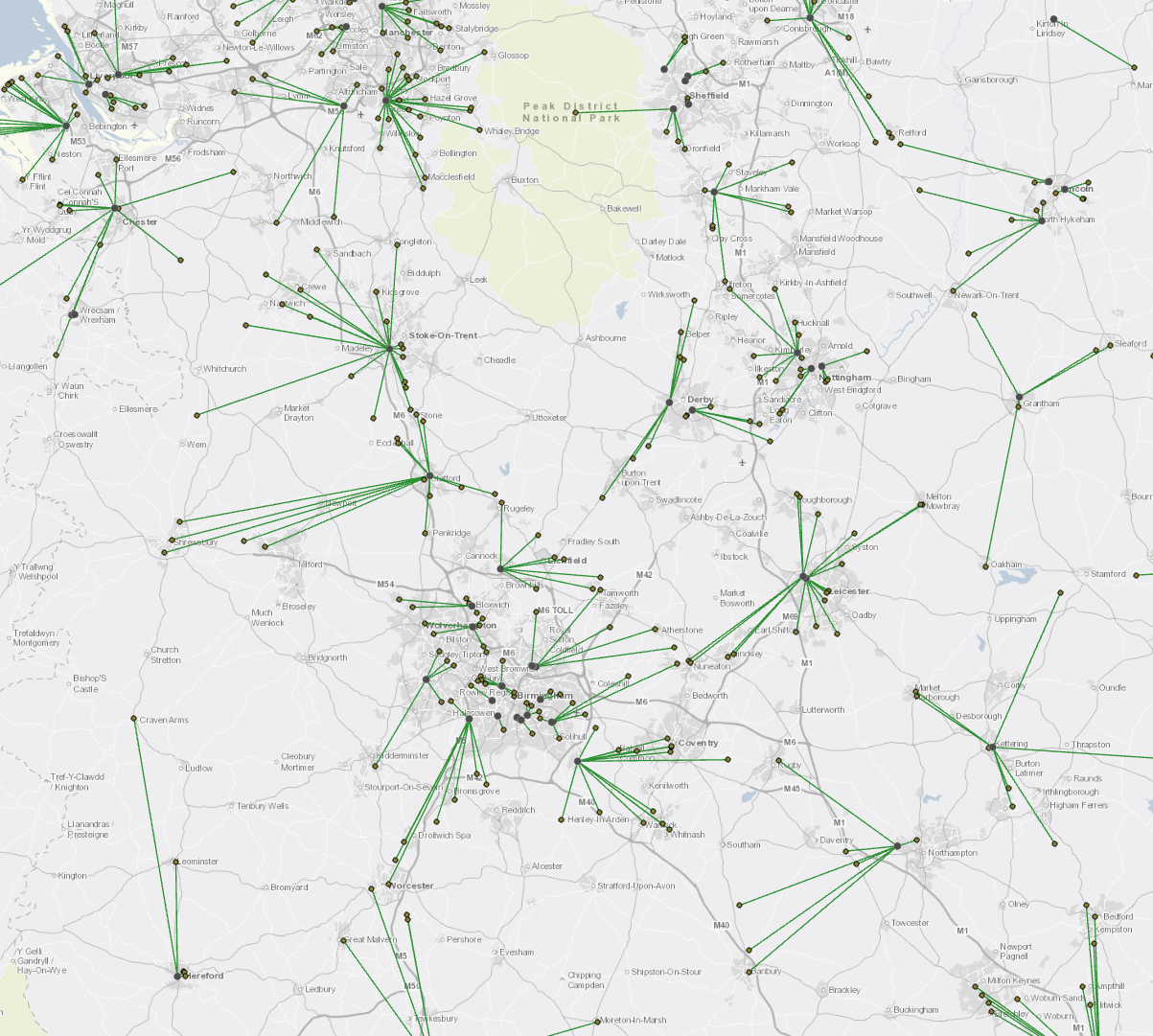
- Mark as New
- Bookmark
- Subscribe
- Mute
- Subscribe to RSS Feed
- Permalink
- Report Inappropriate Content
To determine straight line distances between hospitals and ambulances, I'd recommend the following workflow.
1. Run the NEAR geoprocessing tool with your input as ambulances and your near feature hospitals. Be sure to check the box next to Location (optional) as this will generate the XY coordinates of the closest hospital to the nearest ambulance.
2. Run the Add XY Coordinates GP tool using ambulances as the Input Features parameter.
3. Run the XY to Line GP tool with Ambulances as your Input Table, your output feature class to be written, StartX field as POINT_X, StartY Field as POINT_Y, End X Field as NEAR_X, End Y Field as NEAR_Y, Line Type as Geodesic and ID (Optional) as NEAR_ID
4. Symbolize the new layer. Now you have a Spider Diagram as listed in your question.
Hope this helps!