- Home
- :
- All Communities
- :
- Products
- :
- ArcGIS Pro
- :
- ArcGIS Pro Questions
- :
- Problems with creating cost distance raster and co...
- Subscribe to RSS Feed
- Mark Topic as New
- Mark Topic as Read
- Float this Topic for Current User
- Bookmark
- Subscribe
- Mute
- Printer Friendly Page
Problems with creating cost distance raster and cost path
- Mark as New
- Bookmark
- Subscribe
- Mute
- Subscribe to RSS Feed
- Permalink
Hi everyone!:)
I am new to GIS and currently working on some exercises as part of a study course. The task is to determine a well fitting path for a new highway. The basic input datas are:
1. Landuse (Forest, Buildings) as reclassified raster
2. Terrain slope in percent rise, also as reclassified raster
3. Two points (as vector, but converting seems difficult --> not neccessary according to teachers task description) that markup end and begin of the highway
4. Nature reserves as vector data --> must be converted to Raster by "Feature to Raster"
All rasters have the same cellsize of 12,5, because the slope raster is given with this cellsize.
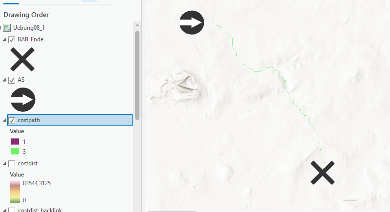
The general procedure should be, to build a weighted overlay firstly. After that, one should generate the costdist and costdist-backlink raster to build the costpath. The task is divided into two parts:
1. Performing the procedure above with an weighted Overlay only of Landuse and Terrain Slope.
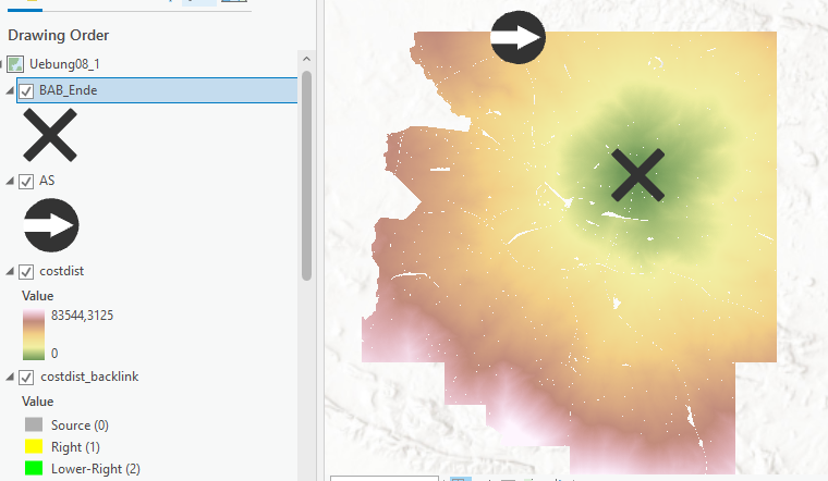
2. Performing the procedure above with an weighted Overlay of Landuse, Terrain Slope and the nature reserves.
The first part works perfectly as you can see on the screenshots. But there is a problem creating distance rasters in the second part. Unfortunately the values are very unrealistic (see attached images) and the rasters aren't even visible. Creating a path from it also doesn't show anything.
What I've tried so far:
- Different Conversion Tools (Feature to Raster, Feature to Polygon) with different fields (area, length)
- Converting the two points into rasters
- Different reclassifications
- Different weights in creating weighted overlay (only 1 % of the nature reservates raster destroys it all)
Please note the pictures for better understanding. I would be very happy, if anyone could help me with that problem!:) Thank you all!
Best regards
Niko
.PNG)
- Mark as New
- Bookmark
- Subscribe
- Mute
- Subscribe to RSS Feed
- Permalink
I found the solution: The NoData field in the nature reservate (weighted overlay) must be assigned to a value except NoData.