- Home
- :
- All Communities
- :
- Products
- :
- ArcGIS Pro
- :
- ArcGIS Pro Questions
- :
- Problems executing Spatial Join
- Subscribe to RSS Feed
- Mark Topic as New
- Mark Topic as Read
- Float this Topic for Current User
- Bookmark
- Subscribe
- Mute
- Printer Friendly Page
Problems executing Spatial Join
- Mark as New
- Bookmark
- Subscribe
- Mute
- Subscribe to RSS Feed
- Permalink
I am trying to join a shapefile with polygons (administrative are)s) to a xy event (points) but I get NULL for the variables in the shapefile. There are more points than areas, i.e. some areas have more than one point, and not all areas have points. Grateful for all suggestions! Lars
- Mark as New
- Bookmark
- Subscribe
- Mute
- Subscribe to RSS Feed
- Permalink
Are you using ArcMap or ArcGIS Pro for the Spatial Join? What methodology are you using? Pls advise.
- Mark as New
- Bookmark
- Subscribe
- Mute
- Subscribe to RSS Feed
- Permalink
Hi Robert,
I am using ArcGIS Pro. I have had the exact problem before, but I can’t for the life of me remember how I solved it. ☹
Cheers
Lars
- Mark as New
- Bookmark
- Subscribe
- Mute
- Subscribe to RSS Feed
- Permalink
make sure everything is in the same coordinate system/projection and to be safe, convert the event layer to a featureclass or shapefile
- Mark as New
- Bookmark
- Subscribe
- Mute
- Subscribe to RSS Feed
- Permalink
Do I convert the event layer before or after adding it to the map? I have tried converting it afterwards, but I cannot find the resulting .shp file.
- Mark as New
- Bookmark
- Subscribe
- Mute
- Subscribe to RSS Feed
- Permalink
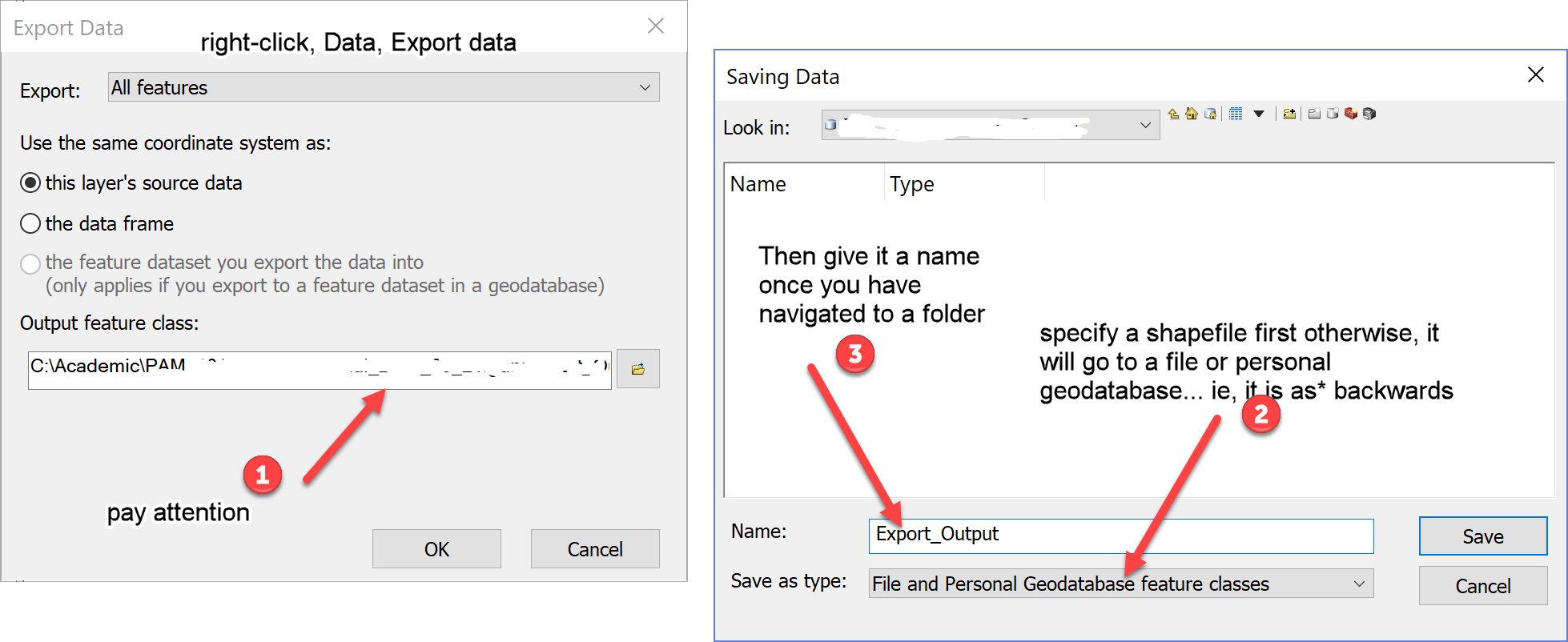
add the event layer as usual, right-click on the event layer in the table of contents, select Data, Export data... specify that you want to save to a shapefile at the bottom of that dialog (the dialog is as*-backwards) you need to specify the type first as a shapefile, otherwise it gets saved to your default geodatabase, which I take you have no clue where it is. Once you specify that you want a shapefile, navigate to an appropriate folder, and give it an appropriate name... success is in the air if the *.shp is appended to the file name that you are trying to save.
- Mark as New
- Bookmark
- Subscribe
- Mute
- Subscribe to RSS Feed
- Permalink
I am missing something. When I right click Data, I get the options Export features or Export table. When I click one of these, the program goes to geoprocessing directly. What does “as*-backwards” in your message refer to?
- Mark as New
- Bookmark
- Subscribe
- Mute
- Subscribe to RSS Feed
- Permalink
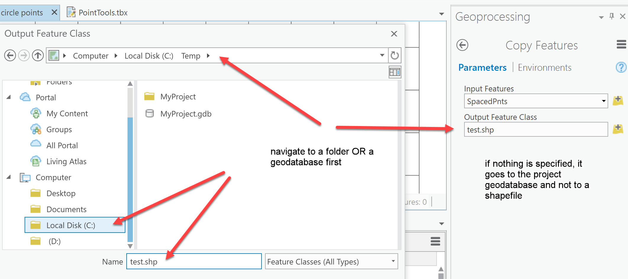
In Pro, it just uses copy features... but choose your saving location, then the filename, otherwise, it goes in the form it wants where it wants

recent versions of arcmap, from the data frame table of contents.

- Mark as New
- Bookmark
- Subscribe
- Mute
- Subscribe to RSS Feed
- Permalink
I cannot find this particular box, but with your help I found a way to solve the problem. Many thanks! Have a good weekend. /Lars