- Home
- :
- All Communities
- :
- Products
- :
- ArcGIS Pro
- :
- ArcGIS Pro Questions
- :
- Opaque land on overlay map -- what gives?
- Subscribe to RSS Feed
- Mark Topic as New
- Mark Topic as Read
- Float this Topic for Current User
- Bookmark
- Subscribe
- Mute
- Printer Friendly Page
Opaque land on overlay map -- what gives?
- Mark as New
- Bookmark
- Subscribe
- Mute
- Subscribe to RSS Feed
- Permalink
Hello all. I am stuck on a problem that impacts my VERY simplistic mapmaking.
I make static, textbook style maps in ArcGISPro. In a layout I have an overlay map with an extent indicator, a scale bar, and a compass arrow. Any points, lines, etc are populated on a "working map" layer. The layout has been fine up until this week.
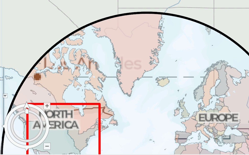
The problem is that the overlay map on the layout is see through, but only on the land. The picture below shows this: what you see is a zoomed in view that shows "Los Angeles" visible through the land, but not the oceans, in the map overlay.
All group layers with maps are 0% opaque and Layer Blends are "Normal," and the overlay is the topmost item in the contents pane. Map layers are "Charted Territory Base".
I have tried a quick fix and put a white shadow behind this to "lift" it off the map and create another layer below, but it is always offset when I print the layout as a PDF. Same as exporting.
What is happening?
Solved! Go to Solution.
Accepted Solutions
- Mark as New
- Bookmark
- Subscribe
- Mute
- Subscribe to RSS Feed
- Permalink
Hi @JohnCW
By default maps / map frames in a layout do not have a background set.
If you have a few of them overlapping, and set the content of a map to be semi transparent, the bottom frames will show through. In your case you may have tweaked the basemap or another layer recently and exposed the issue.
To fix it make sure to give any maps/frames that are ' on top' of others a solid background.
- Mark as New
- Bookmark
- Subscribe
- Mute
- Subscribe to RSS Feed
- Permalink
This is great. I played around and found a "hack" where I put a very light grey circle behind the overlay, but this is better. Thanks so much!