Turn on suggestions
Auto-suggest helps you quickly narrow down your search results by suggesting possible matches as you type.
Cancel
- Home
- :
- All Communities
- :
- Products
- :
- ArcGIS Pro
- :
- ArcGIS Pro Questions
- :
- Network analysis of green availability in urban ar...
Options
- Subscribe to RSS Feed
- Mark Topic as New
- Mark Topic as Read
- Float this Topic for Current User
- Bookmark
- Subscribe
- Mute
- Printer Friendly Page
Network analysis of green availability in urban areas (ARC GIS PRO)
Subscribe
04-19-2021
03:46 AM
- Mark as New
- Bookmark
- Subscribe
- Mute
- Subscribe to RSS Feed
- Permalink
- Report Inappropriate Content
Hi everyone,
in university project, we are trying to find out how available are green areas for local inhabitants living in urban enviroment (center of Ostrava; about 40 000 residents).
- we deciced to choose network analysis - services area as the main tool to figure out
- cleaned open street maps paths shp in Ostrava center (from which we builed network dataset)
- created polygons with green areas
- created facilities (entries to green areas) - intersect of paths and green area polygons
Then we launched a service area analysis, which was designed to reveal which part of the area of interest has access to greenery in 300 and 500 meters.
Problem is that this analysis doesnt seem to work right. Created buffers are odd and they do not seem to correspond to the selected distances. To the subject guarantor it also comes quite strange and quite different to what she was used in working with arc maps.
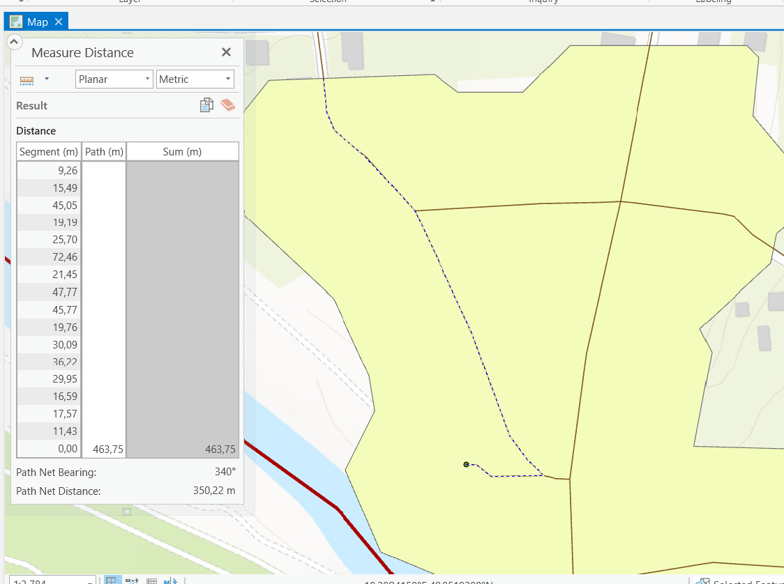
Comment for attached picture: Problem is that when I measure range of polygon (corresponding to certain facility - entry to green area) along the line its very different from what I entered as the service area calculation. Here is the example. I entered into services area calculation that i want to know area (along the line) which is 300 m away from facility, but it created polygon which coresponds to more than 400 m distance.
Does anyone have experience with this and could you advise us?
Have a pleasant day
Solved! Go to Solution.
1 Solution
Accepted Solutions
04-19-2021
04:25 AM
- Mark as New
- Bookmark
- Subscribe
- Mute
- Subscribe to RSS Feed
- Permalink
- Report Inappropriate Content
Were you using a projected coordinate system appropriate to your area?
Don't use Web Mercator if that was the one... it returns very poor results for anything involving distance and/or area measurements
... sort of retired...
1 Reply
04-19-2021
04:25 AM
- Mark as New
- Bookmark
- Subscribe
- Mute
- Subscribe to RSS Feed
- Permalink
- Report Inappropriate Content
Were you using a projected coordinate system appropriate to your area?
Don't use Web Mercator if that was the one... it returns very poor results for anything involving distance and/or area measurements
... sort of retired...