- Home
- :
- All Communities
- :
- Products
- :
- ArcGIS Pro
- :
- ArcGIS Pro Questions
- :
- Multidimensional Trend: Time unit used in nedcdf f...
- Subscribe to RSS Feed
- Mark Topic as New
- Mark Topic as Read
- Float this Topic for Current User
- Bookmark
- Subscribe
- Mute
- Printer Friendly Page
Multidimensional Trend: Time unit used in nedcdf files
- Mark as New
- Bookmark
- Subscribe
- Mute
- Subscribe to RSS Feed
- Permalink
- Report Inappropriate Content
Using ArcGIS Pro 2.9.1 on windows 10 I imported a netcdf file to a Multidimensional Raster Layer. The data is a time series with one data set per year for 20 years (2001-2020). The original time dimension in the netcdf file is days When I calculate the trend using ArcGIS Pro (Multidimensional Trend) I get very small values and I suspect that Multidimensional Trend uses days instead of year as time unit. How can I correct that?
Details in attached PDF, data attached.
Any suggestion appreciated
/Jonas Ardö
Solved! Go to Solution.
Accepted Solutions
- Mark as New
- Bookmark
- Subscribe
- Mute
- Subscribe to RSS Feed
- Permalink
- Report Inappropriate Content
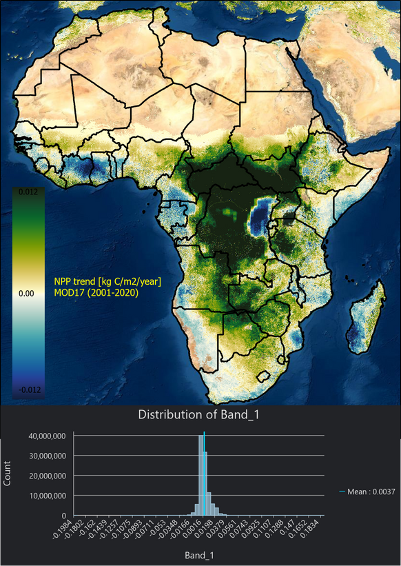
Solved using "trend" in CDO (https://code.mpimet.mpg.de/projects/cdo). Gives reasonable value in line with "manual" calculations. Even if multidimensional tools are nice and very computational effective (which CDO is as well) I find it tricky to keep track of time settings etc. And why can't TREND take normal multiband rasters files as input? The ARCMAP tool Curvefit (https://www.umesc.usgs.gov/management/dss/curve_fit.html) is excellent but slow for big data sets, the data set below ( SUBDATASET_1_DESC=[20x19070x18091] Npp_500m (16-bit integer) ) took a about 3 minutes to calculate the trend (gain, offset) with either CDO "Trend" or ARCGIS Pro "Multidimensional Trend", using the *.nc file as direct input. Interesting pattern in east Congo?
/Jonas Ardö
