Turn on suggestions
Auto-suggest helps you quickly narrow down your search results by suggesting possible matches as you type.
Cancel
- Home
- :
- All Communities
- :
- Products
- :
- ArcGIS Pro
- :
- ArcGIS Pro Questions
- :
- In the continental U.S., is the Geoid above or bel...
Options
- Subscribe to RSS Feed
- Mark Topic as New
- Mark Topic as Read
- Float this Topic for Current User
- Bookmark
- Subscribe
- Mute
- Printer Friendly Page
In the continental U.S., is the Geoid above or below the Ellipsoid?
Subscribe
610
1
02-12-2025 04:39 PM
02-12-2025
04:39 PM
- Mark as New
- Bookmark
- Subscribe
- Mute
- Subscribe to RSS Feed
- Permalink
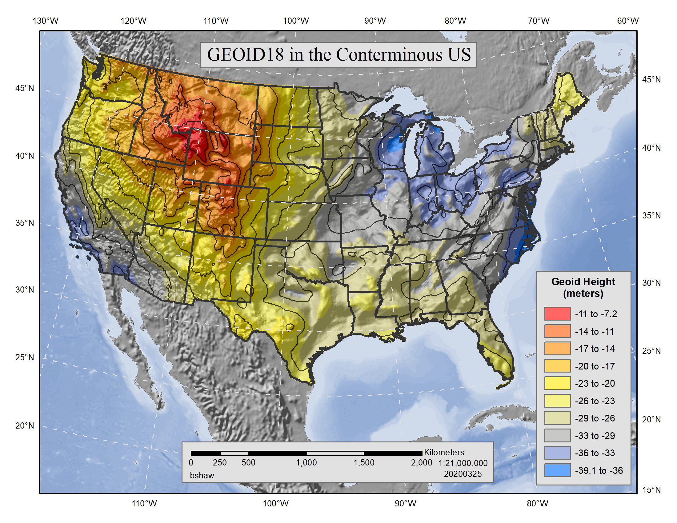
In the continental U.S., do we know if the Geoid for NAVD 88 is above or below the NAD83/GRS 80 Spheroid? Or, do they every criss-cross each other?
...Just a "curious" thing.
With that, I'm wondering about where we have negative elevation values like in Death Valley?
1 Reply
05-13-2025
08:22 AM
- Mark as New
- Bookmark
- Subscribe
- Mute
- Subscribe to RSS Feed
- Permalink
Hi @Craig_Eissler_Iceman,
According to the NOAA's National Geodetic Survey website regarding the current GEOID18 model, it appears that geoid heights are all negative for CONUS. This would indicate that the current geoid model for NAVD88 is consistently below the GRS80 ellipsoid for NAD83 (2011).
I hope this helps,
Bojan
