- Home
- :
- All Communities
- :
- Products
- :
- ArcGIS Pro
- :
- ArcGIS Pro Questions
- :
- IDW surfaces created using wizard and toolbox are ...
- Subscribe to RSS Feed
- Mark Topic as New
- Mark Topic as Read
- Float this Topic for Current User
- Bookmark
- Subscribe
- Mute
- Printer Friendly Page
IDW surfaces created using wizard and toolbox are different
- Mark as New
- Bookmark
- Subscribe
- Mute
- Subscribe to RSS Feed
- Permalink
- Report Inappropriate Content
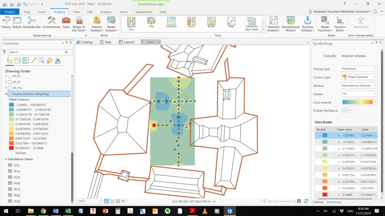
I am running an IDW using the Geostatistical Wizard and a layer is created. However, when I try to export that layer into a raster, the surface changes almost completely, meaning values are added or changed in ways I do not understand. I have also tried running IDW outside the Geostatistical Wizard with the exact same parameters I used in the wizard and the IDW surfaces generated never match those created by the wizard. I am ensuring my environments/extent do not change in any of these. I am attaching a screenshot of both surfaces - the one with more red/higher values was created using the "export layer to rasters" method.
thank you for any help, I don't know what I'm doing wrong!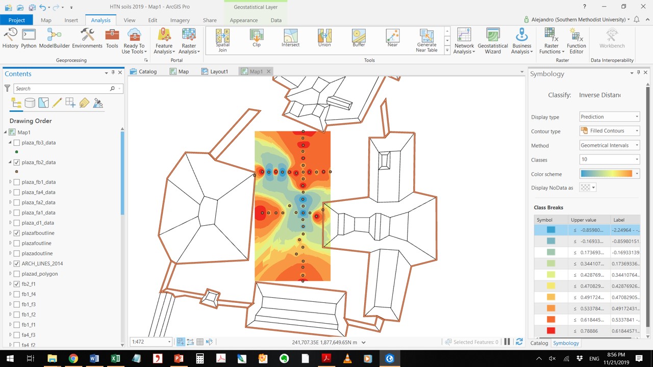
- Mark as New
- Bookmark
- Subscribe
- Mute
- Subscribe to RSS Feed
- Permalink
- Report Inappropriate Content
some of the defaults might make a difference, can you make sure that things like the neighborhood to use, the power etc are the same. Extent cell size and snap raster can be set in environments, which you say is covered and it looks so, hence, something else is different in the other options
- Mark as New
- Bookmark
- Subscribe
- Mute
- Subscribe to RSS Feed
- Permalink
- Report Inappropriate Content
Dan, the OP is asking about the Geostatistical Analyst implementation of IDW, not the Spatial Analyst raster tool.
These two results look like they are using different exponents for the weighting, I would look closer to make sure they match. The GA version may be optimizing the exponent where with the raster tool it is a fixed value (default 2).
- Mark as New
- Bookmark
- Subscribe
- Mute
- Subscribe to RSS Feed
- Permalink
- Report Inappropriate Content
Curtis the link is from … geostatistical-analyst/idw.htm ... that is what I was wondering as well.