- Home
- :
- All Communities
- :
- Products
- :
- ArcGIS Pro
- :
- ArcGIS Pro Questions
- :
- Re: I'm looking for a layer that will allow me to ...
- Subscribe to RSS Feed
- Mark Topic as New
- Mark Topic as Read
- Float this Topic for Current User
- Bookmark
- Subscribe
- Mute
- Printer Friendly Page
I'm looking for a layer that will allow me to export an elevation value to a list of global locations. Can anyone tell me what layer to add or data source to use?
- Mark as New
- Bookmark
- Subscribe
- Mute
- Subscribe to RSS Feed
- Permalink
- Report Inappropriate Content
I have added a layer named Terrain, which indicates it can be used for analysis but when I export it, there is no elevation value applied. What should I do to get the feet or meters above or below sea level to be applied to the points on my map, in an export file?
- Mark as New
- Bookmark
- Subscribe
- Mute
- Subscribe to RSS Feed
- Permalink
- Report Inappropriate Content
There is very little in the description to help with a possible solution/answer.
Can you provide some screenshots and more information on the layer called "Terrain"?
What format are you exporting the terrain file to? Are you using a GP tool, right click options, Python,etc.?
What do you mean by global locations?
- Mark as New
- Bookmark
- Subscribe
- Mute
- Subscribe to RSS Feed
- Permalink
- Report Inappropriate Content
Hi George,
I'm just using Arc-GIS Online. Terrain is a layer offered by Esri. Here is a shot of the locations with the Terrain layer
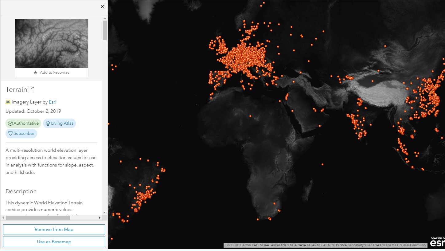
I selected it because in the description it says: Use for Analysis: Yes. This layer provides data as floating point elevation values suitable for use in analysis. The elevation values are what I am seeking. I could not figure out how to get them to appear in an exported csv file.
- Mark as New
- Bookmark
- Subscribe
- Mute
- Subscribe to RSS Feed
- Permalink
- Report Inappropriate Content
I am not sure that there is a "direct" export to CSV. You could try Terrain To Points—Help | ArcGIS Desktop in ArcGIS Pro, it does require 3D Analyst in Pro. Then export the points to a CSV
Note: There may be a cost in ArcGIS Online credits for the process.
You could also look at the following workflows: ArcGIS Imagery Workflows | ArcGIS
- Mark as New
- Bookmark
- Subscribe
- Mute
- Subscribe to RSS Feed
- Permalink
- Report Inappropriate Content
James
sorry for the delay in my response.
Terrain is an image service, and IDENTIFY will do this
Identify (Image Service)—ArcGIS REST API: Services Directory | ArcGIS for Developers
I think you can ignore many of the parameters
Let us know if you need more assistance
Cody B
- Mark as New
- Bookmark
- Subscribe
- Mute
- Subscribe to RSS Feed
- Permalink
- Report Inappropriate Content
Hi Cody,
I’ll need to study this. It looks beyond my technical capabilities. I really thought there must be a simple way to export a csv with sea level values just like I do with lat & lon. This does not look simple. I don’t have time to look at it right now. I’ll make a project of it and try to figure it out in November.
Thanks
Jim Preslar
Global Purchasing and Supply Chain Risk Management
james.preslar@gm.com<mailto:james.preslar@gm.com>
Phone/Text/WhatsApp: +1-318-347-7372
Work Phone: +1-586-805-6669