- Home
- :
- All Communities
- :
- Products
- :
- ArcGIS Pro
- :
- ArcGIS Pro Questions
- :
- I cannot establish the multidimensional raster wit...
- Subscribe to RSS Feed
- Mark Topic as New
- Mark Topic as Read
- Float this Topic for Current User
- Bookmark
- Subscribe
- Mute
- Printer Friendly Page
I cannot establish the multidimensional raster with NetCDF
- Mark as New
- Bookmark
- Subscribe
- Mute
- Subscribe to RSS Feed
- Permalink
- Report Inappropriate Content
Hello,
I am a researcher that is currently requiring to extract monthly data NetCDF within the area of interest. My purpose is to turn the NetCDF into multidimensional raster and clip it with my area of interest in the North America.
I first tried the "add data" function and ArcGIS simply ruined the raster result with following look.
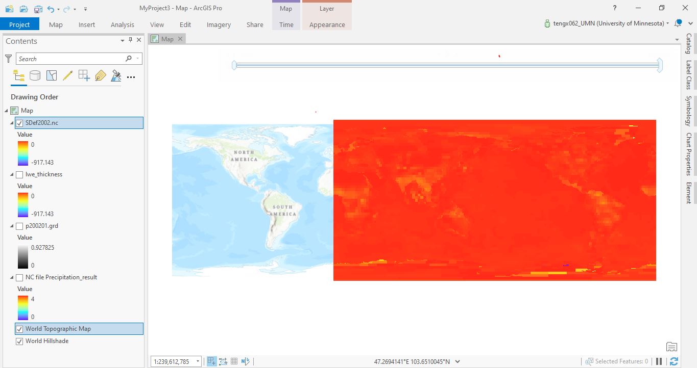
It displayed the North America proportion of the raster EAST of the Eastern Hemisphere with undefined projection and it made me impossible to extract data with polygon in the North America.
When I attempted to "define projection" or "project raster" of this file, the raster result will only show the first layer and it will no longer be multidimensional.
The result is that you can have either multidimensional raster and accurately-projected raster but you cannot have both.
I was exhausted because i tried every mean possible but I got the same result. Please explain to me how I can project the NetCDF so that it will be the accurately project multidimensional raster. thank you.