Turn on suggestions
Auto-suggest helps you quickly narrow down your search results by suggesting possible matches as you type.
Cancel
- Home
- :
- All Communities
- :
- Products
- :
- ArcGIS Pro
- :
- ArcGIS Pro Questions
- :
- I am using ArcMap 10.6.1. Here is the problem I am...
Options
- Subscribe to RSS Feed
- Mark Topic as New
- Mark Topic as Read
- Float this Topic for Current User
- Bookmark
- Subscribe
- Mute
- Printer Friendly Page
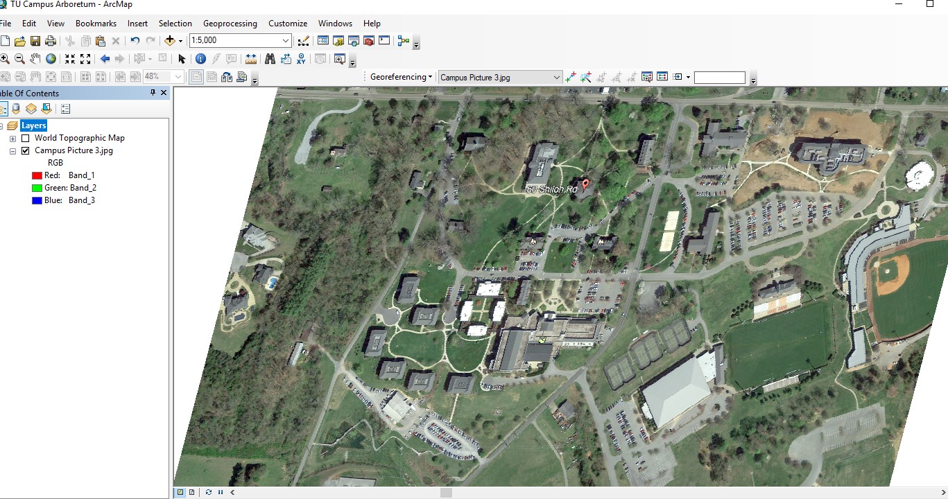
I am using ArcMap 10.6.1. Here is the problem I am having: I have georastered a .jpeg of a campus map I am making. Once I georastered, the map image became slanted. I have tried to rotate it, etc. It still looks slanted. It prints this way, too. How can I
Subscribe
701
2
04-09-2019 02:50 PM
04-09-2019
02:50 PM
- Mark as New
- Bookmark
- Subscribe
- Mute
- Subscribe to RSS Feed
- Permalink
- Report Inappropriate Content
2 Replies
04-09-2019
07:42 PM
- Mark as New
- Bookmark
- Subscribe
- Mute
- Subscribe to RSS Feed
- Permalink
- Report Inappropriate Content
Imagery and Remote Sensing is the forum for you. I think you meant georeferenced? I suggest removing your georeferencing and starting again from scratch, being careful with setting up your control points (remember, image > map) and not updating georeferencing until you know your links are good, based on the statistics shown for the links.
Before you start again, it probably would be good to re-read the help:
04-10-2019
07:37 AM
- Mark as New
- Bookmark
- Subscribe
- Mute
- Subscribe to RSS Feed
- Permalink
- Report Inappropriate Content
I found this youtube video that walks you through the process, though he probably uses more control points than needed