- Home
- :
- All Communities
- :
- Products
- :
- ArcGIS Pro
- :
- ArcGIS Pro Questions
- :
- Re: How to average climate data in a Raster- Datas...
- Subscribe to RSS Feed
- Mark Topic as New
- Mark Topic as Read
- Float this Topic for Current User
- Bookmark
- Subscribe
- Mute
- Printer Friendly Page
How to average climate data in a Raster- Dataset?
- Mark as New
- Bookmark
- Subscribe
- Mute
- Subscribe to RSS Feed
- Permalink
- Report Inappropriate Content
Hello,
I am utterly new to ArcGIS Pro.
I downloaded monthly precipitation data, in the GRIB- format, from 1979 - present.
It was possible for me to create a Raster- Dataset and it shows me now the different values with a color gradient and a time dimension.
But what I need to do is averaging the data that ist shown every month over the 40 years,
so I can see the mean monthly precipitation in one view that contains the last 40 years.
I would be glad if someone is able to help me.
Thanks
Leonhard
- Mark as New
- Bookmark
- Subscribe
- Mute
- Subscribe to RSS Feed
- Permalink
- Report Inappropriate Content
Are you able to use the Cell Statistics function to calculate the mean of the multiple time layers? https://pro.arcgis.com/en/pro-app/help/data/imagery/cell-statistics-function.htm
- Mark as New
- Bookmark
- Subscribe
- Mute
- Subscribe to RSS Feed
- Permalink
- Report Inappropriate Content
Yes I already did it, but are you sure that it calculates the mean over the time dimension?
What would you think of the Space-Time-Cube, but I didnt suceed with it?
- Mark as New
- Bookmark
- Subscribe
- Mute
- Subscribe to RSS Feed
- Permalink
- Report Inappropriate Content
Are the data daily values? for 40 years? and you want monthly values by year?
Are your data an array stack? or single rasters?
- Mark as New
- Bookmark
- Subscribe
- Mute
- Subscribe to RSS Feed
- Permalink
- Report Inappropriate Content
It is already averaged monthly data and I want the average for 40 years.
The data is in one GRIB- file so I would say single rasters.
- Mark as New
- Bookmark
- Subscribe
- Mute
- Subscribe to RSS Feed
- Permalink
- Report Inappropriate Content
cell statistics will give you the average. It is location based, so each cell will receive the chosen statistic for the time period you specify. In this case, it will yield a 40 year average of your monthly averages. If you want to isolate particular months prior to averaging, then this will have to be done as a separate operation prior to cell statistics.
- Mark as New
- Bookmark
- Subscribe
- Mute
- Subscribe to RSS Feed
- Permalink
- Report Inappropriate Content
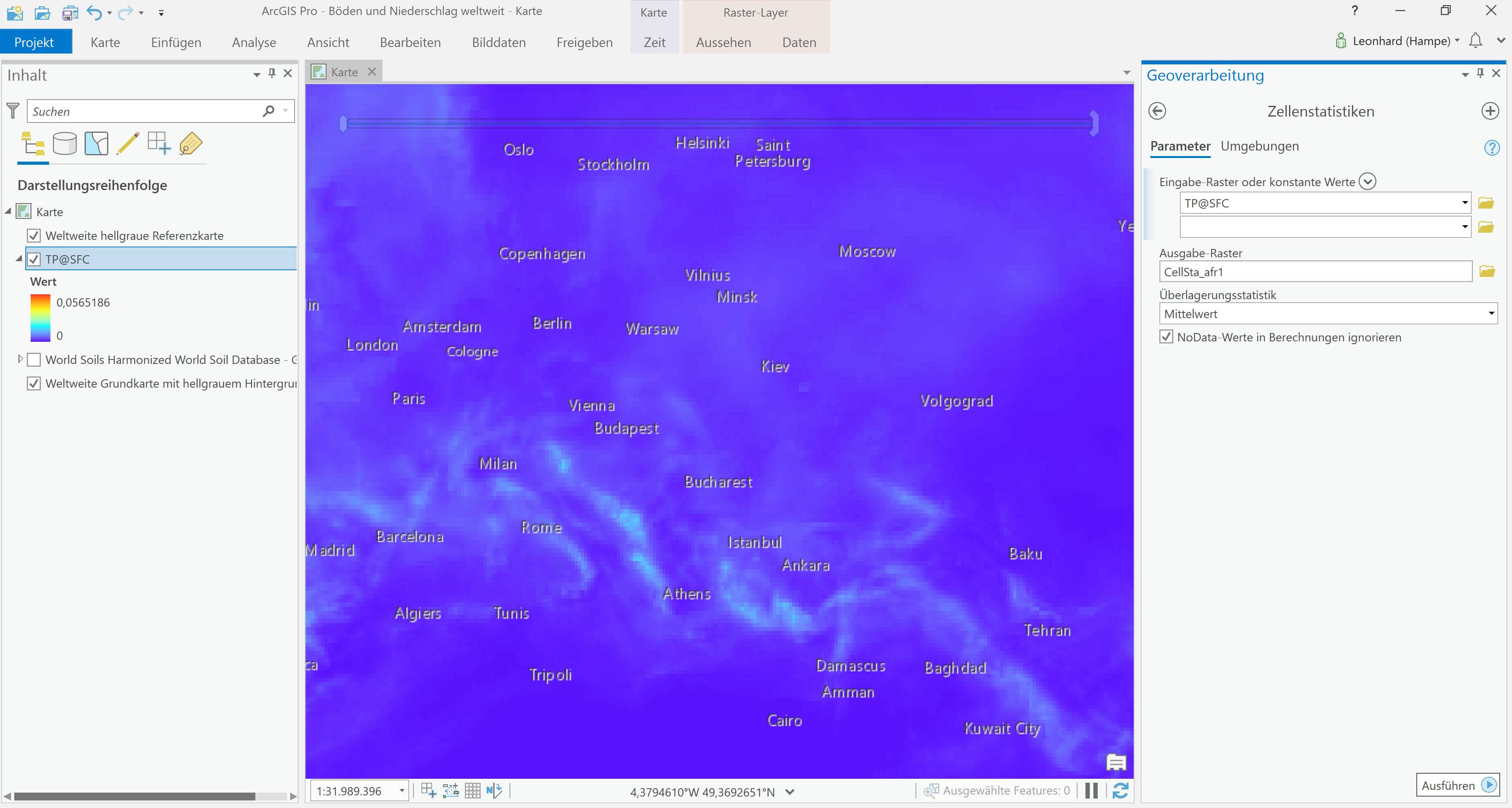
I guess there is just one Raster (TP@SFC).
And in the blue map you see the data for the first month (I can use the time slider). When I carry it out, the blue map doesn`t really change.
- Mark as New
- Bookmark
- Subscribe
- Mute
- Subscribe to RSS Feed
- Permalink
- Report Inappropriate Content
I think that this is the problem:
If a single raster is used as the input for maximum, minimum, mean, median, majority, minority, or sum, the output pixel values will be the same as the input pixel values.