- Home
- :
- All Communities
- :
- Products
- :
- ArcGIS Pro
- :
- ArcGIS Pro Questions
- :
- Re: How do you calculate a point into decimal degr...
- Subscribe to RSS Feed
- Mark Topic as New
- Mark Topic as Read
- Float this Topic for Current User
- Bookmark
- Subscribe
- Mute
- Printer Friendly Page
How do you calculate a point into decimal degres in ArcGIS Pro
- Mark as New
- Bookmark
- Subscribe
- Mute
- Subscribe to RSS Feed
- Permalink
- Report Inappropriate Content
I'm trying to use ArcGIS Pro to calculate the lat/long of a point in decimal degrees. I must not be understanding the help section below. In the calculate field I enter !SHAPE.FirstPoint.X@decimaldegrees! but it fails because decimaldegrees is not defined...
Usage
Python expressions can be created using properties from the Geometry object including type, extent, centroid, firstPoint, lastPoint, area, length, isMultipart, and partCount (for example, !shape.area!).
Python expressions can use the geometry area and length properties with an areal or linear unit to convert the value to a different unit of measure (for example, !shape.length@kilometers!).
- Linear unit of measure keywords:
- CENTIMETERS | DECIMALDEGREES | DECIMETERS | FEET | INCHES | KILOMETERS | METERS | MILES | MILLIMETERS | NAUTICALMILES | POINTS | UNKNOWN | YARDS
- Linear unit of measure keywords:
Solved! Go to Solution.
- Mark as New
- Bookmark
- Subscribe
- Mute
- Subscribe to RSS Feed
- Permalink
- Report Inappropriate Content
I really appreciate your help. I tried your tool but it failed and this is what I got:
Start Time: Thursday, July 20, 2017 8:56:42 AM
Running script UpdateLATLONG...
WARNING 001097: LAT already exists -- overwriting.
Failed script UpdateLATLONG...
Traceback (most recent call last):
File "C:\Users\spsummers\Downloads\CalcGeometryModified\CalcGeometryModified.tbx#UpdateLATLONG_CalcGeometryModified.py", line 387, in <module>
File "C:\Users\spsummers\Downloads\CalcGeometryModified\CalcGeometryModified.tbx#UpdateLATLONG_CalcGeometryModified.py", line 61, in execute
File "C:\Users\spsummers\Downloads\CalcGeometryModified\CalcGeometryModified.tbx#UpdateLATLONG_CalcGeometryModified.py", line 313, in CreateOutputFields
RuntimeError: Table is already locked [Table is already locked[gis.GISDB.AddressPoints.LONG]]
Failed to execute (UpdateLATLONG).
Failed at Thursday, July 20, 2017 8:58:06 AM (Elapsed Time: 1 minutes 24 seconds)
I know some very basic python but this is a little over my head.
- Mark as New
- Bookmark
- Subscribe
- Mute
- Subscribe to RSS Feed
- Permalink
- Report Inappropriate Content
Since you are working in an Enterprise Geodatabase Environment it is hard to tell why this is locked. It lockes when trying to create the fields - even if this is a process that accepts existing fields. I can make another modification - and remove the ATTEMPT to create the fields as they are never actually need to be added - I've updated the attachement above. I left the warning for existing fields in there but added a counter-message that tells you how many records are updated. Keep in mind: I only check for the LAT field being NULL ... if so - record is updated .... I renamed the UI-selection to be POINT_LAT_LONG only to reflect more what you do ... hope it works for you - then you owe me a beer 🙂 and some points here 🙂
- Mark as New
- Bookmark
- Subscribe
- Mute
- Subscribe to RSS Feed
- Permalink
- Report Inappropriate Content
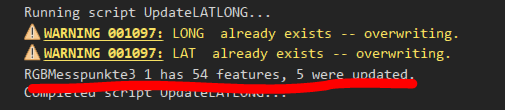
That is some impressive script wizardry! It worked and did what I needed. Thank you so much! I appreciate you taking the time to help me out.
- Mark as New
- Bookmark
- Subscribe
- Mute
- Subscribe to RSS Feed
- Permalink
- Report Inappropriate Content
Glad I could help. Never doubt ArcGIS can do it 🙂
- Mark as New
- Bookmark
- Subscribe
- Mute
- Subscribe to RSS Feed
- Permalink
- Report Inappropriate Content
Hi Gunter Dorffel:
I have a same problem that is mentioned in here, I need to calculate and update the existing X, Y, Z fields in the .sde layers but I don't want to add additional fields. Would you mind to send me your working script please if you have available. The one you shared here does not work any more. I would heartily appreciate your support. Thank you so much.
- « Previous
-
- 1
- 2
- Next »
- « Previous
-
- 1
- 2
- Next »