- Home
- :
- All Communities
- :
- Products
- :
- ArcGIS Pro
- :
- ArcGIS Pro Questions
- :
- How do I rotate a feature class in ArcGIS Pro?
- Subscribe to RSS Feed
- Mark Topic as New
- Mark Topic as Read
- Float this Topic for Current User
- Bookmark
- Subscribe
- Mute
- Printer Friendly Page
How do I rotate a feature class in ArcGIS Pro?
- Mark as New
- Bookmark
- Subscribe
- Mute
- Subscribe to RSS Feed
- Permalink
I have one point feature class and one polyline feature class in a projected coordinate reference system. How can I rotate these feature classes by a number of degrees? For example, rotate all features in the feature class through 90 degrees so what did face north now faces east? The polylines and point feature class represent the outline of an oil rig and I would like to rotate the feature classes to match the rig orientation in the real world.
Solved! Go to Solution.
Accepted Solutions
- Mark as New
- Bookmark
- Subscribe
- Mute
- Subscribe to RSS Feed
- Permalink
Hi Rob,
- Open the Rotate tool - Move, rotate, or scale a feature—ArcGIS Pro | ArcGIS Desktop
- Select the features you want to rotate.
- If needed, move the anchor by holding CTRL.
- Hit TAB to set a rotation angle if using dynamic constraints (Constrain direction for a segment—ArcGIS Pro | ArcGIS Desktop) or hit A key to bring up a dialog to set the angle.
- Finish the job with F2.
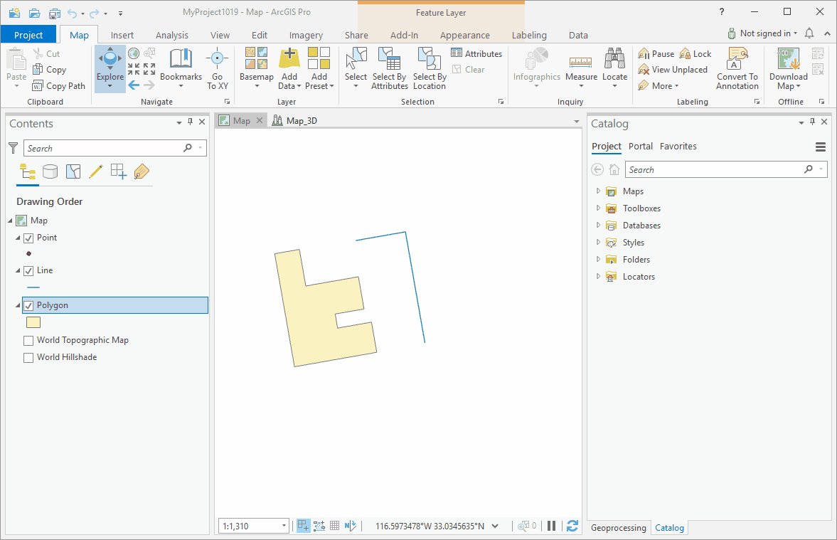
Bonus: if you want to snap while rotating hit the S key to set a secondary rotation anchor:
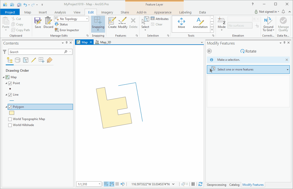
This shows a polygon and line, but it will work just the same with points too.
-Scott
- Mark as New
- Bookmark
- Subscribe
- Mute
- Subscribe to RSS Feed
- Permalink
Hello Rob, if just editing the feature class isn't well-controlled enough for you there is code in this sample you could re-purpose for the job:
https://pm.maps.arcgis.com/home/item.html?id=9398bd2232cb4c8490b0b05015364d28
- Mark as New
- Bookmark
- Subscribe
- Mute
- Subscribe to RSS Feed
- Permalink
Hi Bruce, how can I do it by editing the feature class? Ideally I would select all features and then enter a rotation angle?
- Mark as New
- Bookmark
- Subscribe
- Mute
- Subscribe to RSS Feed
- Permalink
Hi, I had to go ask a colleague, but you select all the features you want to rotate, select the Rotate tool, move the rotation circle center point to where you need (control key, drag it and snap it somewhere, then spin it round using the green circle edge as a handle. There is an option to enter an angle (which is relative to the map's rotation). Looks like someone beat me to the workflow below!
- Mark as New
- Bookmark
- Subscribe
- Mute
- Subscribe to RSS Feed
- Permalink
Hi Rob,
- Open the Rotate tool - Move, rotate, or scale a feature—ArcGIS Pro | ArcGIS Desktop
- Select the features you want to rotate.
- If needed, move the anchor by holding CTRL.
- Hit TAB to set a rotation angle if using dynamic constraints (Constrain direction for a segment—ArcGIS Pro | ArcGIS Desktop) or hit A key to bring up a dialog to set the angle.
- Finish the job with F2.
Bonus: if you want to snap while rotating hit the S key to set a secondary rotation anchor:
This shows a polygon and line, but it will work just the same with points too.
-Scott
- Mark as New
- Bookmark
- Subscribe
- Mute
- Subscribe to RSS Feed
- Permalink
Rob, please remember to mark an answer correct to help others who find this thread.