- Home
- :
- All Communities
- :
- Products
- :
- ArcGIS Pro
- :
- ArcGIS Pro Questions
- :
- Re: Does the angle alignment for graduated symbols...
- Subscribe to RSS Feed
- Mark Topic as New
- Mark Topic as Read
- Float this Topic for Current User
- Bookmark
- Subscribe
- Mute
- Printer Friendly Page
Does the angle alignment for graduated symbols not work?
- Mark as New
- Bookmark
- Subscribe
- Mute
- Subscribe to RSS Feed
- Permalink
- Report Inappropriate Content
I am attempting to symbolize a polygon layer as a point using the graduated symbols primary symbol option. I have the settings at 1 class, with both the minimum and maximum size being 14 pt. when I select my symbol to open the format pane, there is an option for angle alignment. I have the option set to "display". When I open my map series, which is rotated based on a field in the index layer, the graduated symbol will not rotate with the display. I have tried restarting and all the normal troubleshooting and cannot tell if this is a bug.
- Mark as New
- Bookmark
- Subscribe
- Mute
- Subscribe to RSS Feed
- Permalink
- Report Inappropriate Content
Hi Andrew. I tested this quickly and can't replicate the issue with my data and I was curious of the following:
What version of ArcGIS Pro are you using?
When angle alignment is set to Map does the behavior persist?
What angle is it set to under angle alignment?
What is the coordinate system?
I will investigate if this is a known issue but wanted to check the above with you to aid.
- Mark as New
- Bookmark
- Subscribe
- Mute
- Subscribe to RSS Feed
- Permalink
- Report Inappropriate Content
Hi Aaron,
I did have a colleague check this to make sure I wasn't just missing something and we both think it may be an issue.
- Pro 2.4.2
- Yes, the symbol does not change from a North orientation regardless of angle alignment setting
- 0 degrees (it needs to be dynamic based on the orientation of each orientation in the map series defined by another field)
- (NAD 1983 StatePlane Virginia North FIPS 4501 Feet) for all layers and map
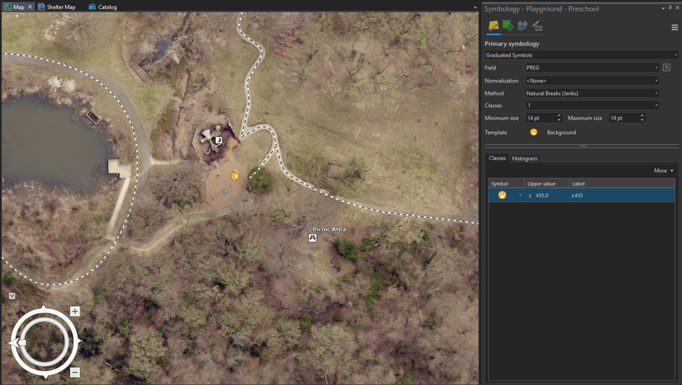
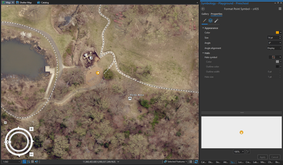
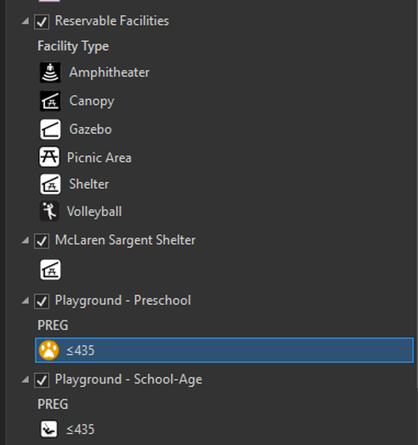
Attached are screenshots of the map with both the symbology for the layer in question and the symbol properties as well as the table of contents for my layers in question. I have the generic dog footprint as a placeholder (I have tested different symbols, they all have the issue). Both the playground icon and the dog footprint icon are polygon feature classes from an enterprise geodatabase symbolized as graduated symbols with the same settings, while the picnic table icon in my map (which is orientated correctly) is a point feature class from a file geodatabase set to angle alignment = "Display". I tested this method with a feature class from file geodatabase and it still does not orient correctly.
- Mark as New
- Bookmark
- Subscribe
- Mute
- Subscribe to RSS Feed
- Permalink
- Report Inappropriate Content
Thanks for the additional details, I see this now as soon as the map is rotated with graduate symbols. Still looking for something documenting this specific behavior in Pro, (most documented issues I am seeing are older issues in ArcMap with data frame rotations or exporting in Pro). Since this is a polygon it may need to be varied by rotation. At least a map series set with rotation will properly rotate in this configuration. I may follow up directly to keep this moving and see if we can get you connected with support to dive deeper*.
*Edit.