- Home
- :
- All Communities
- :
- Products
- :
- ArcGIS Pro
- :
- ArcGIS Pro Questions
- :
- Re: Deep Learning
- Subscribe to RSS Feed
- Mark Topic as New
- Mark Topic as Read
- Float this Topic for Current User
- Bookmark
- Subscribe
- Mute
- Printer Friendly Page
Deep Learning
- Mark as New
- Bookmark
- Subscribe
- Mute
- Subscribe to RSS Feed
- Permalink
- Report Inappropriate Content
I've gone through the deep learning tutorial to detect palm trees in Tonga several times, each time thinking I could try something new to achieve better results. I have failed every time to come up with something even remotely better than old school image classification. I've spent months watching every video I can find and researching every article I can find about deep learning. Everything ESRI puts out shows people using Jupyter notebooks and they never explain exactly how to train those models using notebooks. They just show their final results, which of course always look good. There are several references to using the model provided by the "data scientist" but I've had a hard time finding useful examples for my application (detecting macadamia nut trees in an orchard). If you go through the deep learning tutorial for identifying palm tree health, the results are pretty much useless. Anyone know where else I can turn to get some better instruction?
- Mark as New
- Bookmark
- Subscribe
- Mute
- Subscribe to RSS Feed
- Permalink
- Report Inappropriate Content
Scott... is this the tutorial you are referring to?
Use deep learning to assess palm tree health | Learn ArcGIS
Issues abound
https://community.esri.com/search.jspa?q=palm-tree-health
... sort of retired...
- Mark as New
- Bookmark
- Subscribe
- Mute
- Subscribe to RSS Feed
- Permalink
- Report Inappropriate Content
Hi Dan,
Yes, that's the one. I've watched about a half dozen videos produced by
ESRI showing examples of object detection in the case of cars, pools,
damaged vs undamaged houses, well pads, and shipwrecks. In those examples
the model performs very well, but the demonstrators are always using
jupyter notebooks to train their model and I can't find any help on using
notebooks or example code. I'm trying to learn but running into dead ends.
Thanks for replying.
My best,
Scott
- Mark as New
- Bookmark
- Subscribe
- Mute
- Subscribe to RSS Feed
- Permalink
- Report Inappropriate Content
ArcGIS API for Python | ArcGIS for Developers
API Reference for the ArcGIS API for Python — arcgis 1.8.2 documentation
Don't expect riveting examples in the help however
... sort of retired...
- Mark as New
- Bookmark
- Subscribe
- Mute
- Subscribe to RSS Feed
- Permalink
- Report Inappropriate Content
Yes exactly.
I tried ESRI example for palm identification it gives promising results but same steps if i apply on my Drone image (Tiff format with 3 bands) i am able to create Image chips files output is very good up to this step, but when i go forward to "Train a Deep learning model" next steps its showing me an error cannot identify image chips.
is there any solution for this step ?
Please guide me on this Dan Patterson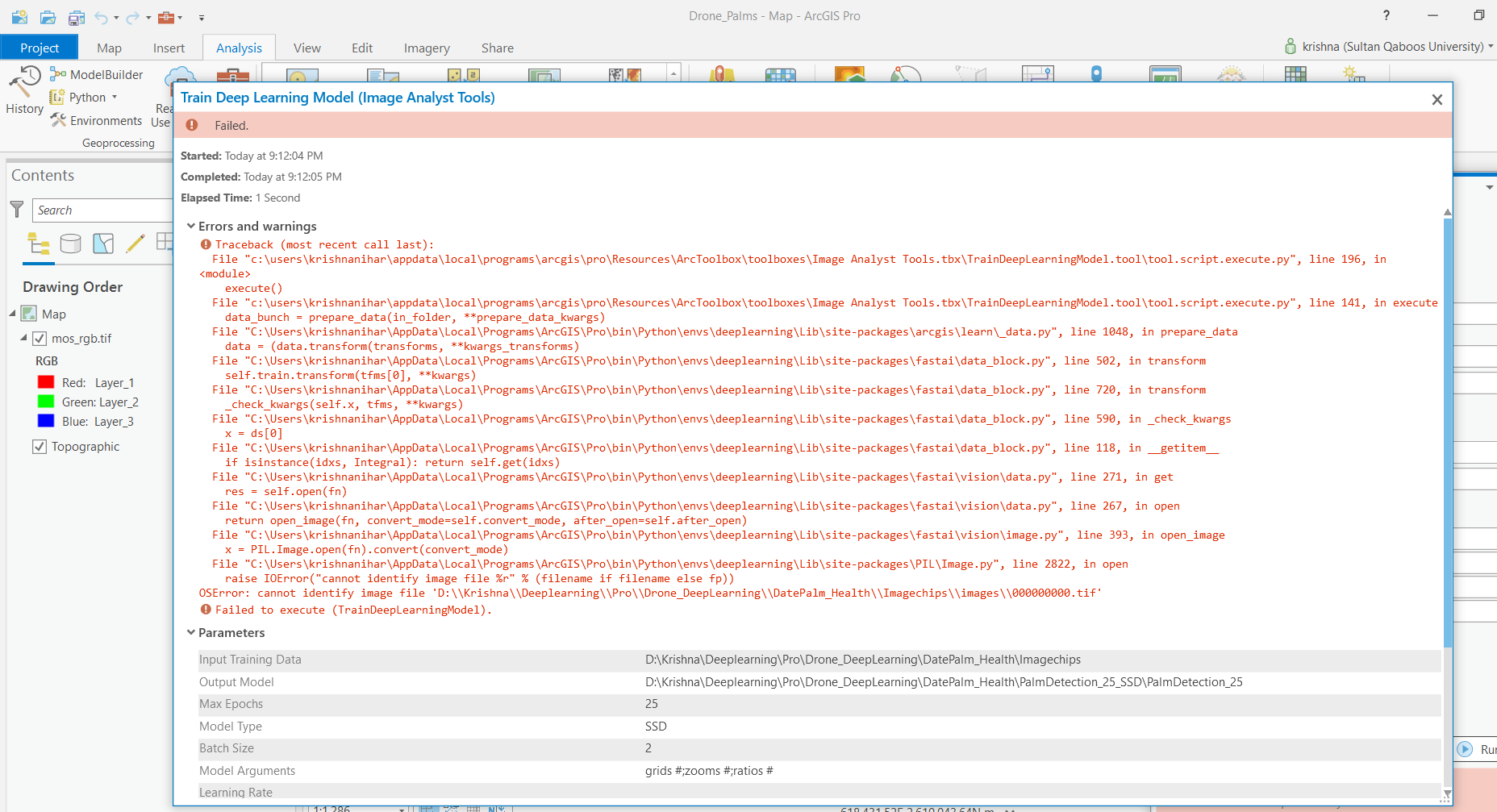
- Mark as New
- Bookmark
- Subscribe
- Mute
- Subscribe to RSS Feed
- Permalink
- Report Inappropriate Content
Hi Krishnanihar,
Your environment is not correctly setup, follow the steps here to correctly setup your env ArcGIS API For Python | ArcGIS for Developers.
Thanks,
Sandeep