- Home
- :
- All Communities
- :
- Products
- :
- ArcGIS Pro
- :
- ArcGIS Pro Questions
- :
- copy/duplicate layer, change attributes in new lay...
- Subscribe to RSS Feed
- Mark Topic as New
- Mark Topic as Read
- Float this Topic for Current User
- Bookmark
- Subscribe
- Mute
- Printer Friendly Page
copy/duplicate layer, change attributes in new layer without changing in original layer
- Mark as New
- Bookmark
- Subscribe
- Mute
- Subscribe to RSS Feed
- Permalink
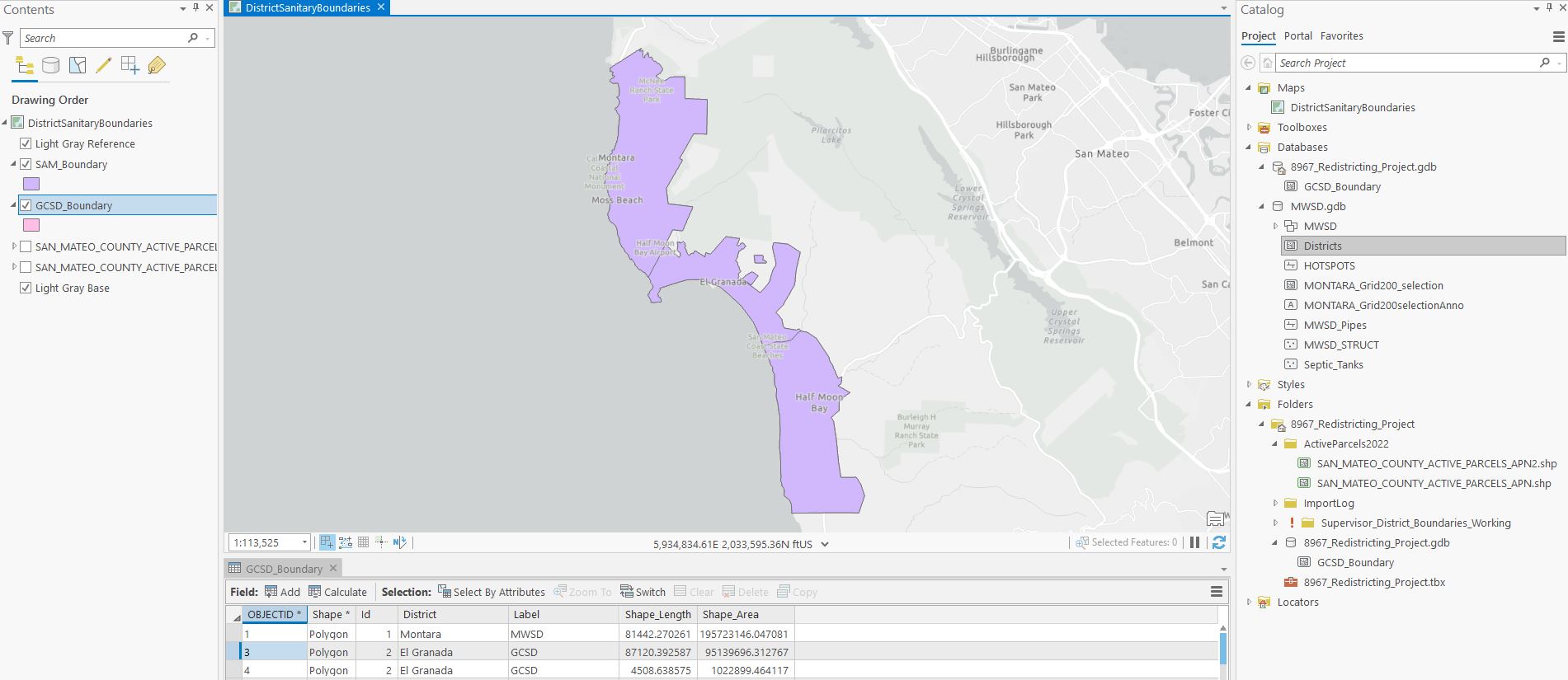
Extreme Beginner: I have a Boundary map layer that encompasses three polygon boundaries. Want to separate this layer into 4 layers (combined that has all 3 - attached), layers 2, 3 and 4 showing only 1 each of the boundaries.
SAM_Boundary - all 3
MWSD_Boundary - top boundary
GCSD_Boundary - middle boundary
HMB_Boundary - bottom boundary
I tired to copy but when I deleted the boundaries of the new layer, they deleted in the original as well. How do I do that without changing the original?
Thanks, Barbara
Solved! Go to Solution.
Accepted Solutions
- Mark as New
- Bookmark
- Subscribe
- Mute
- Subscribe to RSS Feed
- Permalink
I like to select the boundary in the layer, the right-click on the layer in the Contents Pane and choose Data -> Export Features. This will create a new feature class with only the selected polygon.

Aubri
- Mark as New
- Bookmark
- Subscribe
- Mute
- Subscribe to RSS Feed
- Permalink
First, it's important that you understand the difference between layers and data.
Data mostly comes in the form of tables, shape files, and feature classes in geodatabases. This is what gets saved on your hard drive or server.
Layers are representations of data. They control what data to show (data source and applied filters), and how to show it (e.g. symbols, labels, popups), and they allow you to change the underlying data (create, update, and delete features). Layers normally don't get saved separately, they are a part of the ArcGIS project.
When you copy a layer, you create a new layer that represents the same underlying data. If you delete a feature in the new layer, you don't delete it from the layer, but from the data. All other layers representing that data will show the change, too.
Solutions:
- If you need separate feature classes / shape files for each boundary (different data structure), go with Aubri's solution: Export the features from the original layer into three different feature classes, then delete the unneeded features in each feature class.
- If you only need to show the boundaries indepently from each other (different representation), copy the layer three times and set the defniition query of each layer: Filter features with definition queries—ArcGIS Pro | Documentation
Have a great day!
Johannes
- Mark as New
- Bookmark
- Subscribe
- Mute
- Subscribe to RSS Feed
- Permalink
I like to select the boundary in the layer, the right-click on the layer in the Contents Pane and choose Data -> Export Features. This will create a new feature class with only the selected polygon.
Aubri
- Mark as New
- Bookmark
- Subscribe
- Mute
- Subscribe to RSS Feed
- Permalink
First, it's important that you understand the difference between layers and data.
Data mostly comes in the form of tables, shape files, and feature classes in geodatabases. This is what gets saved on your hard drive or server.
Layers are representations of data. They control what data to show (data source and applied filters), and how to show it (e.g. symbols, labels, popups), and they allow you to change the underlying data (create, update, and delete features). Layers normally don't get saved separately, they are a part of the ArcGIS project.
When you copy a layer, you create a new layer that represents the same underlying data. If you delete a feature in the new layer, you don't delete it from the layer, but from the data. All other layers representing that data will show the change, too.
Solutions:
- If you need separate feature classes / shape files for each boundary (different data structure), go with Aubri's solution: Export the features from the original layer into three different feature classes, then delete the unneeded features in each feature class.
- If you only need to show the boundaries indepently from each other (different representation), copy the layer three times and set the defniition query of each layer: Filter features with definition queries—ArcGIS Pro | Documentation
Have a great day!
Johannes