- Home
- :
- All Communities
- :
- Products
- :
- ArcGIS Pro
- :
- ArcGIS Pro Questions
- :
- Can the Reference Grid in Map Layout be synced wit...
- Subscribe to RSS Feed
- Mark Topic as New
- Mark Topic as Read
- Float this Topic for Current User
- Bookmark
- Subscribe
- Mute
- Printer Friendly Page
Can the Reference Grid in Map Layout be synced with the map features?
- Mark as New
- Bookmark
- Subscribe
- Mute
- Subscribe to RSS Feed
- Permalink
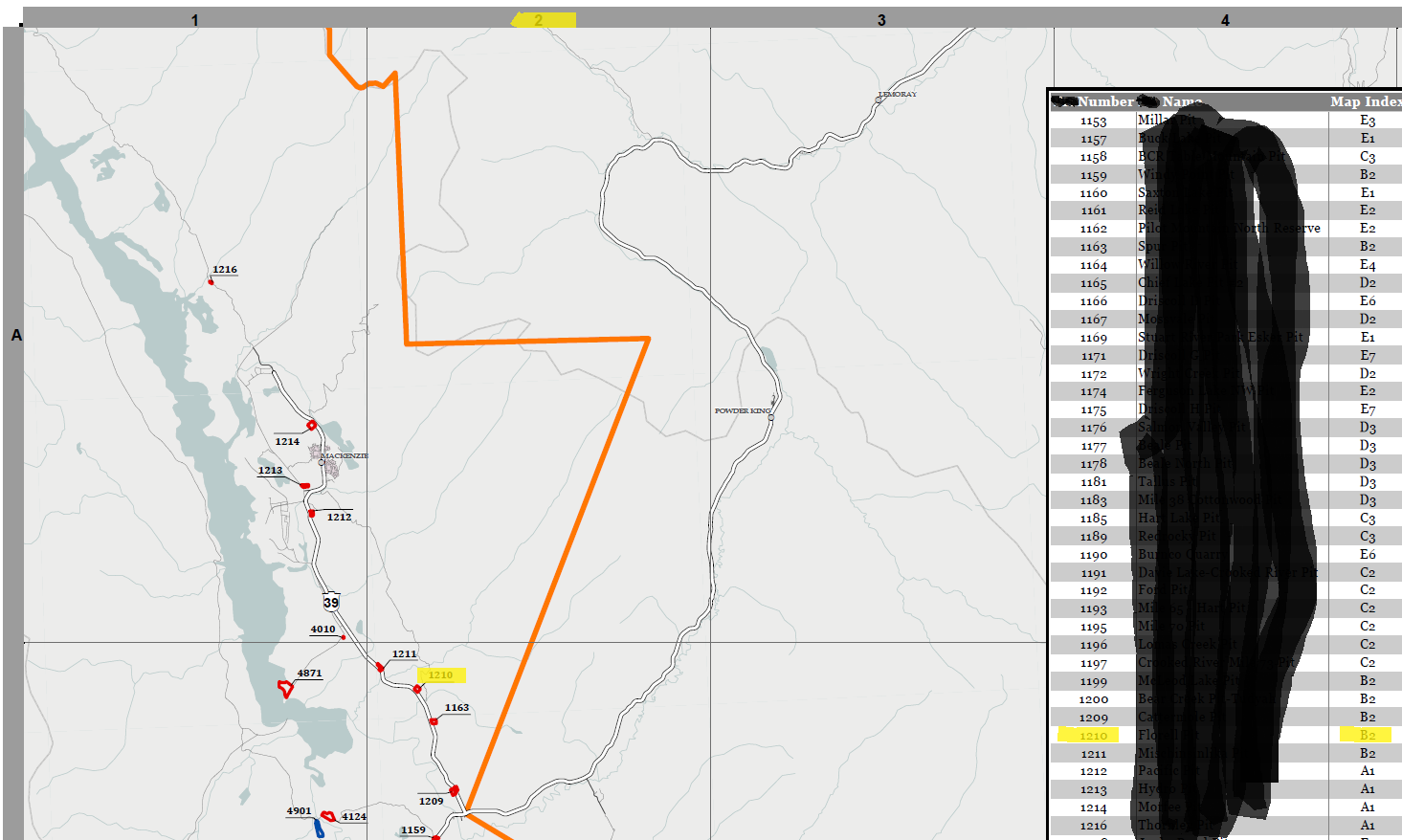
Here’s my Goal: Create a Map Series of Wall Maps that show polygon features labeled with their number ID and a corresponding table with some feature details and it's Reference Grid location (eg. "A4"). The purpose of the map is so that someone can call in and say “I need blah blah at feature #1234” and an employee can use the map to locate the feature quickly to get a better sense of the location of the request. See image below.

Problem: The Reference Grid in the layout is static which means I have to create a grid feature class that is exactly the same dimension as the layout for each map series and perform a spatial join to get the Map Index number for each feature. This works when the Index layers don't overlap, but in my case they do! So using an iterate feature doesn't seem to work as it overwrites the last Map Index that was assigned to the feature. (ie Feature # 1234 shows on map #3 and map#4. Since it appears in a different location on each map, it will get assigned a different Map Index # and be overwritten by the most recent map).
Does anyone have experience creating Reference Grid maps with corresponding Table Frames and any help/advice to share?? Really hoping to make this a script/model process so I can pass this off to other employees and reproduce consistently year after year.
Thanks!
- Mark as New
- Bookmark
- Subscribe
- Mute
- Subscribe to RSS Feed
- Permalink
Curious if you ever found a solution?