- Home
- :
- All Communities
- :
- Products
- :
- ArcGIS Pro
- :
- ArcGIS Pro Questions
- :
- Assessment Bicycle infrastructure Munich Aggregate...
- Subscribe to RSS Feed
- Mark Topic as New
- Mark Topic as Read
- Float this Topic for Current User
- Bookmark
- Subscribe
- Mute
- Printer Friendly Page
Assessment Bicycle infrastructure Munich Aggregate Polygons HELP NEEDED
- Mark as New
- Bookmark
- Subscribe
- Mute
- Subscribe to RSS Feed
- Permalink
- Report Inappropriate Content
Dear all,
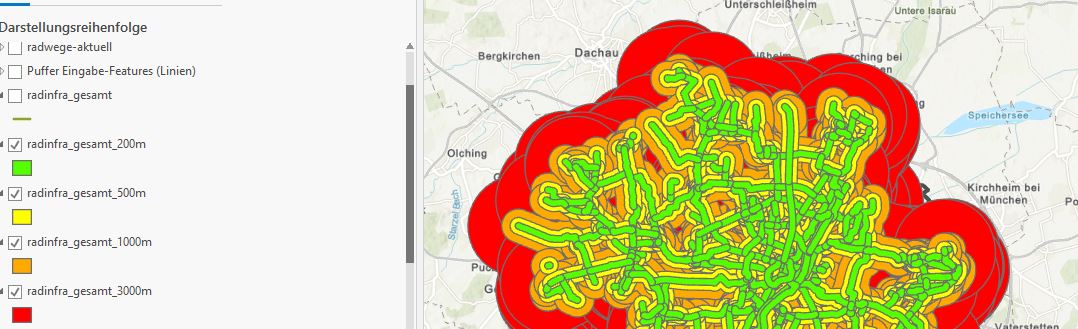
currently I am working on a project to analyse the bicylce infrastructure in Munich.
Therefore I created different layers with the bicycle infrastructure and different buffer zones.
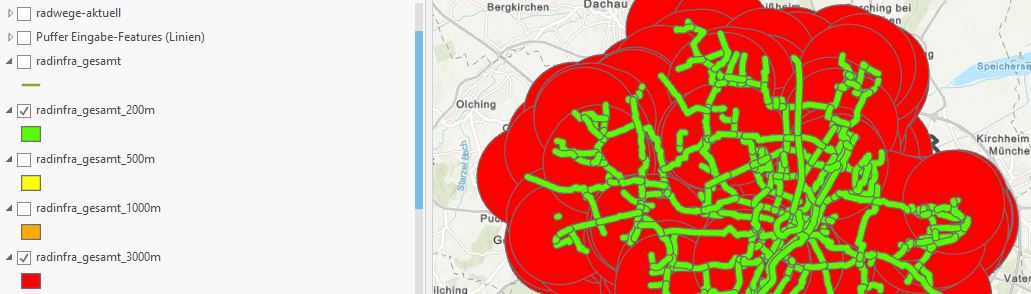
Buffer zones include 200m 500m 1000m and 3000m
The closer the zones to the bicycle infrastructure, the better. 200m (green) got grade 1 and 500 Meter grade 2 etc.
So I would like to merge the currently four layers to one layer and include the information about the grades.
I already used the tool union, but it didnt work. The tool merge, merged the polygons without including the information about the grades
Hope that you get the struggle.
- Mark as New
- Bookmark
- Subscribe
- Mute
- Subscribe to RSS Feed
- Permalink
- Report Inappropriate Content
If you only have 4 zones, I'd say the easiest option is to add a field called 'grade' to each zone feature class/shapefile.
For each feature, start editing, and add the relevant grade to the 'grade' field in the attribute table.
Edit feature attributes—ArcGIS Pro | Documentation
then merge the features.
However, looking at your data, the features seem to be overlapping, and this is incorrect.
I would recompute your buffers using Multiple Ring Buffer (Analysis)—ArcGIS Pro | Documentation
with a dissolve option of 'ALL' /ring buffers.
- Mark as New
- Bookmark
- Subscribe
- Mute
- Subscribe to RSS Feed
- Permalink
- Report Inappropriate Content
Hello David,
thanks for your reply.
Yes they are overlapping so this is one reason why I am struggeling.
Ok thank you for your feedback
Kind regards
Hanne
- Mark as New
- Bookmark
- Subscribe
- Mute
- Subscribe to RSS Feed
- Permalink
- Report Inappropriate Content
- Mark as New
- Bookmark
- Subscribe
- Mute
- Subscribe to RSS Feed
- Permalink
- Report Inappropriate Content
Can you provide a sample of the data so we can experiment with various workflows?