- Home
- :
- All Communities
- :
- Products
- :
- ArcGIS Pro
- :
- ArcGIS Pro Questions
- :
- Re: ArcGIS Pro Convert 2D to 3D algorithm??
- Subscribe to RSS Feed
- Mark Topic as New
- Mark Topic as Read
- Float this Topic for Current User
- Bookmark
- Subscribe
- Mute
- Printer Friendly Page
ArcGIS Pro Convert 2D to 3D algorithm??
- Mark as New
- Bookmark
- Subscribe
- Mute
- Subscribe to RSS Feed
- Permalink
- Report Inappropriate Content
Dear users,
I am working on a project in which I want to overlay vector and raster data on DTM. I do have layers that cover whole area of DTM. The final purpose is to 3D print the terrain model in full-color.
I am just wondering what is the methodology/workflow/algorithm of the Convert tool (the one in view tab) in ArcGIS Pro. While having all the mentioned layers active in 2D view, after clicking Convert it automatically overlays those 2D layers onto 3D terrain model created from raster DTM. The final result looks nice but I would like to perform some accuracy analysis but cannot find the tool being described anywhere.
Is there any other way to do it in a controlled manner?
Best Regards,
Jakub
- Mark as New
- Bookmark
- Subscribe
- Mute
- Subscribe to RSS Feed
- Permalink
- Report Inappropriate Content
Proprietary? What do you mean by 'accuracy assessment'? what are you looking at assessing? that isn't clear.
Beyond simple vector to raster conversion, is there something else?
- Mark as New
- Bookmark
- Subscribe
- Mute
- Subscribe to RSS Feed
- Permalink
- Report Inappropriate Content
The data that I am using comes from National Park's database and is given on demand.
As I said, the orthofoto is stretched over 3D terrain model. I am wondering how the software matches the 3D surface with 2D surface after hitting Convert and entering 3D view.
The whole project is meant to have a scientific approach and this is why I need to perform quality assessment. I know what is input's data accuracy, I know what is the output device's (3D printer) accuracy, post-processing, etc. but I also need to know what happens in between - during conversions for example.
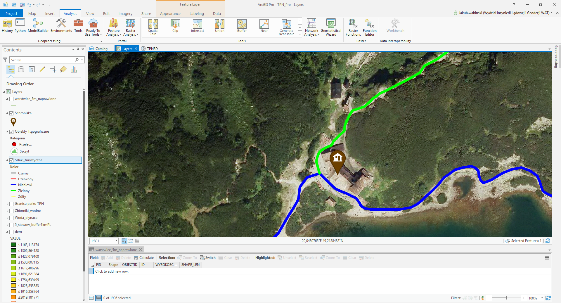
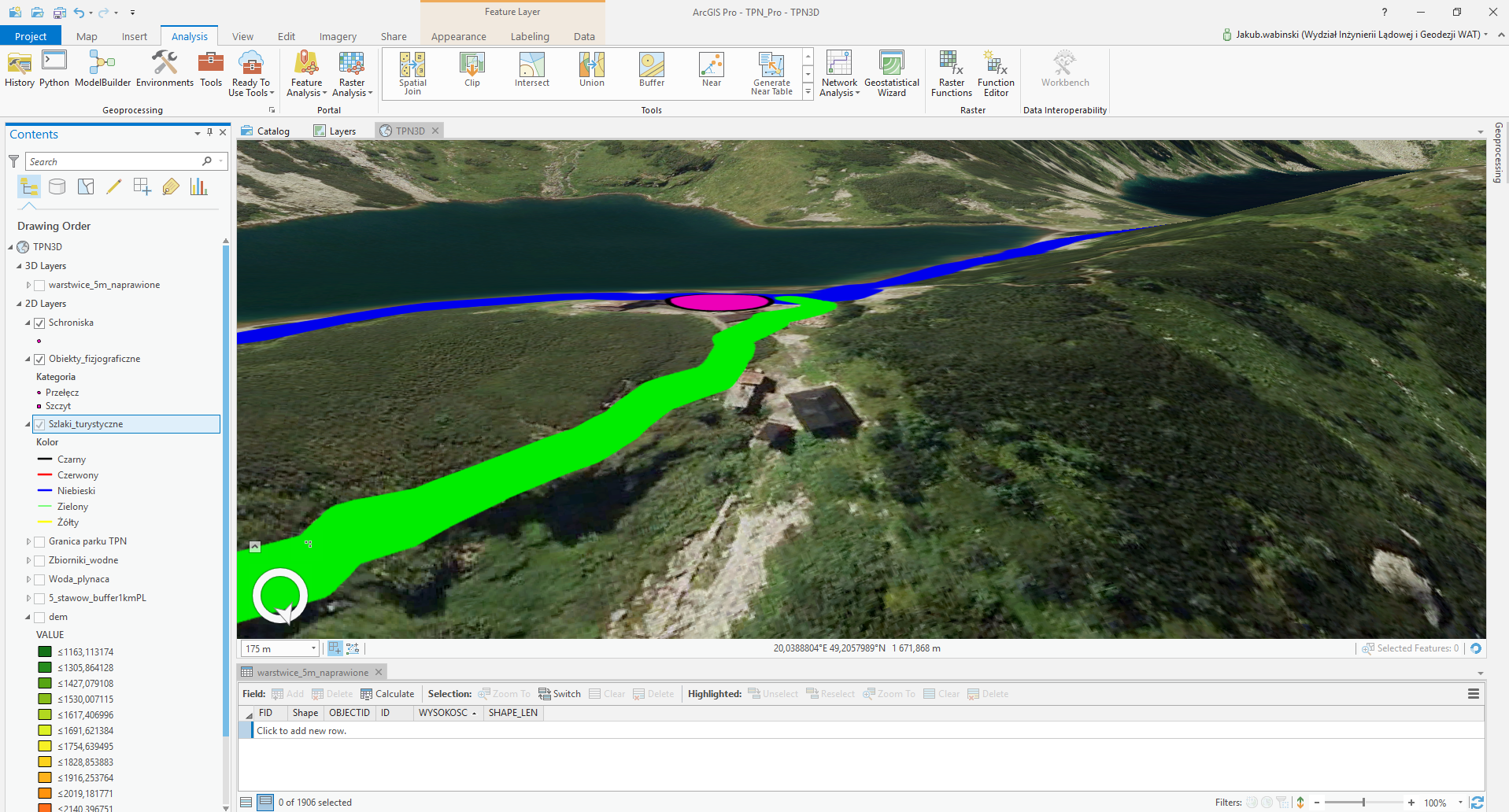
To give an idea about the project I enclose two screenshots of the same area in 2D and 3D view.
- Mark as New
- Bookmark
- Subscribe
- Mute
- Subscribe to RSS Feed
- Permalink
- Report Inappropriate Content
Ok, makes more sense now. I will cross-share with https://community.esri.com/community/gis/3d?sr=search&searchId=33df317d-da68-48cf-a7e7-5e0262051368&... since I doubt there was a huge shift between ArcMap and ArcGIS Pro in terms of how the general vector to raster was done. As for the 3D perspective view, it looks like they just offset the vector from the terrain, unless you did that
- Mark as New
- Bookmark
- Subscribe
- Mute
- Subscribe to RSS Feed
- Permalink
- Report Inappropriate Content
All the 2D data are projected on 3D surface and I am wondering how it's done.
Raster data here are only orthofoto and DEM.
The view shown in 3D screen was generated automatically after preparing all the layers in 2D view first and hitting this famous Convert tool  BTW: What is the equivalent of this tool in ArcMap?