- Home
- :
- All Communities
- :
- Products
- :
- ArcGIS Pro
- :
- ArcGIS Pro Questions
- :
- ArcGIS Pro 2.5: The “back link raster” obtained fr...
- Subscribe to RSS Feed
- Mark Topic as New
- Mark Topic as Read
- Float this Topic for Current User
- Bookmark
- Subscribe
- Mute
- Printer Friendly Page
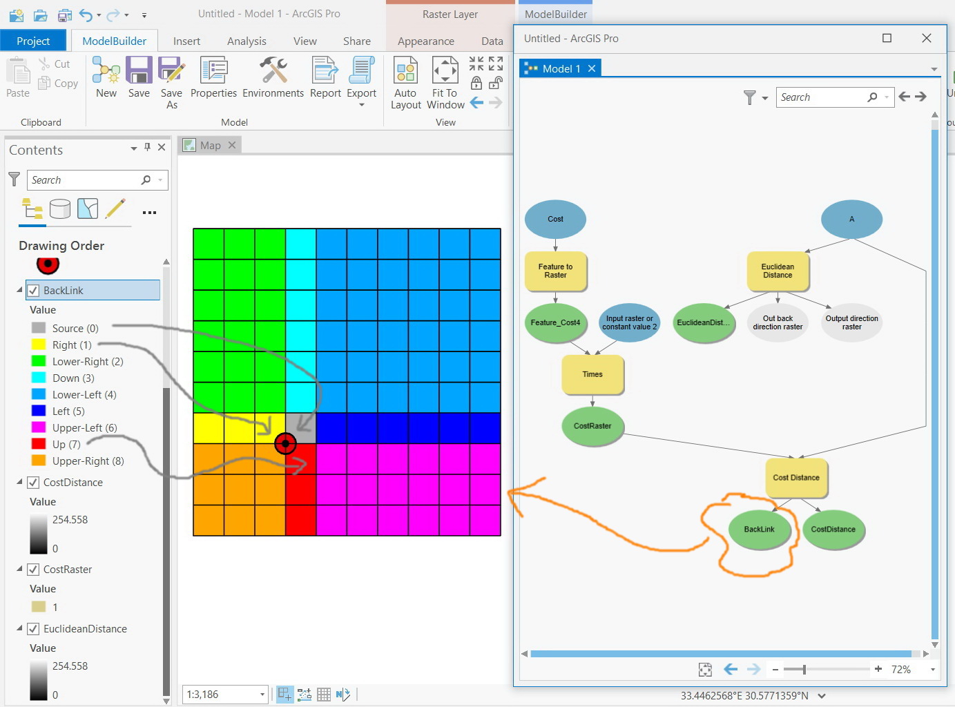
ArcGIS Pro 2.5: The “back link raster” obtained from “cost distance” appears to contain incorrect values for some of its cells particularly around the source point,
- Mark as New
- Bookmark
- Subscribe
- Mute
- Subscribe to RSS Feed
- Permalink
ArcGIS Pro 2.5: The “back link raster” obtained from “cost distance” appears to contain incorrect values for some of its cells particularly around the source point,
For example, in the screenshot below, the red color around the source point is expected to indicate moving “upper-left” but not “up” in order to best approach the source point!
What could be the issue here?
Jamal Numan
Geomolg Geoportal for Spatial Information
Ramallah, West Bank, Palestine
- Mark as New
- Bookmark
- Subscribe
- Mute
- Subscribe to RSS Feed
- Permalink
How cost distance tools work—Help | Documentation
From your related question, the cost calculation methods for diagonal and adjacent cells are described here
... sort of retired...
- Mark as New
- Bookmark
- Subscribe
- Mute
- Subscribe to RSS Feed
- Permalink
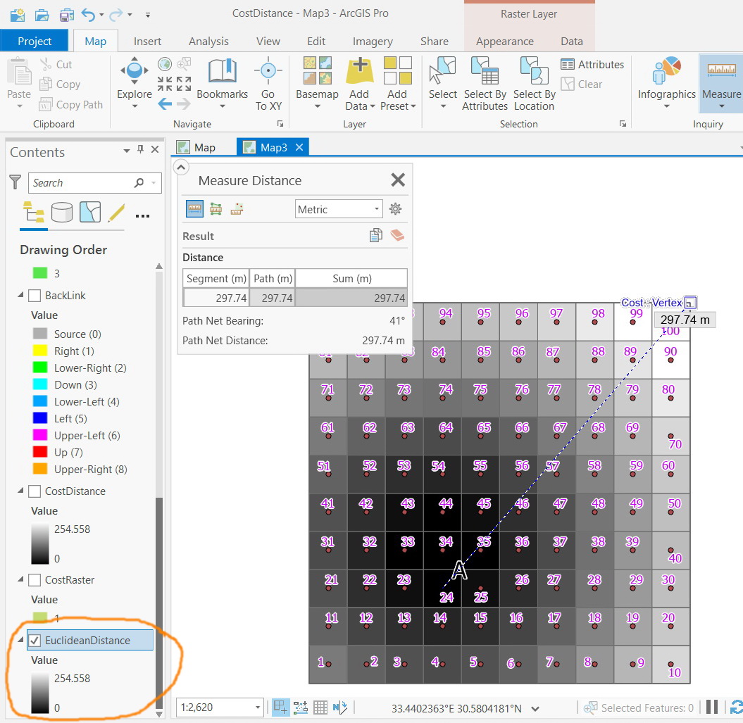
I moved the source point to the center of cell # 24. I reviewed the output Back Link raster and found out that the description of the colors doesn’t match the correct direction the cell needs to go in order to approach the source point.
For example, cell # 25 needs to move to “left” but not “upper left”.
Jamal Numan
Geomolg Geoportal for Spatial Information
Ramallah, West Bank, Palestine
- Mark as New
- Bookmark
- Subscribe
- Mute
- Subscribe to RSS Feed
- Permalink
measure to the cell center not the upper corner edge
... sort of retired...
- Mark as New
- Bookmark
- Subscribe
- Mute
- Subscribe to RSS Feed
- Permalink
Do you mean that the colors of the cells surrounding the source point are correct? The description of colors don’t match the best way the neighboring cells should approach the source point

Jamal Numan
Geomolg Geoportal for Spatial Information
Ramallah, West Bank, Palestine
- Mark as New
- Bookmark
- Subscribe
- Mute
- Subscribe to RSS Feed
- Permalink
It really looks like you're moving the 'source' point but not recomputing the cost distance, or using the old output, if it's not set to override it will output something like BackLink_1
- Mark as New
- Bookmark
- Subscribe
- Mute
- Subscribe to RSS Feed
- Permalink
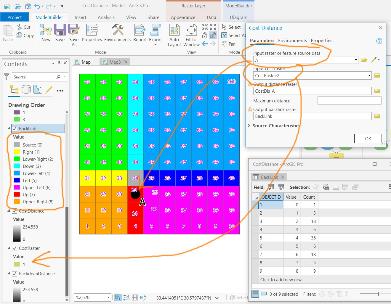
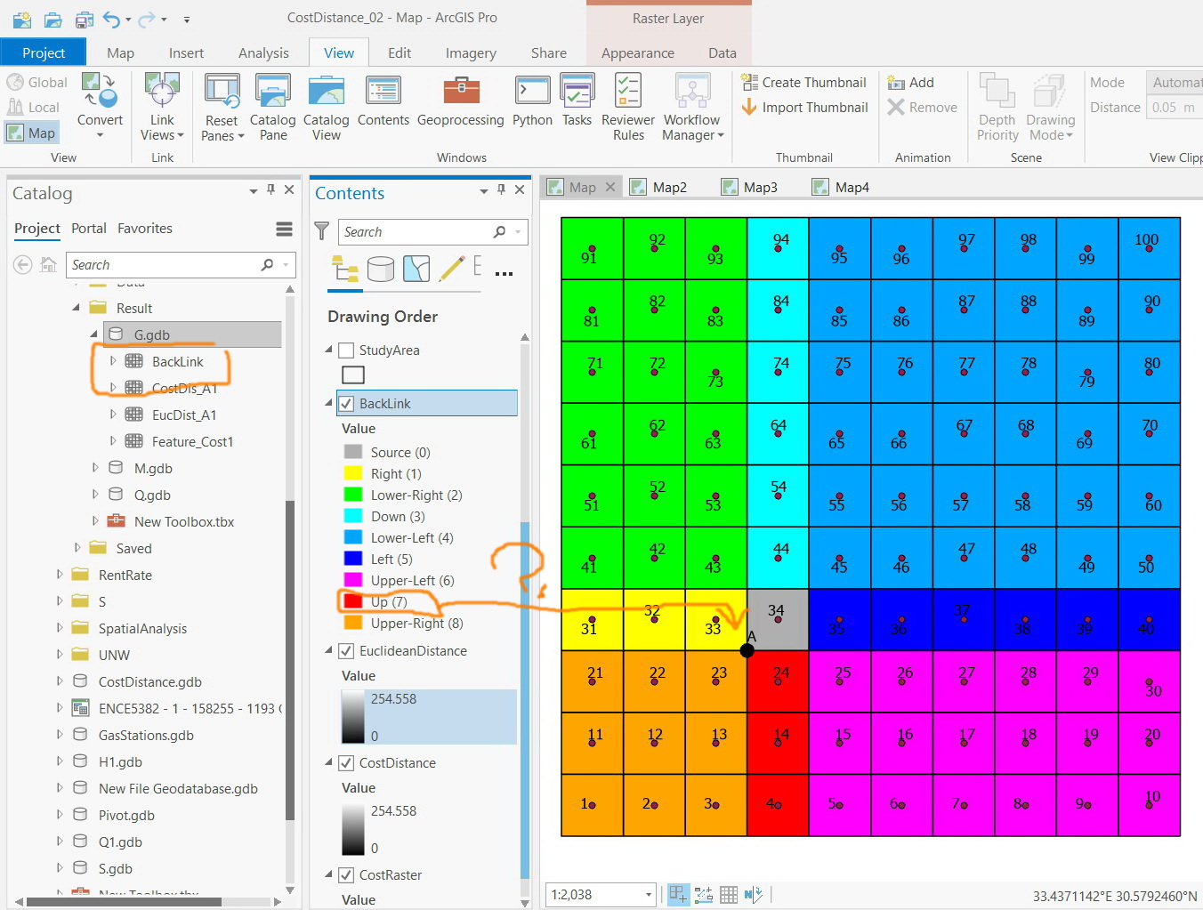
Let me then remove the source point to the original location as in my first post (which is at the upper left corner of cell#24)
Are the directions that appear for the cells of the “back link” correct?
The data is attached
Jamal Numan
Geomolg Geoportal for Spatial Information
Ramallah, West Bank, Palestine
- Mark as New
- Bookmark
- Subscribe
- Mute
- Subscribe to RSS Feed
- Permalink
Notice that your source cell (in gray) is numbered 34, Your point is identified as being that cell, so the cell 24 is indeed Up (7)
... sort of retired...
- Mark as New
- Bookmark
- Subscribe
- Mute
- Subscribe to RSS Feed
- Permalink
The source point is located the point of intersection of cell#23, 24, 33, and 34. Why is it considered as if at the center of cell#34?
Jamal Numan
Geomolg Geoportal for Spatial Information
Ramallah, West Bank, Palestine
- Mark as New
- Bookmark
- Subscribe
- Mute
- Subscribe to RSS Feed
- Permalink
when the raster was formed, it was assigned that location because of the way you set the extent of the raster. If you wanted the origin to be located in the center of the cell you should have accounted for the potential 1/2 cell size translocation to ensure that the point was in the center.
Perhaps that is the source of your confusion. when looking at the backlink raster you have to look at the source "cell" and not the original point
... sort of retired...