- Home
- :
- All Communities
- :
- Products
- :
- ArcGIS Pro
- :
- ArcGIS Pro Questions
- :
- ArcGIS Pro 2.5: Is there a geoprocessing tool to p...
- Subscribe to RSS Feed
- Mark Topic as New
- Mark Topic as Read
- Float this Topic for Current User
- Bookmark
- Subscribe
- Mute
- Printer Friendly Page
ArcGIS Pro 2.5: Is there a geoprocessing tool to plot the Triangulated Irregular Network (TIN) given a set of points?
- Mark as New
- Bookmark
- Subscribe
- Mute
- Subscribe to RSS Feed
- Permalink
- Report Inappropriate Content
ArcGIS Pro 2.5: Is there a geoprocessing tool to plot the Triangulated Irregular Network (TIN) given a set of points?
I couldn’t figure out if there is a geoprocessing tool to plot the Triangulated Irregular Network (TIN) given a set of points
Jamal Numan
Geomolg Geoportal for Spatial Information
Ramallah, West Bank, Palestine
Solved! Go to Solution.
Accepted Solutions
- Mark as New
- Bookmark
- Subscribe
- Mute
- Subscribe to RSS Feed
- Permalink
- Report Inappropriate Content
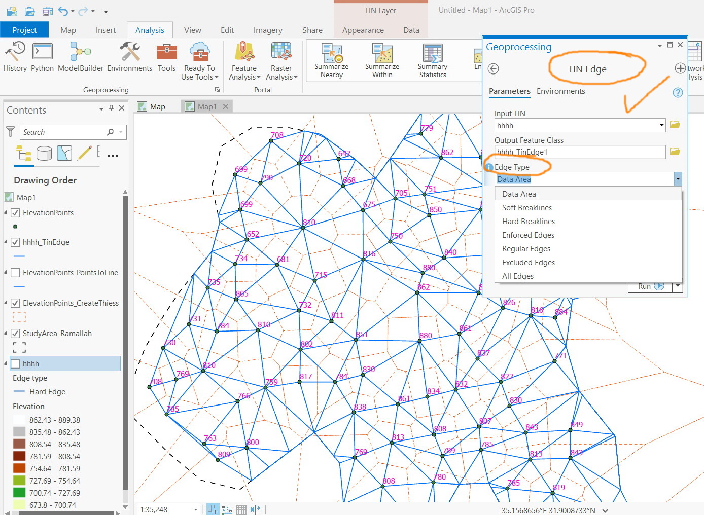
Exploring the 3D toolset, I came across
3D, Tin Dataset, Conversion ... Tin edge, Tin breakline etc
here is Tin edge
explore with the toolset for more options
... sort of retired...
- Mark as New
- Bookmark
- Subscribe
- Mute
- Subscribe to RSS Feed
- Permalink
- Report Inappropriate Content
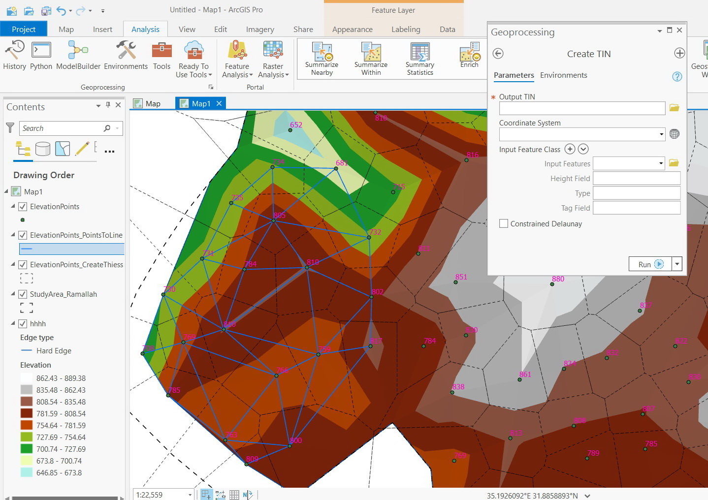
You need the 3D analyst
Create TIN—Help | Documentation
Or soon... Tin is done using a Delaunay triangulation
... sort of retired...
- Mark as New
- Bookmark
- Subscribe
- Mute
- Subscribe to RSS Feed
- Permalink
- Report Inappropriate Content
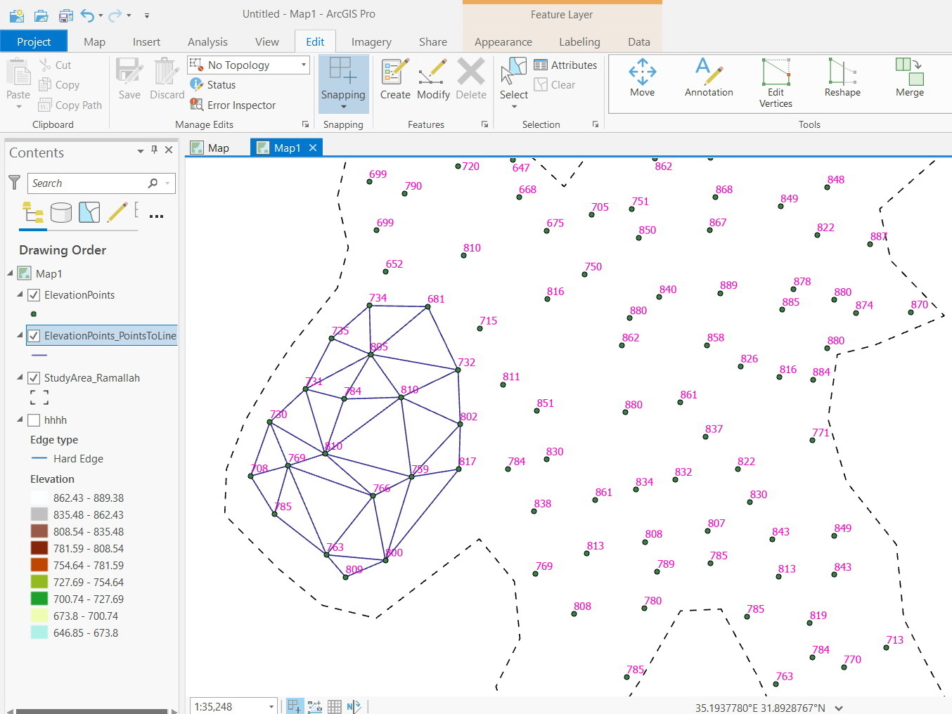
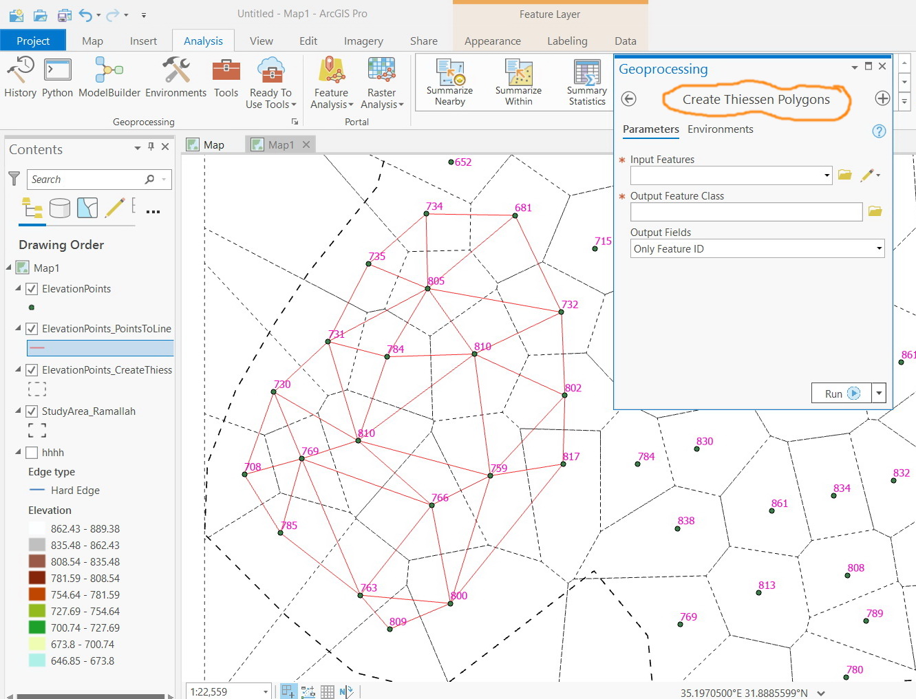
What I wanted here is a tool that can draw the Triangulated Irregular Network (TIN) but not to create the TIN itself or the Thiessen Polygons Delaunay Triangulation, i.e., I need to draw the triangles network between the given set of points
Jamal Numan
Geomolg Geoportal for Spatial Information
Ramallah, West Bank, Palestine
- Mark as New
- Bookmark
- Subscribe
- Mute
- Subscribe to RSS Feed
- Permalink
- Report Inappropriate Content
Exploring the 3D toolset, I came across
3D, Tin Dataset, Conversion ... Tin edge, Tin breakline etc
here is Tin edge
explore with the toolset for more options
... sort of retired...
- Mark as New
- Bookmark
- Subscribe
- Mute
- Subscribe to RSS Feed
- Permalink
- Report Inappropriate Content
Great. It works for me. Many thanks Dan
Jamal Numan
Geomolg Geoportal for Spatial Information
Ramallah, West Bank, Palestine