- Home
- :
- All Communities
- :
- Products
- :
- ArcGIS Pro
- :
- ArcGIS Pro Questions
- :
- ArcGIS Pro 2.5: How can the “generate near table” ...
- Subscribe to RSS Feed
- Mark Topic as New
- Mark Topic as Read
- Float this Topic for Current User
- Bookmark
- Subscribe
- Mute
- Printer Friendly Page
ArcGIS Pro 2.5: How can the “generate near table” tool calculate the distance from each source point layer to each destination point layer?
- Mark as New
- Bookmark
- Subscribe
- Mute
- Subscribe to RSS Feed
- Permalink
- Report Inappropriate Content
ArcGIS Pro 2.5: How can the “generate near table” tool calculate the distance from each source point layer to each destination point layer?
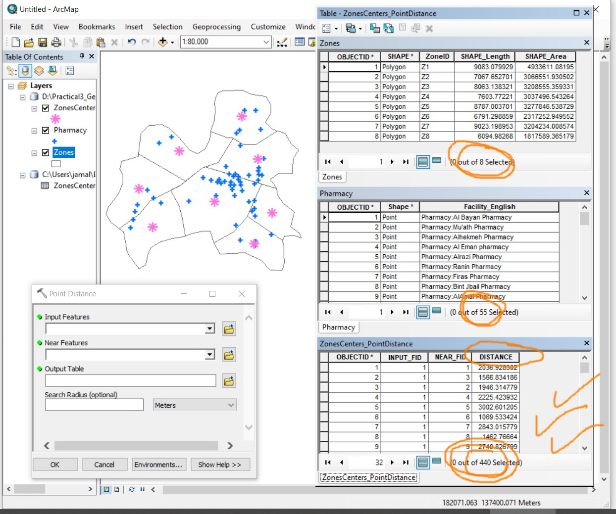
As the “point distance” is deprecated in Pro, I couldn’t figure out how the “generate near table” tool can calculate the distance from each source point layer to each destination point layer
For example, in the screenshot below, I wanted to calculate the distance from the zonecenter layer (which has 8 points) and the pharmacies (which has 55 points). I’m expecting to have a table of 440 rows (8x55). This is used to be performed easily in ArcMap with the “point distance” tool.
How can the “generate near table” tool generates a table of 440 rows from a source point layer of 8 point layer and destination layer of 55 points?
This issue has been already discussed here:

Jamal Numan
Geomolg Geoportal for Spatial Information
Ramallah, West Bank, Palestine
Solved! Go to Solution.
Accepted Solutions
- Mark as New
- Bookmark
- Subscribe
- Mute
- Subscribe to RSS Feed
- Permalink
- Report Inappropriate Content
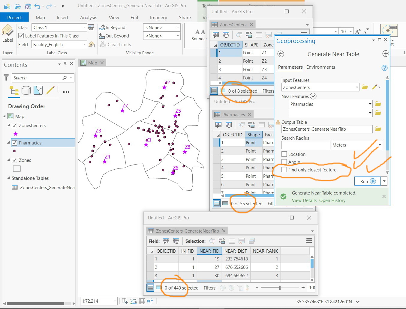
uncheck "find closest feature"
You can find the closest later, since the closest may only be in one layer and not in the other.
If no Search Radius is specified and Find only closest features is unchecked (closest set to ALL in Python), and Maximum number of closest is left to default (0 or empty), the output table will contain distance calculations between all input features and all near features. This kind of process can take quite a long time and can create a large output table. For example, if you have 1,000 input features and 1,000 near features, the output table will contain 1,000,000 records.
- Mark as New
- Bookmark
- Subscribe
- Mute
- Subscribe to RSS Feed
- Permalink
- Report Inappropriate Content
Many thanks Dan for the help. This precisely answers my questions
Jamal Numan
Geomolg Geoportal for Spatial Information
Ramallah, West Bank, Palestine