- Home
- :
- All Communities
- :
- Products
- :
- ArcGIS Pro
- :
- ArcGIS Pro Questions
- :
- Re: ArcGIS Pro 2.5: “analyze mosaic dataset” tool ...
- Subscribe to RSS Feed
- Mark Topic as New
- Mark Topic as Read
- Float this Topic for Current User
- Bookmark
- Subscribe
- Mute
- Printer Friendly Page
ArcGIS Pro 2.5: “analyze mosaic dataset” tool ends up with “references files are inaccessible” error,
- Mark as New
- Bookmark
- Subscribe
- Mute
- Subscribe to RSS Feed
- Permalink
ArcGIS Pro 2.5: “analyze mosaic dataset” tool ends up with “references files are inaccessible” error,
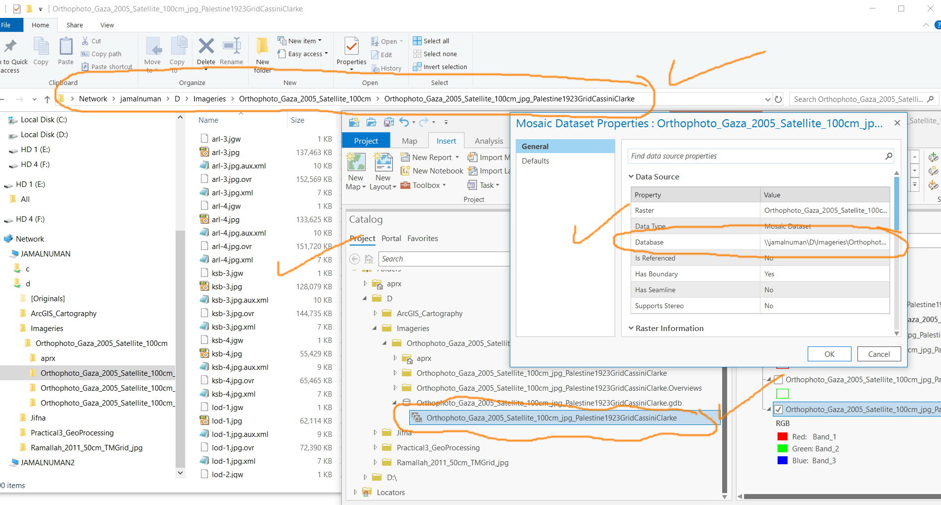
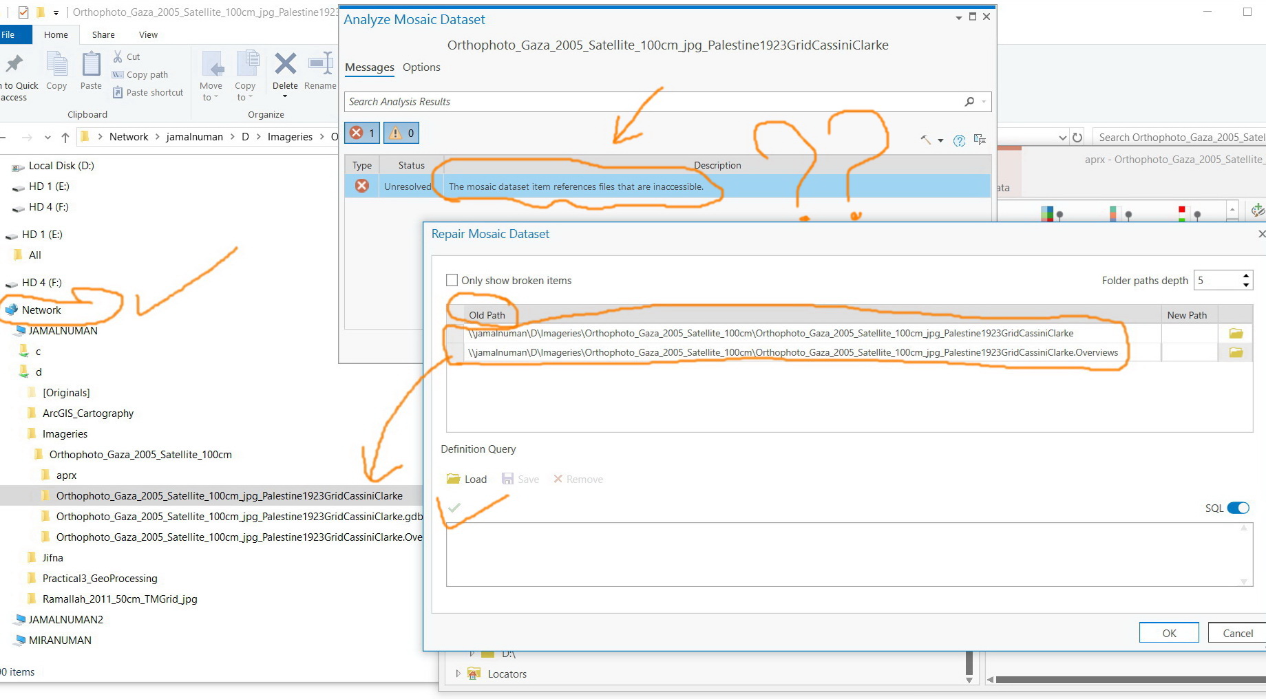
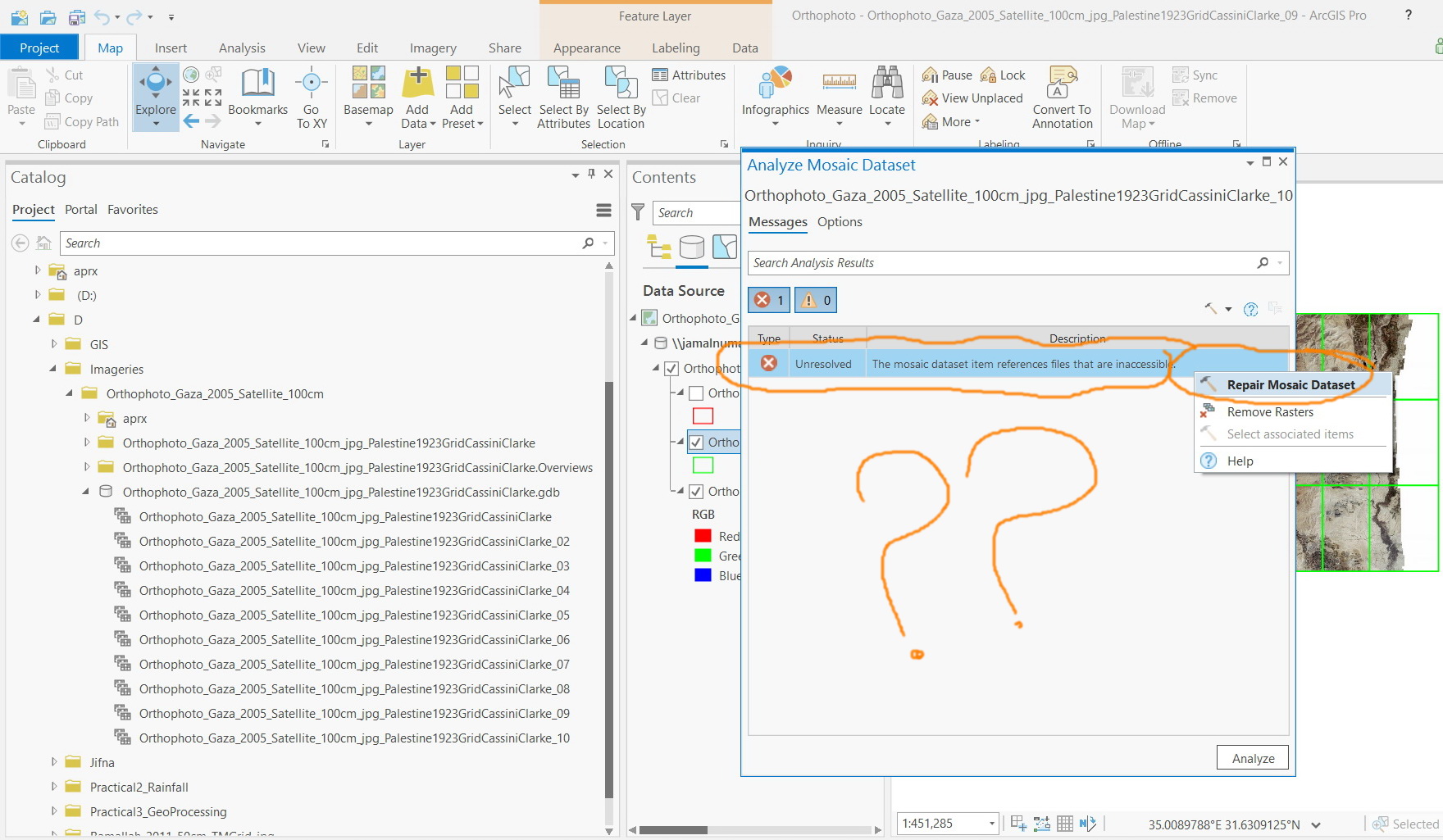
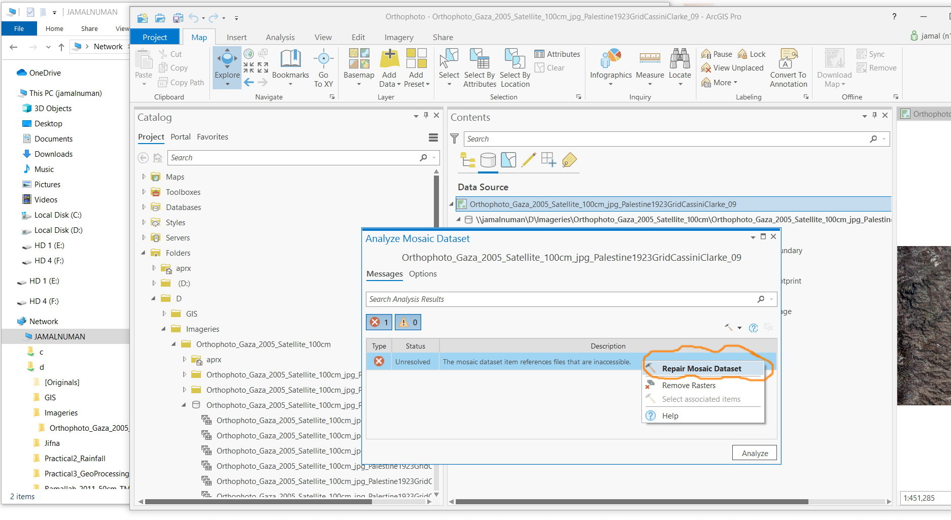
The “analyze mosaic dataset” tool ends up with “references files are inaccessible” despite the fact that the folder where the images are saved is shared and accessible as shown in the screenshots below.
What could be the issue here?

Jamal Numan
Geomolg Geoportal for Spatial Information
Ramallah, West Bank, Palestine
- Mark as New
- Bookmark
- Subscribe
- Mute
- Subscribe to RSS Feed
- Permalink
In reviewing some internal documents, one workflow to try to resolve is the following:
"Resolution: A mapped drive was used when adding image path to the mosaic dataset (MDS), and a folder may have been changed, thus resulting in the file path save in the MDS to be not accessible. We can Observe the Paths with the Export Mosaic Dataset Paths tool (1), and repair them with Repair Mosaic Dataset Paths (2), It's best practice to use UNC paths(3) to files in a MDS, and here is some documentation that may be applicable to NTSF or NAS Storage devices when used with ArcGIS Server (4) "
Supporting Documentation:
1 - Export Mosaic Dataset Paths - https://pro.arcgis.com/en/pro-app/tool-reference/data-management/export-mosaic-dataset-paths.htm
2 - Repair Mosaic Dataset Paths - https://pro.arcgis.com/en/pro-app/tool-reference/data-management/repair-mosaic-dataset-paths.htm
3 - Paths explained: Absolute, relative, UNC, and URL - http://desktop.arcgis.com/en/arcmap/10.3/tools/supplement/pathnames-explained-absolute-relative-unc-...
4 - Choose a NAS device for ArcGIS Server - https://enterprise.arcgis.com/en/server/latest/install/windows/choosing-a-nas-device.htm
If this doesn't work, then I'll research a bit deeper.
- Mark as New
- Bookmark
- Subscribe
- Mute
- Subscribe to RSS Feed
- Permalink
Hi Robert,
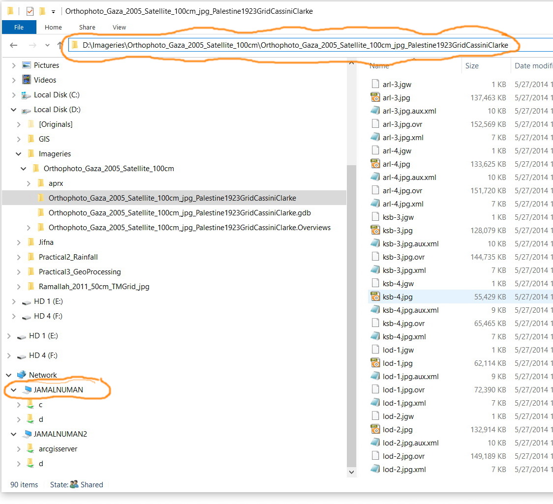
All what I did is that I added the images to the mosaic with their UNC path instead of non-UNC path
Non-UNC path
D:\Imageries\Orthophoto_Gaza_2005_Satellite_100cm\Orthophoto_Gaza_2005_Satellite_100cm_jpg_Palestine1923GridCassiniClarke
UNC path
\\Jamalnuman\d\Imageries\Orthophoto_Gaza_2005_Satellite_100cm\Orthophoto_Gaza_2005_Satellite_100cm_jpg_Palestine1923GridCassiniClarke
Why should this generates all of these errors?

Jamal Numan
Geomolg Geoportal for Spatial Information
Ramallah, West Bank, Palestine
- Mark as New
- Bookmark
- Subscribe
- Mute
- Subscribe to RSS Feed
- Permalink
Jamal:
Did you create the Raster Mosaic Datasets (RMDs) in ArcMap or Pro?
What is the workflow you have used thus far in processing your RMDs in Pro?
If you performed the same process of analyzing the RMD in ArcMap, would you have the same issue?
- Mark as New
- Bookmark
- Subscribe
- Mute
- Subscribe to RSS Feed
- Permalink
Hi Michael,
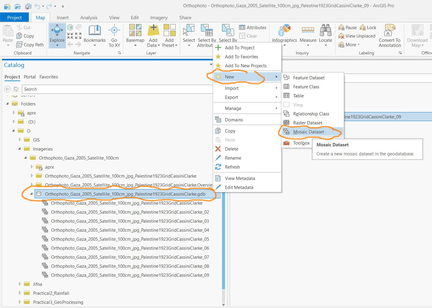
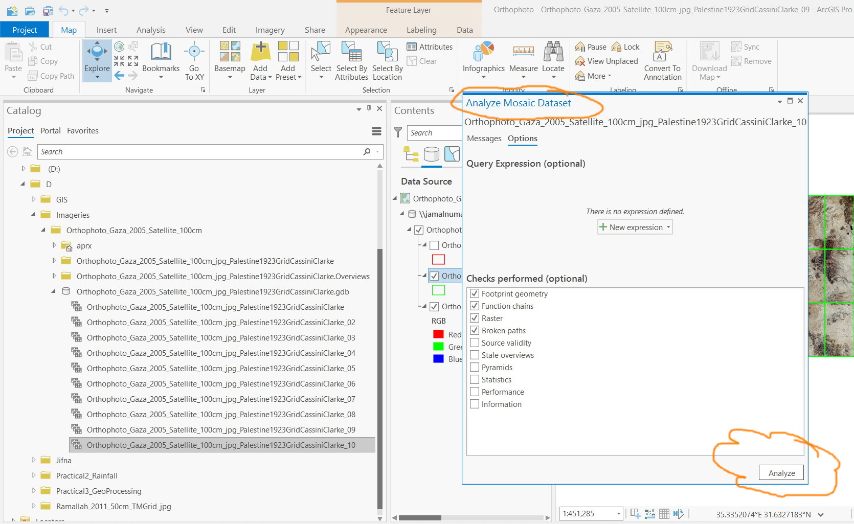
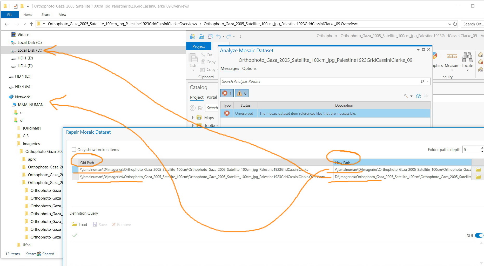
The steps are illustrated in the screenshots below
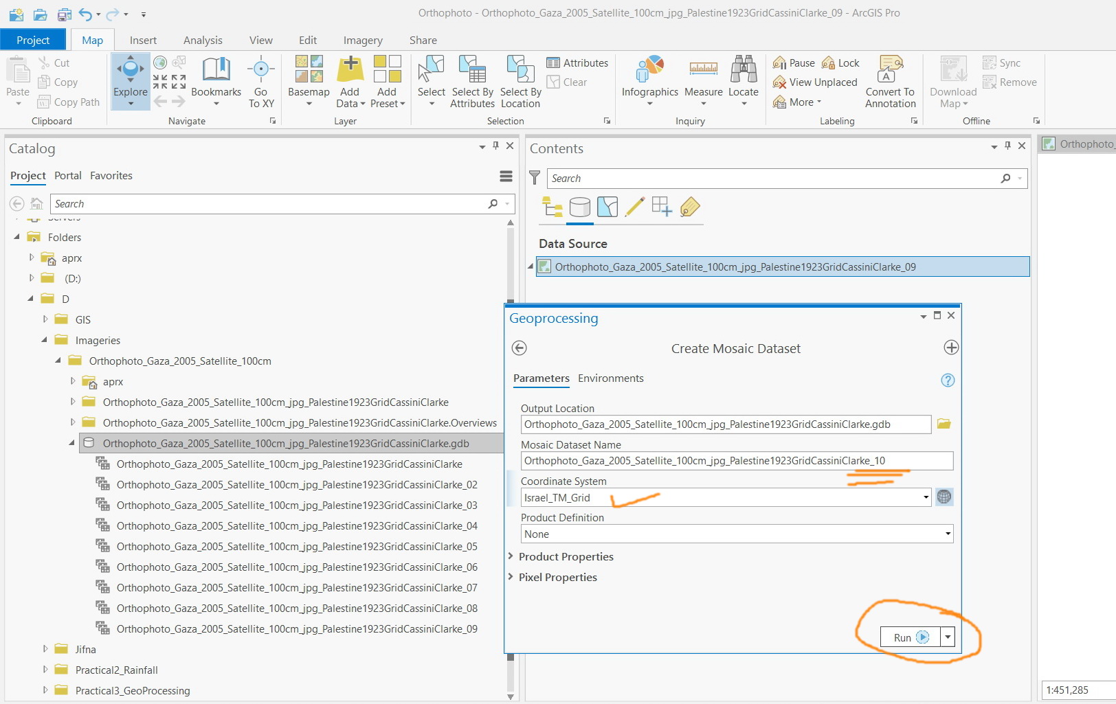
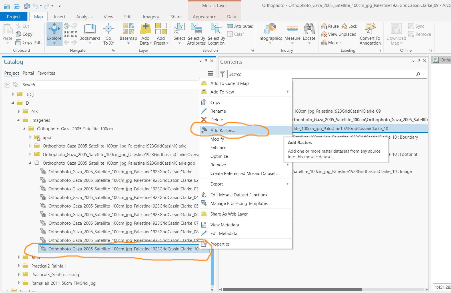

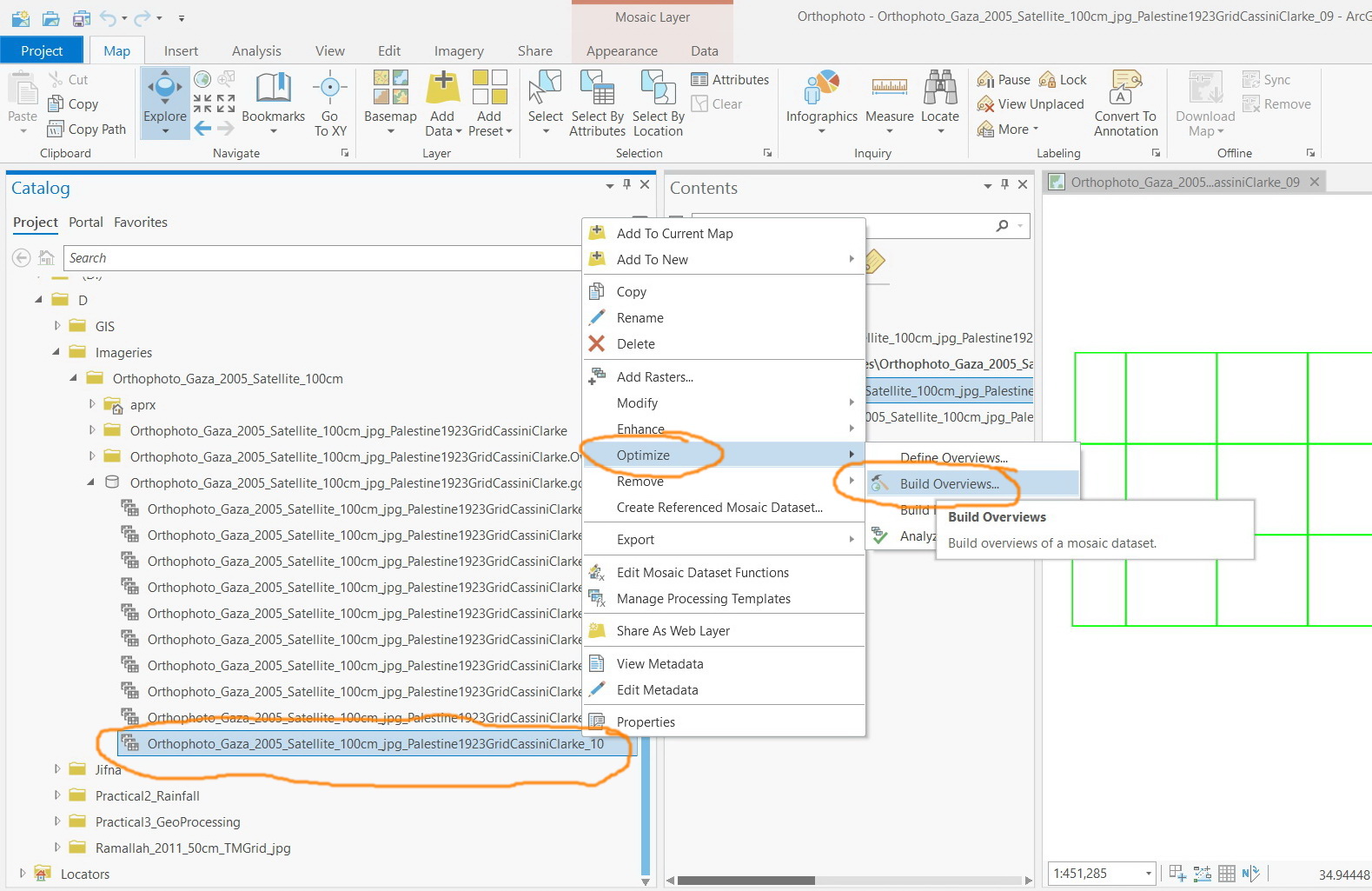
Jamal Numan
Geomolg Geoportal for Spatial Information
Ramallah, West Bank, Palestine
- Mark as New
- Bookmark
- Subscribe
- Mute
- Subscribe to RSS Feed
- Permalink
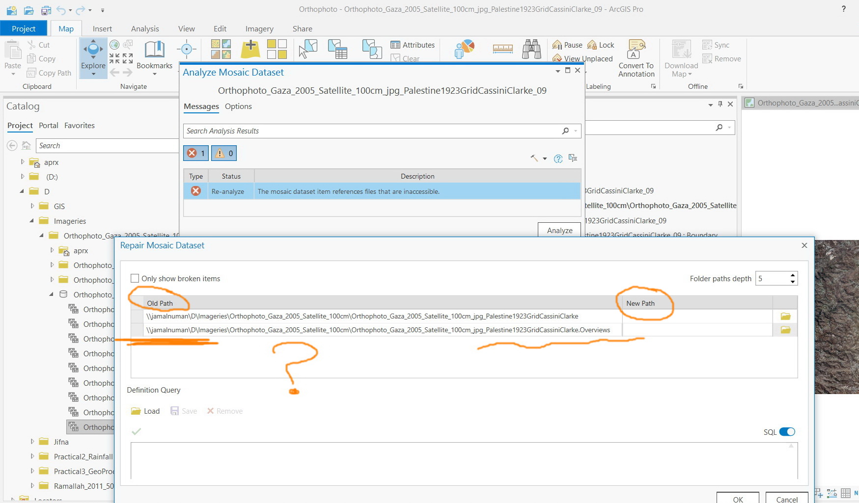
Cont. for the steps
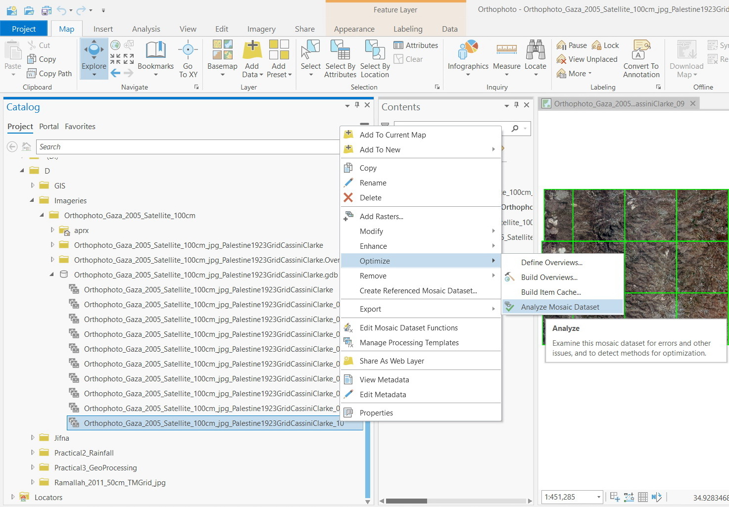
Jamal Numan
Geomolg Geoportal for Spatial Information
Ramallah, West Bank, Palestine
- Mark as New
- Bookmark
- Subscribe
- Mute
- Subscribe to RSS Feed
- Permalink
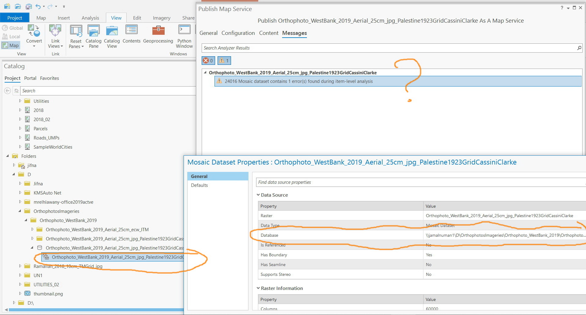
The “the mosaic dataset item references files that are inaccessible” error persists to exist despite the fact that all the content of the mosaic are referenced with their UNC.
What could be the issue here?

Jamal Numan
Geomolg Geoportal for Spatial Information
Ramallah, West Bank, Palestine
- Mark as New
- Bookmark
- Subscribe
- Mute
- Subscribe to RSS Feed
- Permalink
You need to repair the path for the overviews and set it to read from the original path and not from the shared folder, this will solve the issue!! But I couldn’t figure out why it fails to read it from the shared folder!!
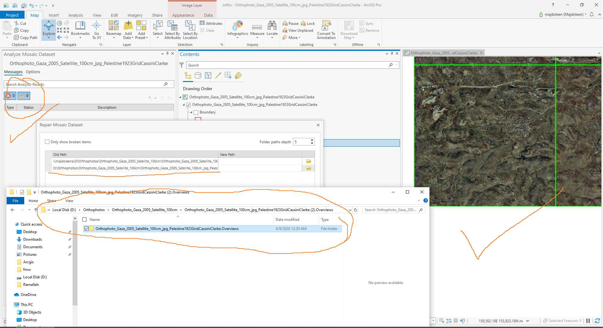
Also, you need to close the Acgis pro before publishing the map, and then open in and make sure that the aprx is opened from the network path and not the D drive.
- Mark as New
- Bookmark
- Subscribe
- Mute
- Subscribe to RSS Feed
- Permalink
Thank you Majdoleen for the help.
Changing the overview path fails and sticks to the UNC path and thus the error persists to exist
Jamal Numan
Geomolg Geoportal for Spatial Information
Ramallah, West Bank, Palestine
- Mark as New
- Bookmark
- Subscribe
- Mute
- Subscribe to RSS Feed
- Permalink
Jamal:
Did you originally add your rasters and create your overviews with a mapped network drive or unc path?
I just created a new folder on a network drive and copied some image files to this folder. I then created a folder connection in Pro using a unc path and not a mapped network drive as I would like to create an image service from this RMD. I then created a new file gdb in Pro and created a new RMD in Pro inside the new file gdb. I then added the Rasters to the RMD with the unc path. I then created the overviews with the destination for the overviews also being written to the unc path. The RMD worked perfectly and when I ran the Repair function on the RMD, it was still using the unc path.
So if you have not already done so, I would make sure all operations pertaining to the RMD (adding rasters and creating overviews) are done with a folder connection defined by a unc path and not a mapped network drive letter.