- Home
- :
- All Communities
- :
- Products
- :
- ArcGIS Pro
- :
- ArcGIS Pro Questions
- :
- 24138 Unknown Measurement fields / Web Map Share
- Subscribe to RSS Feed
- Mark Topic as New
- Mark Topic as Read
- Float this Topic for Current User
- Bookmark
- Subscribe
- Mute
- Printer Friendly Page
24138 Unknown Measurement fields / Web Map Share
- Mark as New
- Bookmark
- Subscribe
- Mute
- Subscribe to RSS Feed
- Permalink
Hello everyone,
I can't share a Web Map on ArcGIS Online due to error 24138: the layer's pop-up definition contains measurement fields that are not supported online.
This is the first time we have encountered this issue. The help associated with this error hasn't been very useful. Is there a simpler solution by any chance?
Thanks in advance for your help.
- Mark as New
- Bookmark
- Subscribe
- Mute
- Subscribe to RSS Feed
- Permalink
Typically, these warnings do not entirely prevent the publishing of a Web Map. Typically an error which is the red circle and X are the ones that prevent publishing. I can't see the publish button at the bottom so it may very well be grayed out, but it might not be because of this.
If possible, would you be able to post a screenshot of the error that produces when you attempt to share the map? It should show up as the red box and text at the bottom of the share tool.
Cody
- Mark as New
- Bookmark
- Subscribe
- Mute
- Subscribe to RSS Feed
- Permalink
Hello @CodyPatterson
Alright, got it! Attached is the error message I get when sharing the Web Map. Here is the translated error message: Failed to publish the Web Layer.
Thanks for your help !
Norbert
- Mark as New
- Bookmark
- Subscribe
- Mute
- Subscribe to RSS Feed
- Permalink
Thank you for the screenshot! If you press the "View Log" button, could you send a screenshot of that along with a translation if possible and when time allows? I think we're onto something good here, but I think the log may show us something a little deeper!
Cody
- Mark as New
- Bookmark
- Subscribe
- Mute
- Subscribe to RSS Feed
- Permalink
Here is the log associated with this error 🙂
Etudes FFS - Arkéma - DMDS 20 WebMap TECHNIPIPE https://www.arcgis.com Technipipe_Commercial 2025-03-12 14:08:16 Status: InProgress StatusMessage: Successfully wrote sharing info file
Etudes FFS - Arkéma - DMDS 20 WebMap TECHNIPIPE https://www.arcgis.com/ Technipipe_Commercial 2025-03-12 14:08:17 Status: InProgress StatusMessage: Creating thumbnail from map
Etudes FFS - Arkéma - DMDS 20 WebMap TECHNIPIPE https://www.arcgis.com/ Technipipe_Commercial 2025-03-12 14:08:17 Status: Pending StatusMessage: Sharing process started
Etudes FFS - Arkéma - DMDS 20 WebMap TECHNIPIPE https://www.arcgis.com/ Technipipe_Commercial 2025-03-12 14:08:17 Status: InProgress StatusMessage: Sharing process started
Etudes FFS - Arkéma - DMDS 20 WebMap TECHNIPIPE https://www.arcgis.com/ Technipipe_Commercial 2025-03-12 14:08:17 Status: InProgress StatusMessage: Reading thumbnail from file
Etudes FFS - Arkéma - DMDS 20 WebMap TECHNIPIPE https://www.arcgis.com/ Technipipe_Commercial 2025-03-12 14:08:18 Status: InProgress StatusMessage: The sharing process has started
Etudes FFS - Arkéma - DMDS 20 WebMap TECHNIPIPE https://www.arcgis.com/ Technipipe_Commercial 2025-03-12 14:08:18 Status: InProgress StatusMessage: Extracting all manifests from the Web item configuration
Etudes FFS - Arkéma - DMDS 20 WebMap TECHNIPIPE https://www.arcgis.com/ Technipipe_Commercial 2025-03-12 14:08:18 Status: InProgress StatusMessage: Publishing individual Web layers
Etudes FFS - Arkéma - DMDS 20 WebMap TECHNIPIPE https://www.arcgis.com/ Technipipe_Commercial 2025-03-12 14:08:18 Status: InProgress StatusMessage: Creating type keywords for the Web item
Etudes FFS - Arkéma - DMDS_WFL1 20 WebMap TECHNIPIPE https://www.arcgis.com/ Technipipe_Commercial 2025-03-12 14:08:18 Status: InProgress StatusMessage: Loading manifest
Etudes FFS - Arkéma - DMDS_WFL1 20 WebMap TECHNIPIPE https://www.arcgis.com/ Technipipe_Commercial 2025-03-12 14:08:19 Status: InProgress StatusMessage: Publishing process started
Etudes FFS - Arkéma - DMDS_WFL1 20 WebMap TECHNIPIPE https://www.arcgis.com/ Technipipe_Commercial 2025-03-12 14:08:19 Status: InProgress StatusMessage: Consolidating data and transferring Web layer
Arkema\Etudes FFS - Arkéma - DMDS 20 WebMap TECHNIPIPE https://www.arcgis.com/ Technipipe_Commercial 2025-03-12 14:08:19 Status: InProgress StatusMessage: Using ArcGIS version 13.3 for intermediate (source version: Intermediate geoprocessing settings)
Etudes FFS - Arkéma - DMDS_WFL1 20 WebMap TECHNIPIPE https://www.arcgis.com/ Technipipe_Commercial 2025-03-12 14:08:19 Status: InProgress StatusMessage: Step tool initialized
Etudes FFS - Arkéma - DMDS_WFL1 20 WebMap TECHNIPIPE https://www.arcgis.com/ Technipipe_Commercial 2025-03-12 14:08:19 Status: InProgress StatusMessage: Preparing maps and layers for processing
Etudes FFS - Arkéma - DMDS_WFL1 20 WebMap TECHNIPIPE https://www.arcgis.com/ Technipipe_Commercial 2025-03-12 14:08:19 Status: InProgress StatusMessage: Consolidating data
Etudes FFS - Arkéma - DMDS_WFL1 20 WebMap TECHNIPIPE https://www.arcgis.com/ Technipipe_Commercial 2025-03-12 14:08:19 Status: InProgress StatusMessage: Intermediate feature service
Etudes FFS - Arkéma - DMDS_WFL1 20 WebMap TECHNIPIPE https://www.arcgis.com/ Technipipe_Commercial 2025-03-12 14:08:22 Status: InProgress StatusMessage: Compressing package into SD file
Etudes FFS - Arkéma - DMDS_WFL1 20 WebMap TECHNIPIPE https://www.arcgis.com/ Technipipe_Commercial 2025-03-12 14:08:22 Status: InProgress StatusMessage: Successfully handled intermediate
Etudes FFS - Arkéma - DMDS_WFL1 20 WebMap TECHNIPIPE https://www.arcgis.com/ Technipipe_Commercial 2025-03-12 14:08:23 Status: InProgress StatusMessage: Service definition upload
Etudes FFS - Arkéma - DMDS_WFL1 20 WebMap TECHNIPIPE https://www.arcgis.com/ Technipipe_Commercial 2025-03-12 14:08:23 Status: InProgress StatusMessage: Publishing tool initialized
Etudes FFS - Arkéma - DMDS_WFL1 20 WebMap TECHNIPIPE https://www.arcgis.com/ Technipipe_Commercial 2025-03-12 14:08:23 Status: InProgress StatusMessage: Publishing Web Layer (AGO)
Arkema\Etudes FFS - Arkéma - DMDS 20 WebMap TECHNIPIPE https://www.arcgis.com/ Technipipe_Commercial 2025-03-12 14:08:37 Status: InProgress StatusMessage: failed
Etudes FFS - Arkéma - DMDS_WFL1 20 WebMap TECHNIPIPE https://www.arcgis.com/ Technipipe_Commercial 2025-03-12 14:08:42 Status: InProgress StatusMessage: Failed to publish Web Layer (AGO)
Etudes FFS - Arkéma - DMDS_WFL1 20 WebMap TECHNIPIPE https://www.arcgis.com/ Technipipe_Commercial 2025-03-12 14:08:44 Status: InProgress StatusMessage: Server response: {"error":{"code":400,"message":"Invalid URL","details":["Invalid URL"]}}
Etudes FFS - Arkéma - DMDS_WFL1 20 WebMap TECHNIPIPE https://www.arcgis.com/ Technipipe_Commercial 2025-03-12 14:08:46 Status: InProgress StatusMessage: Server response: Error code: 400 Description: Bad request syntax. Message: Invalid URL Details: Invalid URL
Etudes FFS - Arkéma - DMDS_WFL1 20 WebMap TECHNIPIPE https://www.arcgis.com/ Technipipe_Commercial 2025-03-12 14:08:50 Status: Failed ErrorMessage: Failed to publish Web Layer
Etudes FFS - Arkéma - DMDS 20 WebMap TECHNIPIPE https://www.arcgis.com/ Technipipe_Commercial 2025-03-12 14:08:55 Status: Failed ErrorMessage: Failed to publish one or more Web Layers
- Mark as New
- Bookmark
- Subscribe
- Mute
- Subscribe to RSS Feed
- Permalink
This is perfect! An error message found its way in, specifically the 400 error, this typically may allude to an invalid date field, or domain issue, here are a few posts that you should check out:
You may try to check these fields, and attempt to republish, that's what I had gotten from this here!
Cody
- Mark as New
- Bookmark
- Subscribe
- Mute
- Subscribe to RSS Feed
- Permalink
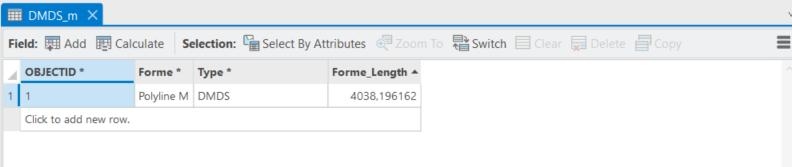
If you right click on the layer that is having the issue (in your case it looks like DMDS_m) you should see "Configure Pop-Ups".

Clicking this will give you the Dialog for configuring the Pop-ups and where you can turn off the offending layers.

Double clicking the generic "Fields" will open the field options and unchecking the "Only use visible fields and arcade expressions" box will allow you to deselect the appropriate fields.

It seems anything marked with Measure needs to be unchecked to clear this error.

Hope this helps.
- Mark as New
- Bookmark
- Subscribe
- Mute
- Subscribe to RSS Feed
- Permalink
Hello @FlightDeck
I just tested this solution by removing all the fields associated with measures, but I get the same result..
Thank you for your help !
Norbert
- Mark as New
- Bookmark
- Subscribe
- Mute
- Subscribe to RSS Feed
- Permalink
I have linked the related documentation below that relates to the error you are getting, apologises if you have already tried this
24138: Layers pop-up definition includes one or more measurement field that is not supported online