Turn on suggestions
Auto-suggest helps you quickly narrow down your search results by suggesting possible matches as you type.
Cancel
- Home
- :
- All Communities
- :
- Products
- :
- ArcGIS Pro
- :
- ArcGIS Pro Ideas
- :
- Pro: Add Coordinate System Column for maps in Cat ...
Options
- Subscribe to RSS Feed
- Mark as New
- Mark as Read
- Bookmark
- Follow this Idea
- Printer Friendly Page
Pro: Add Coordinate System Column for maps in Cat View
Follow this Idea
1479
2
10-08-2018 11:59 AM
Status:
Under Consideration
- Mark as New
- Bookmark
- Subscribe
- Mute
- Subscribe to RSS Feed
- Permalink
So I had a little booboo last week where I cranked out a bunch of maps in WGS84 instead of UTM. Oopsie. If only the following existed...
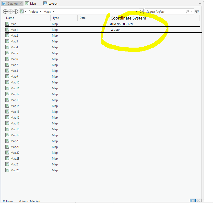
Also handy if you have two of same map, but each in different coordinate system...yes, I know I can write meta data and open it and look at it.....
2 Comments
You must be a registered user to add a comment. If you've already registered, sign in. Otherwise, register and sign in.