- Home
- :
- All Communities
- :
- Products
- :
- ArcGIS Pro
- :
- ArcGIS Pro Ideas
- :
- ArcGIS Pro 2.6: An option to “clear” the coordinat...
- Subscribe to RSS Feed
- Mark as New
- Mark as Read
- Bookmark
- Follow this Idea
- Printer Friendly Page
- Report Inappropriate Content
ArcGIS Pro 2.6: An option to “clear” the coordinate system of “Map” to get it to “unknown” as it is used to be in ArcMap,
- Mark as New
- Bookmark
- Subscribe
- Mute
- Subscribe to RSS Feed
- Permalink
- Report Inappropriate Content
ArcGIS Pro 2.6: An option to “clear” the coordinate system of “Map” to get it to “unknown” as it is used to be in ArcMap,
It would be great if the “clear” option for the coordinate system of “Map” gets available in Pro as it used to be available in ArcMap. In particular cases, it enable us to better understand our data
- Mark as Read
- Mark as New
- Bookmark
- Permalink
- Report Inappropriate Content
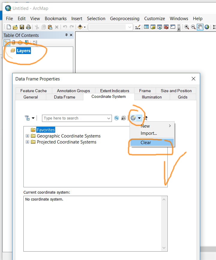
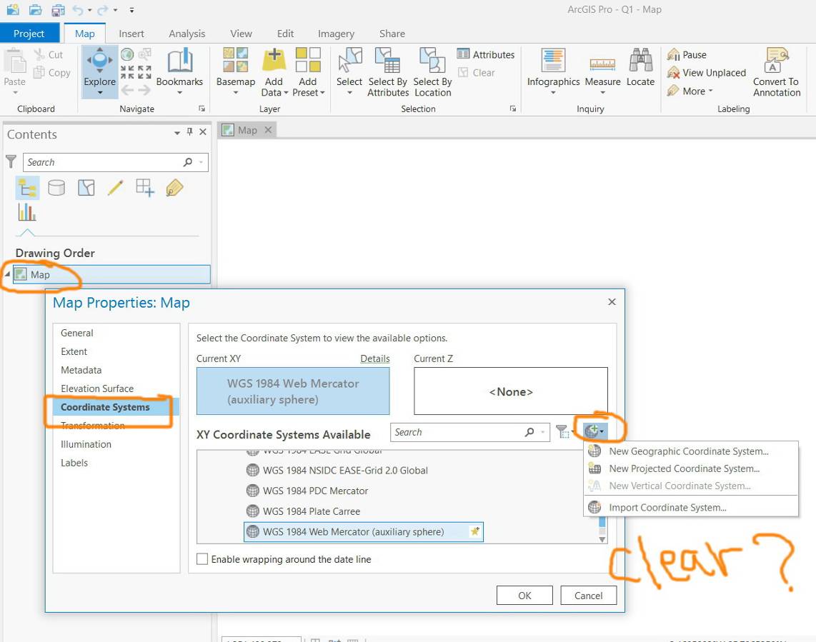
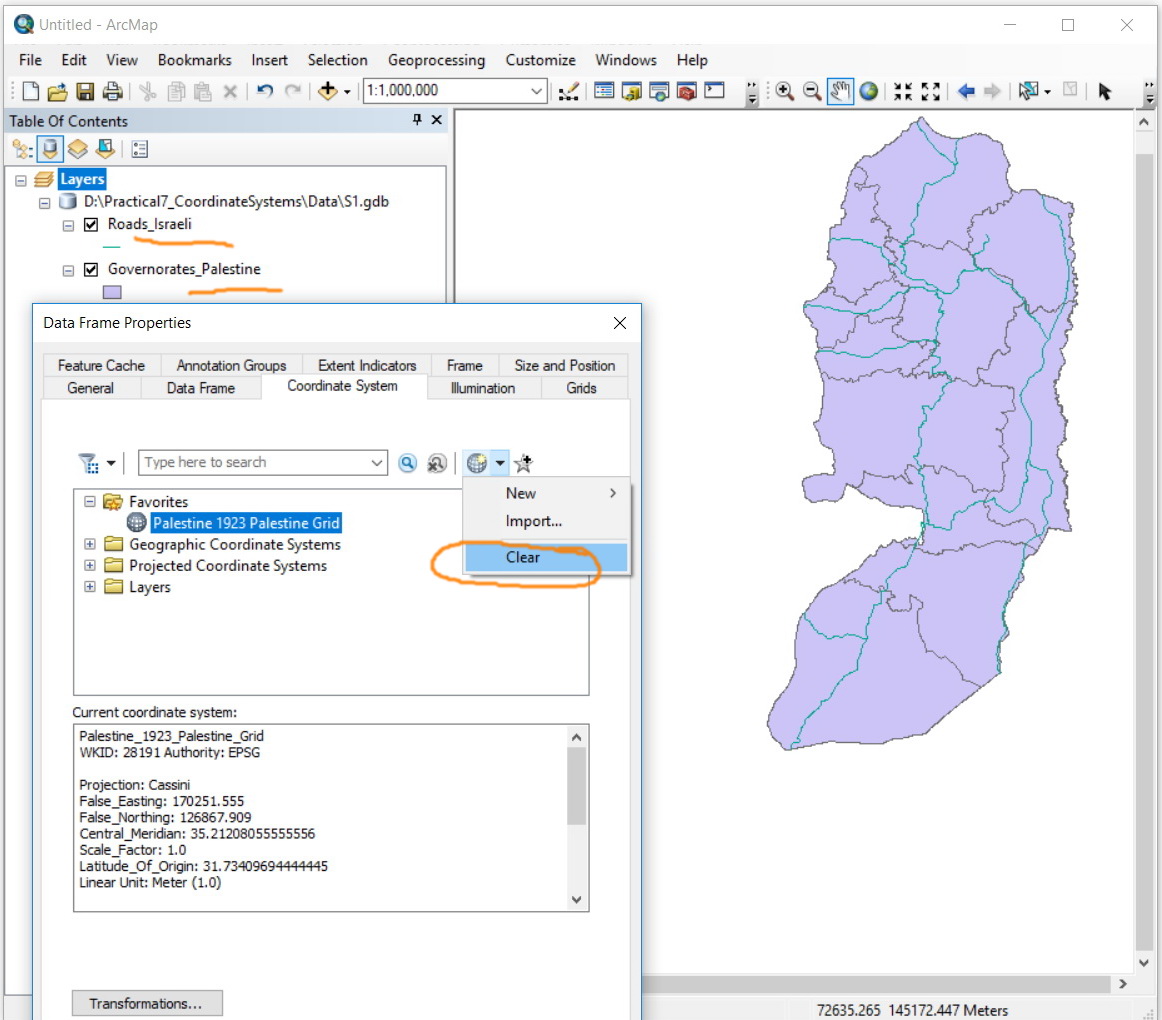
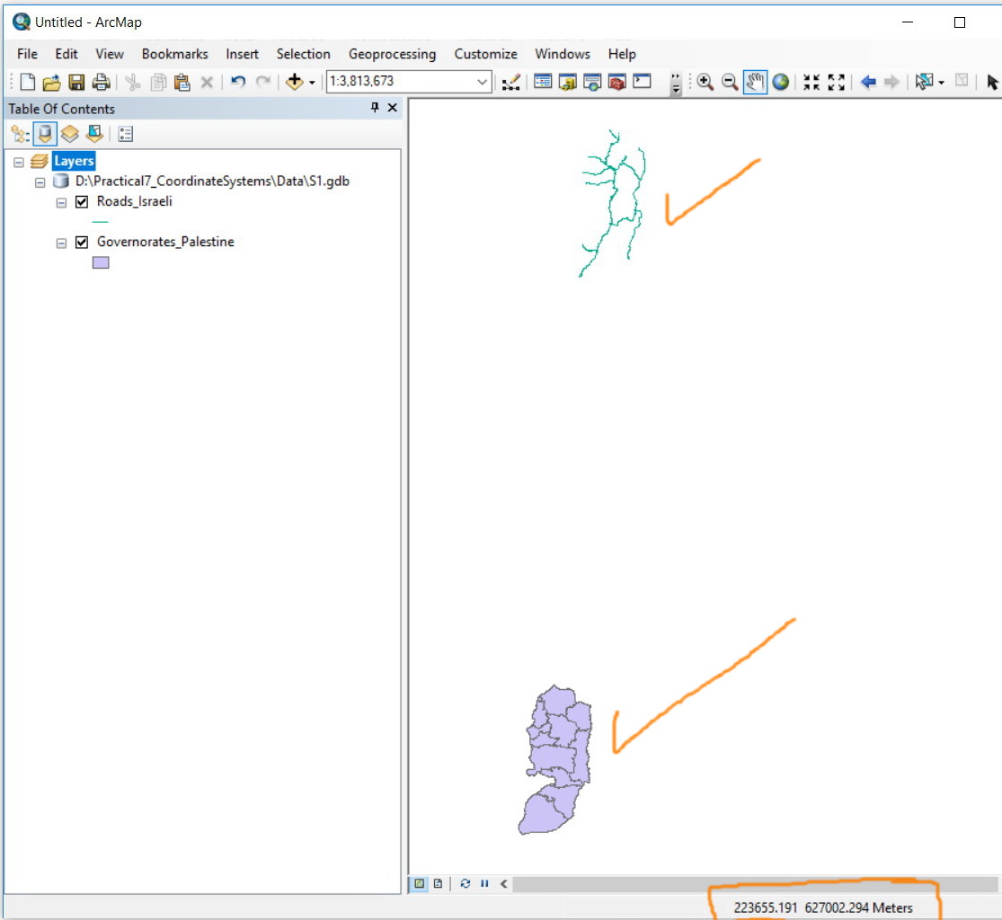
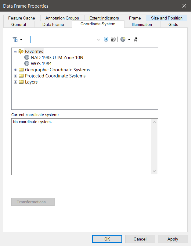
We are now in 2.4 and still the “clear” command is not there!
For example, in the screenshots below, I wanted to clear the coordinate system of the map so that I can see how the layers are mapped in respect to each other. This is not doable in the arcpro!

- Mark as Read
- Mark as New
- Bookmark
- Permalink
- Report Inappropriate Content
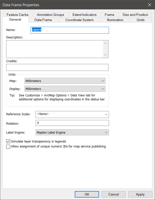
I agree that the ability to have no coordinate system for a map ArcGIS Pro would be very useful and I use it all the time in ArcMap. My application is managing the building interior of our airport terminal. The original data was in millimeters in a CAD format. I moved the data into a Geodatabase and maintained the millimeter units and rotation of the information and did not apply a projection. This has allowed me to easily work with the data, update it based on new CAD information I receive and still use the power of GIS to display and manage the data. I simply set my map coordinate system to none and the units to millimeters,
If I would have georeferenced and projected the data into UTM Zone10 NAD83, as we use for the rest of the airport, the building would be rotated and the units in meters making it difficult to deal with.
Since I do need a projected version of the data for use in ArcGIS Online, I use FME (www.safe.com) to automatically rotate, scale and shift the data into the correct geographic location and create a Geodatabase version I can upload to ArcGIS Online.
So please implement this in ArcGIS Pro so I can move into it from ArcMap.
- Mark as Read
- Mark as New
- Bookmark
- Permalink
- Report Inappropriate Content
Any movement on this? I agree with the posters above that think we need to clear the coordinate system - unless there's another solution to see the actual coords data is drawn in without opening it in CAD or ArcMap
- Mark as Read
- Mark as New
- Bookmark
- Permalink
- Report Inappropriate Content
- Mark as Read
- Mark as New
- Bookmark
- Permalink
- Report Inappropriate Content
This Idea has been implemented in ArcGIS Pro 3.2. Please see the What's New documentation for more new features in Pro 3.2.
The Your Ideas in ArcGIS Pro 3.2 blog and video have been posted to the Esri Community blog. You can take a look at these to see your idea and all others that were implemented in this release of ArcGIS Pro.
You must be a registered user to add a comment. If you've already registered, sign in. Otherwise, register and sign in.