- Home
- :
- All Communities
- :
- Products
- :
- ArcGIS Pro
- :
- ArcGIS Pro Blog
- :
- Using ArcGIS Pro to put the Esri World Imagery Bas...
Using ArcGIS Pro to put the Esri World Imagery Basemap in a Mobile Map
- Subscribe to RSS Feed
- Mark as New
- Mark as Read
- Bookmark
- Subscribe
- Printer Friendly Page
- Report Inappropriate Content
This blog post shows how to create a Map Tile Package from a Image Service and include it in a Mobile Map Package for offline use. But what about the Esri World Imagery Basemap? Well, ArcGIS Pro 2.2 and later provides a convenient way to clip out a portion of the Esri World Imagery basemap for Inclusion in a Mobile map.
Start ArcGIS Pro and Open a Project.
On the Insert Tab click the New Map button.

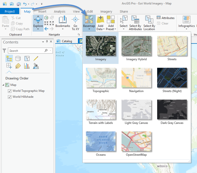
On the Map tab click the Basemap Gallery button and choose the Imagery basemap.
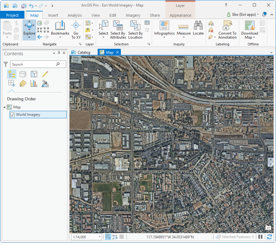
Zoom to the extent of the imagery that you want to include in your Mobile Map.
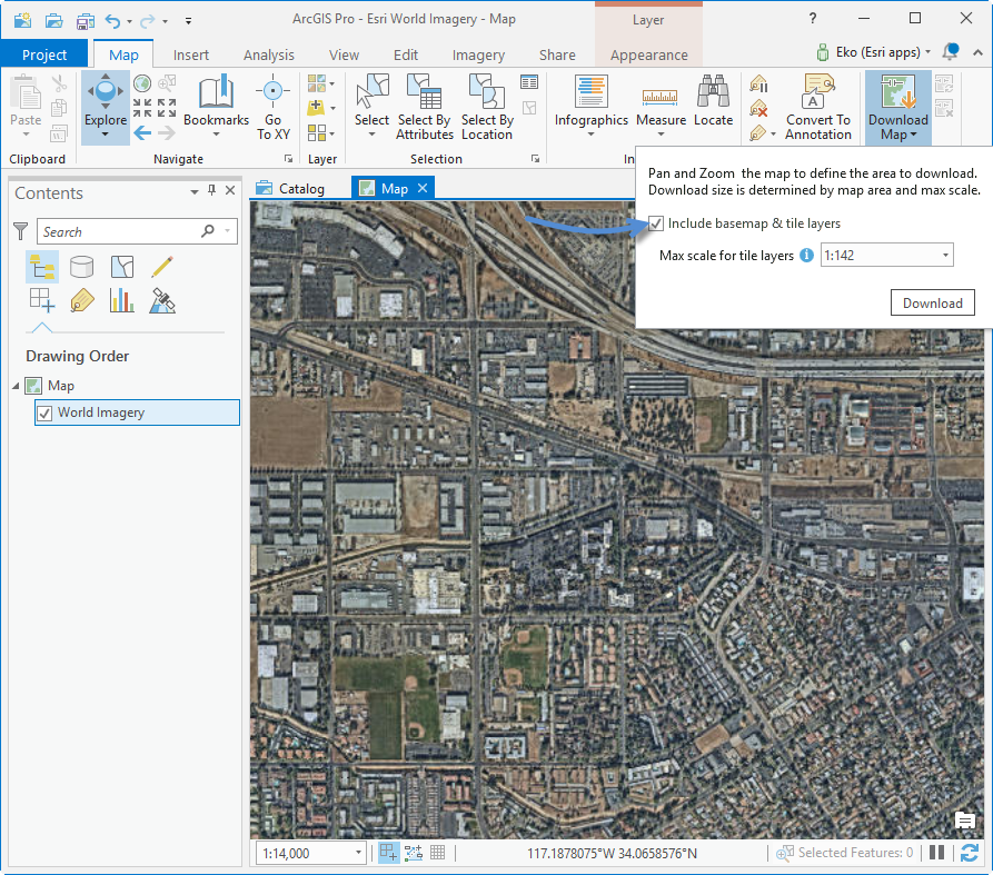
On the Map tab click the Download Map button. Check include basemap & tile layers and click the Download button.

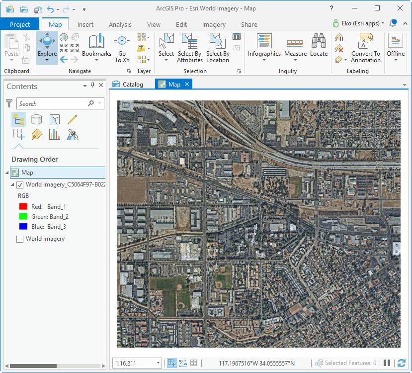
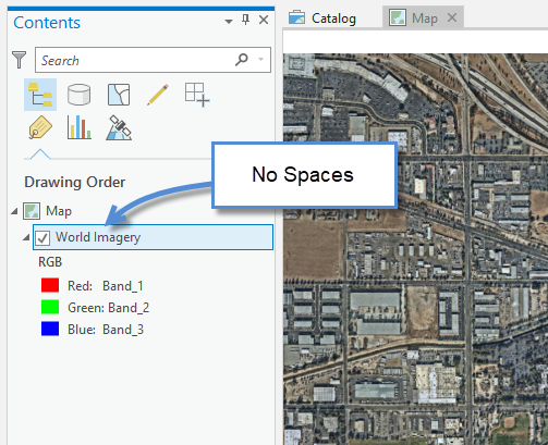
The Map Tile Package layer will be added to the map when the export completes. (remove the space in the layer name.. see notes below)
A few things of interest:
It is best to set the desired max scale.
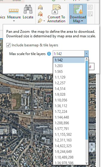
For the Extent Pictured the default scale was 1:142. This created a Map Tile Package file (.tpk) that is 845 mb in size.
Choosing a scale of 1:565 creates a .tpk that is 84 mb in size.

So, consider the scale that your map users need if file size is a concern.
Some extra notes about using Map Tile packages in Mobile Map packages.
Do not use spaces in the name of the Tile Package layer in the Contents pane. It is OK to rename the layer, but do not use spaces in the name. Tile Package are not written into the package correctly when spaces are used in the name, this issue will be addressed at a future release.
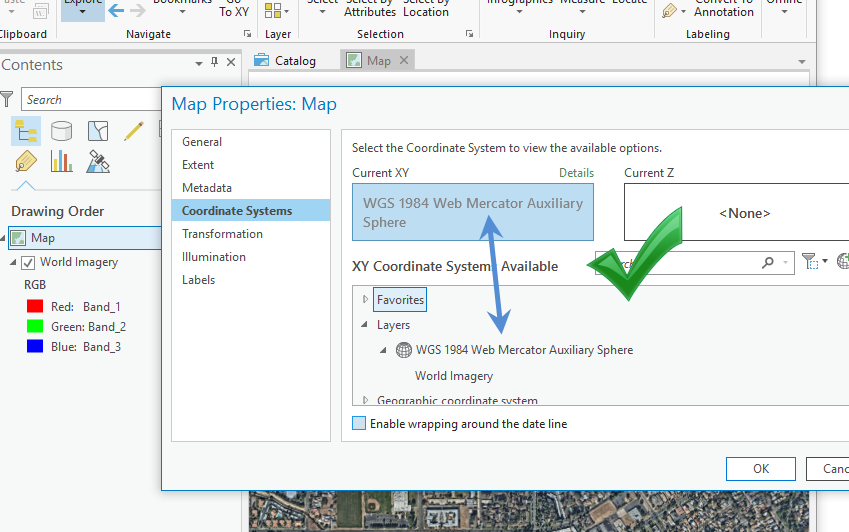
Make sure the coordinate system of the Map Tile Package (.tpk) matches the coordinate system of the Map. Custom applications built with the runtime and Esri Apps like Explorer for ArcGIS will not display Tile Package layers if the coordinate system is not the same as the map.
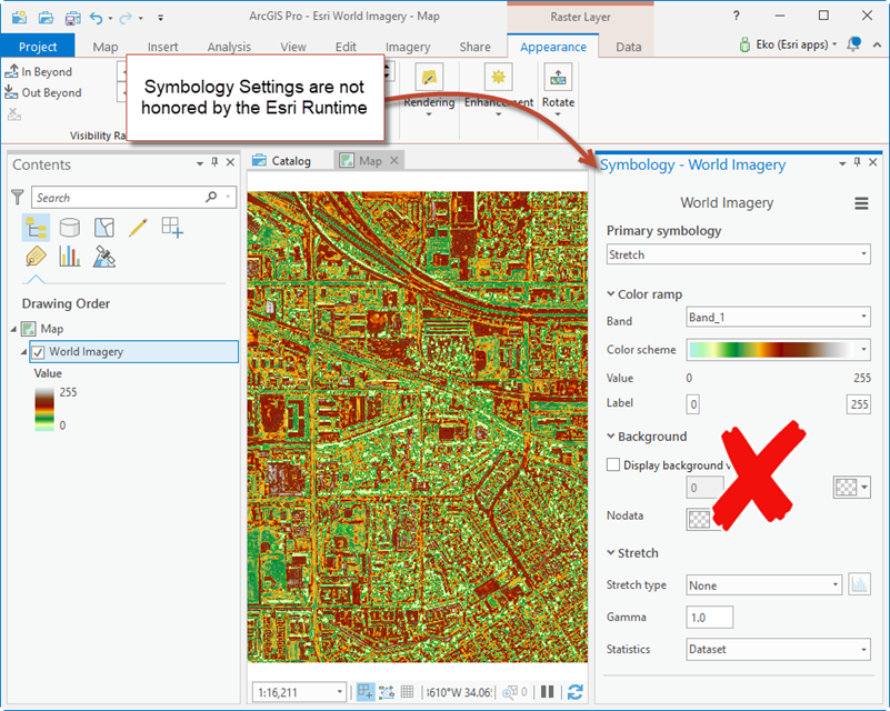
ArcGIS Pro allows you to apply symbology to Tile Package layers. Symbology parameters are not supported by the Esri Runtime. You will just see the TPK as it was originally created in the runtime applications. You can think of the symbology settings in ArcGIS Pro as over-rides for the symbology defined in the TPK.
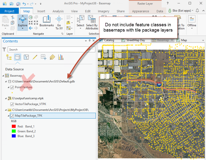
If you create a Basemap that has a Map Tile Package layer and / or Vector Tile Package layers , do not include a Feature Class (point, poly or line features) in the basemap. When a feature class layer is present in the basemap with a tile package layer the Mobile Map package is not written correctly, and some of the basemap layers will not display in runtime applications. This issue will be addressed at a future release.
I just mentioned Vector Tile Package. We are often asked how to get Esri Vector Tile Basemaps into a mobile map package, that capability will be possible in ArcGIS Pro 2.3 (it didn't make it in) its in ArcGIS Pro 2.4. If you have a vector tile package you can add it to the map like any other layer and create a mobile map package. As described in https://community.esri.com/community/gis/applications/arcgis-pro/blog/2018/01/20/use-arcgis-pro-21-t...
Until next time.
Mark
You must be a registered user to add a comment. If you've already registered, sign in. Otherwise, register and sign in.