- Home
- :
- All Communities
- :
- Products
- :
- ArcGIS Online
- :
- ArcGIS Online Questions
- :
- Re: Resolution of base satelite imagery in AGOL co...
- Subscribe to RSS Feed
- Mark Topic as New
- Mark Topic as Read
- Float this Topic for Current User
- Bookmark
- Subscribe
- Mute
- Printer Friendly Page
Resolution of base satelite imagery in AGOL compared to GE
- Mark as New
- Bookmark
- Subscribe
- Mute
- Subscribe to RSS Feed
- Permalink
- Report Inappropriate Content
Does anyone know how the sat imagery offered in AGOL compares generally to GE? I realize that there's only a few sat imagery companies out there so much of the source data is the same, however, for the area of the world that I am working in along the Thailand-Myanmar border, GE sat imagery appears to be much higher resolution than what's offered in AGOL.
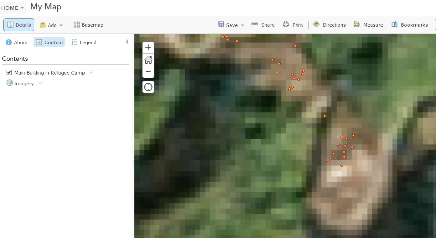
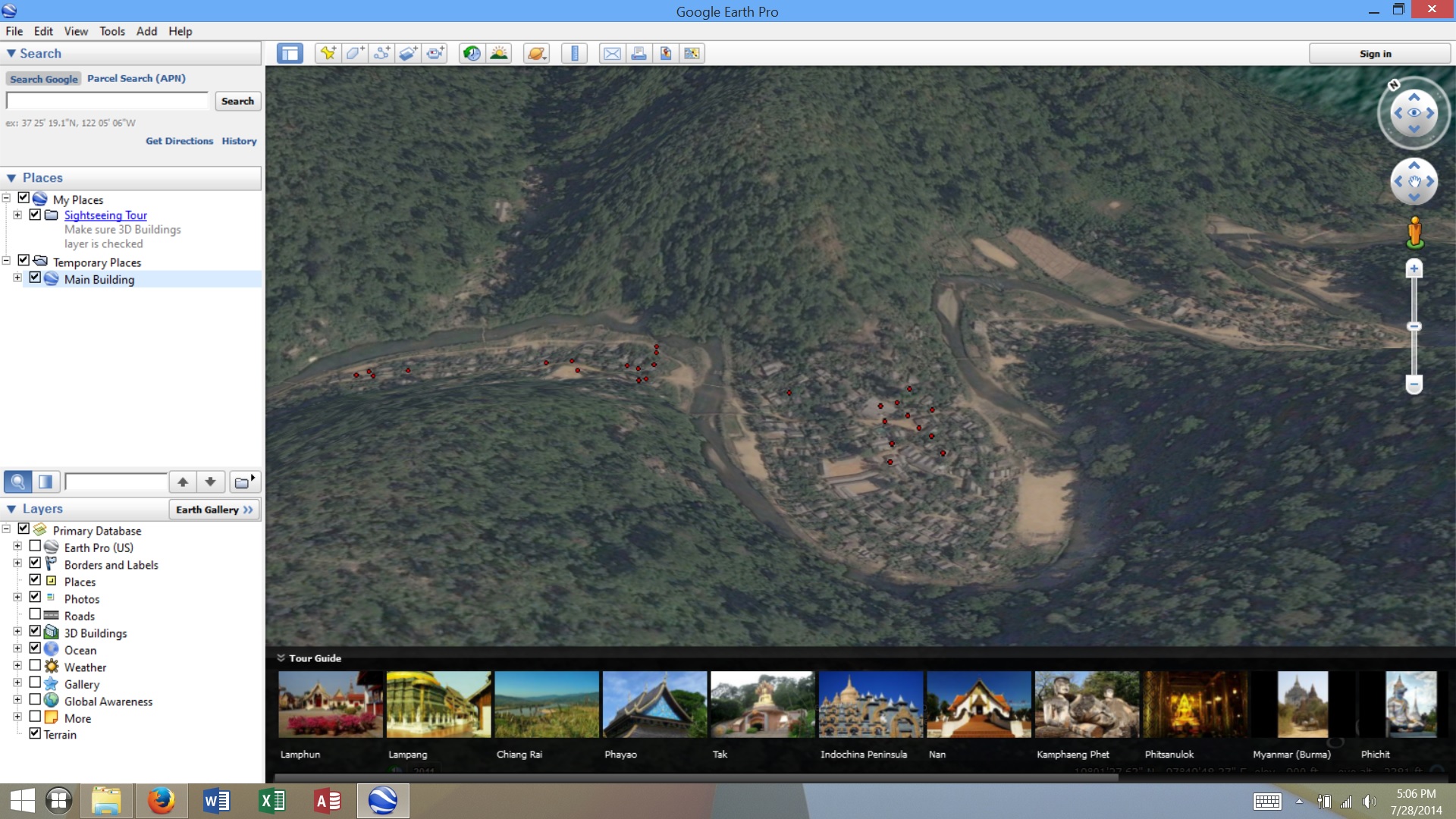
I am just wondering about this as one of the reasons my organization purchased a subscription to AGOL is for our shelter team to be able to digitize refugee camp features inside AGOL; however, to my chagrin, I discovered that resolution is a lot better in GE and user can add points and polygons just as offered in AGOL. So what's the added value of AGOL for this type of work?
Thanks,
Lyndy
- Mark as New
- Bookmark
- Subscribe
- Mute
- Subscribe to RSS Feed
- Permalink
- Report Inappropriate Content
Since they use the same kind of images it must be the same resolution
- Mark as New
- Bookmark
- Subscribe
- Mute
- Subscribe to RSS Feed
- Permalink
- Report Inappropriate Content
Hi Stefan,
I appreciate your response but not the kind of precision I am looking for in an answer.
I already mentioned in my question that, "I realize that there's only a few sat imagery companies out there so much of the source data is the same" so I'm sorry but your response isn't helpful.
I would like a more precise answer from Esri. I realize that resolution varies across the globe but there must be a general comparison of what's offered between GE and AGOL that I think customers would want to know before purchasing AGOL.
For example, if you look at the two screen shots I've attached, you can see quite clearly that GE resolution is better than what's offered in AGOL for my AOI. These are the exact same data overlaid on AGOL and then on top of GE. The AGOL is quite pixelated.
- Mark as New
- Bookmark
- Subscribe
- Mute
- Subscribe to RSS Feed
- Permalink
- Report Inappropriate Content
Maybe these links could help you:
This web map features metadata information for the imagery that is published in Esri's World Imagery map. Zoom into an area and click on map for metadata info:
http://www.arcgis.com/home/webmap/viewer.html?webmap=c1c2090ed8594e0193194b750d0d5f83
This link gives you the hight resolution coverage (< 1m.) in the last update of the World Imagery Basemap:
http://downloads.esri.com/blogs/arcgisonline/WorldImageryGlobal_JULY2014_full.jpg
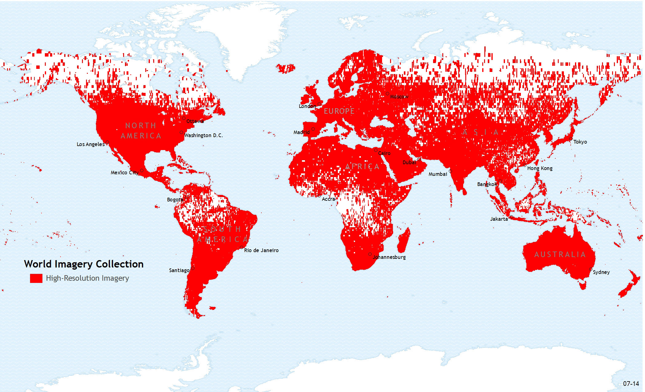
I'm not sure that Google provides a such transparent information so that you can easily compare.
Regards,
Gaëtan LAVENU.
- Mark as New
- Bookmark
- Subscribe
- Mute
- Subscribe to RSS Feed
- Permalink
- Report Inappropriate Content
Bonjour,
Thanks for letting me know about the web map viewer where I can see resolution in my AOI. It looks like most areas in my AOI are 25 meters resolution.
Lyndy