- Home
- :
- All Communities
- :
- Products
- :
- ArcGIS Online
- :
- ArcGIS Online Questions
- :
- Help with adding a weather radar layer that loops...
- Subscribe to RSS Feed
- Mark Topic as New
- Mark Topic as Read
- Float this Topic for Current User
- Bookmark
- Subscribe
- Mute
- Printer Friendly Page
Help with adding a weather radar layer that loops to ArcOnline
- Mark as New
- Bookmark
- Subscribe
- Mute
- Subscribe to RSS Feed
- Permalink
Hello all!
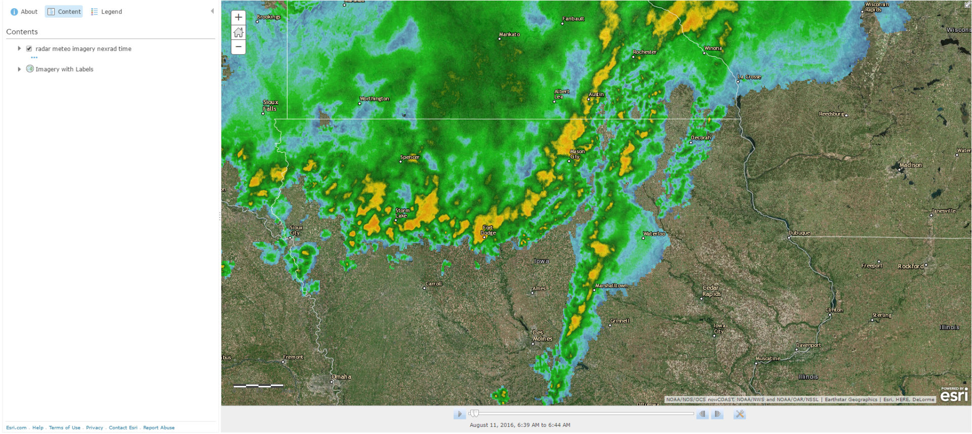
I am attempting to create a map weather map on ArcGIS Online. I am able to add layers that are available from ESRI and the NWS site itself. The static layers do not give any issues, however, when I attempt to link a layer that is timed (looped) it does not work.
My end goal is to have a layer that shows precipitation data that updates as time passes and that repeats after the cycle of images is completed.
NWS - Enhanced Doppler Radar National Mosaic Loop -- This is an example of what I would like to include on my map.
Thank You!
Chris Schreiber
Solved! Go to Solution.
Accepted Solutions
- Mark as New
- Bookmark
- Subscribe
- Mute
- Subscribe to RSS Feed
- Permalink
Hello,
Just to update this, I have found a good radar layer to utilize on my map. It is the NOAA NowCoast Radar layer.
REST Service Url: nowcoast/radar_meteo_imagery_nexrad_time (MapServer)
It is able to have time settings enabled and will update automatically.

Chris
- Mark as New
- Bookmark
- Subscribe
- Mute
- Subscribe to RSS Feed
- Permalink
Hello,
Just to update this, I have found a good radar layer to utilize on my map. It is the NOAA NowCoast Radar layer.
REST Service Url: nowcoast/radar_meteo_imagery_nexrad_time (MapServer)
It is able to have time settings enabled and will update automatically.

Chris
- Mark as New
- Bookmark
- Subscribe
- Mute
- Subscribe to RSS Feed
- Permalink
Chris,
I know your post is a bit old. But oddly enough, when I add this service to an AGOL web map, I am not getting the time slider. Any thoughts?
Thanks!
- Mark as New
- Bookmark
- Subscribe
- Mute
- Subscribe to RSS Feed
- Permalink
Hello!
Sorry about the late response, I was on a trip!
I have reached out to NOAA about this issue as I am experiencing similar behavior with the layer. It seems that there is a defect with time-related layers that is present on the version of ArcGIS Server they are using.
Here is their response:
Hi Chris,
The issue you're experiencing is due to a bug with ArcGIS Server 10.5.
The map service is still time enabled - it will respond properly to time-enabled map requests - however the "Time Extent" metadata is not being exposed properly by ArcGIS Server. This causes any clients which rely on this metadata (e.g. ArcGIS Online maps) to mistakenly assume the service is not time-enabled.
We have logged this as a bug with the software vendor (ESRI) and are presently working with them to identify a solution, however it will likely be several weeks before they are able to deliver a patch for the issue.
We apologize for the inconvenience. If you can provide any more detail about your workflow, we may be able to identify a temporary workaround, but I can't guarantee anything right now.
If you have any other questions, please let us know.
Thanks,
Jason
--
Jason Greenlaw
Software Developer, ERT, Inc.
NOAA/NOS/OCS/CSDL
https://nowcoast.noaa.gov
Jason.Greenlaw@noaa.gov
I wish that I had more, but I hope this sheds some light on the issue.
Thank you,
Chris
- Mark as New
- Bookmark
- Subscribe
- Mute
- Subscribe to RSS Feed
- Permalink
Thank you Chris!
- Mark as New
- Bookmark
- Subscribe
- Mute
- Subscribe to RSS Feed
- Permalink
In the following page https://esriaustraliatechblog.wordpress.com/2023/02/15/rain-radar/ , Esri Australia (Simon Jackon) present a great Experience Builder widget that displays weather radar loop.
Live demo : Preview Demo here
Source code: https://github.com/bgtdevhub/rainfall-radar-exb
References: https://www.rainviewer.com/sources.html