- Home
- :
- All Communities
- :
- Products
- :
- ArcGIS Online
- :
- ArcGIS Online Questions
- :
- Re: Bathymetry/Ocean Basemap Presentation
- Subscribe to RSS Feed
- Mark Topic as New
- Mark Topic as Read
- Float this Topic for Current User
- Bookmark
- Subscribe
- Mute
- Printer Friendly Page
- Mark as New
- Bookmark
- Subscribe
- Mute
- Subscribe to RSS Feed
- Permalink
- Report Inappropriate Content
I would like to use an ESRI basemap for a set of bathymetry drawings (displaying ocean contours and other oceanographic information) that go along a coastline. The ESRI 'World Imagery' basemap provides great imagery of the land which I would like to show, but the oceans are too dark to display bathymetry contours and other ocean information. Does anyone have a suggestion as to how I could use the 'World Imagery' basemap to display only land imagery and leave the oceans without imagery? Ideally it would be great if I could use 'World Ocean' basemap which uses a lighter hue but with the 'World Imagery' basemap for the land data.
Solved! Go to Solution.
Accepted Solutions
- Mark as New
- Bookmark
- Subscribe
- Mute
- Subscribe to RSS Feed
- Permalink
- Report Inappropriate Content
Hello Jovan,
This is all done through the Data Frame Properties. I've outlined the workflow below for you.
1) View > Data Frame Properties
2) Data Frame Tab > Clip to shape
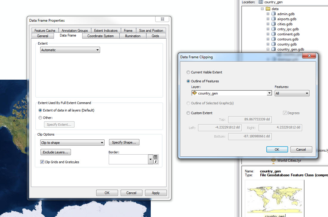
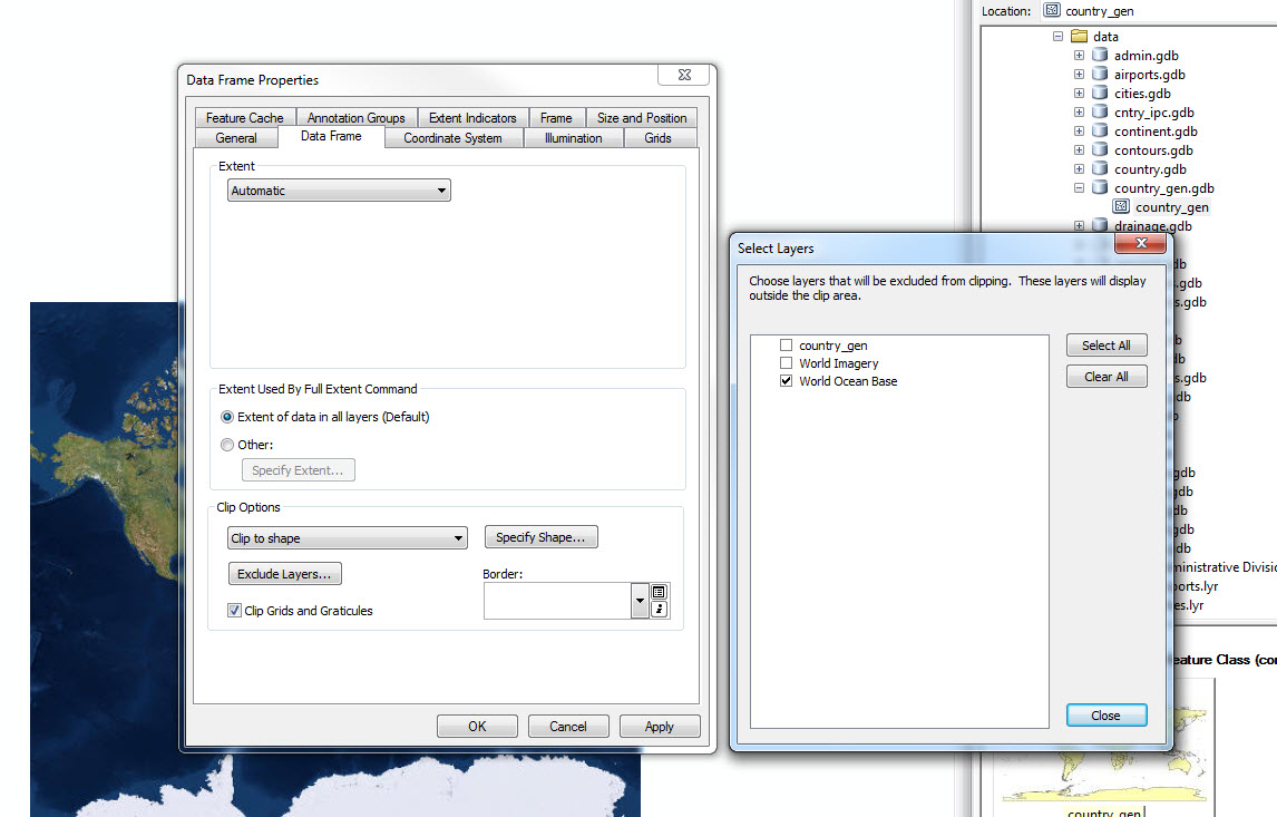
3) Exclude Layers
- Mark as New
- Bookmark
- Subscribe
- Mute
- Subscribe to RSS Feed
- Permalink
- Report Inappropriate Content
If you have a countries boundary, you can bring it and both basemaps into a single map document and then clip the World Imagery to the boundary. Next, we would need to exclude the Oceans Basemap from the clip process. However, in order to exclude it, you will have to ungroup the basemap layers in the data frame.
- Mark as New
- Bookmark
- Subscribe
- Mute
- Subscribe to RSS Feed
- Permalink
- Report Inappropriate Content
Thanks Brian, I didn't know about the raster clipping option. I am trying it out and I can see that it accepts an 'image service' as input. However, when I try to add the ESRI basemap service, the services are not shown. I can only see the subfolders as shown below;
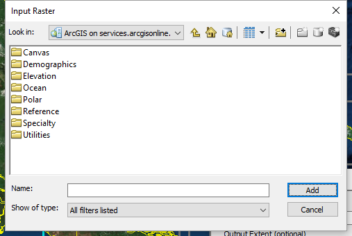
I am using ArcMap 10.4.1.
- Mark as New
- Bookmark
- Subscribe
- Mute
- Subscribe to RSS Feed
- Permalink
- Report Inappropriate Content
Hello Jovan,
This is all done through the Data Frame Properties. I've outlined the workflow below for you.
1) View > Data Frame Properties
2) Data Frame Tab > Clip to shape
3) Exclude Layers
- Mark as New
- Bookmark
- Subscribe
- Mute
- Subscribe to RSS Feed
- Permalink
- Report Inappropriate Content
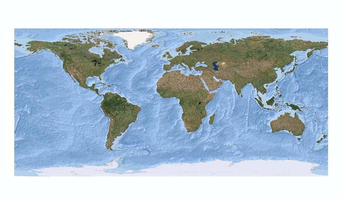
Great thanks Brian, I ran the process and it's achieving exactly what I would like.
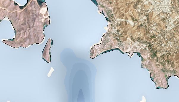
Only my coastline vector dataset is not too accurate. Is there are world vector coastline dataset source that you could recommend?
- Mark as New
- Bookmark
- Subscribe
- Mute
- Subscribe to RSS Feed
- Permalink
- Report Inappropriate Content
I used the Countries file from Data and Maps 2015 which is available for download from My Esri. There are two files available within the download. One is generalized, and the other is not. I used the generalized version in my testing.
- Mark as New
- Bookmark
- Subscribe
- Mute
- Subscribe to RSS Feed
- Permalink
- Report Inappropriate Content
Great thanks for your help Brian.
- Mark as New
- Bookmark
- Subscribe
- Mute
- Subscribe to RSS Feed
- Permalink
- Report Inappropriate Content
Anytime.