- Home
- :
- All Communities
- :
- Products
- :
- ArcGIS Online
- :
- ArcGIS Online Questions
- :
- Am I the only one frustrated by the sub-par qualit...
- Subscribe to RSS Feed
- Mark Topic as New
- Mark Topic as Read
- Float this Topic for Current User
- Bookmark
- Subscribe
- Mute
- Printer Friendly Page
Am I the only one frustrated by the sub-par quality of ESRI web services rendering?
- Mark as New
- Bookmark
- Subscribe
- Mute
- Subscribe to RSS Feed
- Permalink
- Report Inappropriate Content
I've been working on the mapping and visualization side of web GIS for the past three years, and this has bugged me since day one.
In a day and age where HiDPI and Retina displays are everywhere, GPUs are more powerful than ever, and many competitors moved a long time ago to vector-based client rendering that delivers optimal quality in any condition, how comes ESRI users are still stuck with a blurry, erratic, low resolution output that gives no justice whatsoever to authoring work?
No matter what I create and publish, be it a multi-scale basemap, a dynamic map service or a feature service, the end result is ALWAYS disappointing and, more importantly, rendered in a DIFFERENT way than what I see in my software (especially ArcGIS Pro).
Just a quick example to show what I mean even with a basic service:
- this is a web map I created in ArcGIS Pro, to be published as a dynamic map service
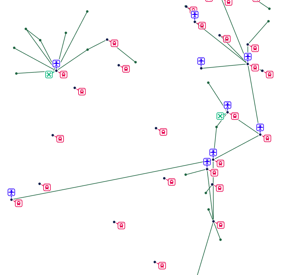
as you can see, lines and symbols are crisp and clear even with very small details.
- this is the same web map published on our ArcGIS Enterprise / Portal as shown in the Map viewer, but it's exactly the same in AGO or any other application that consumes the service
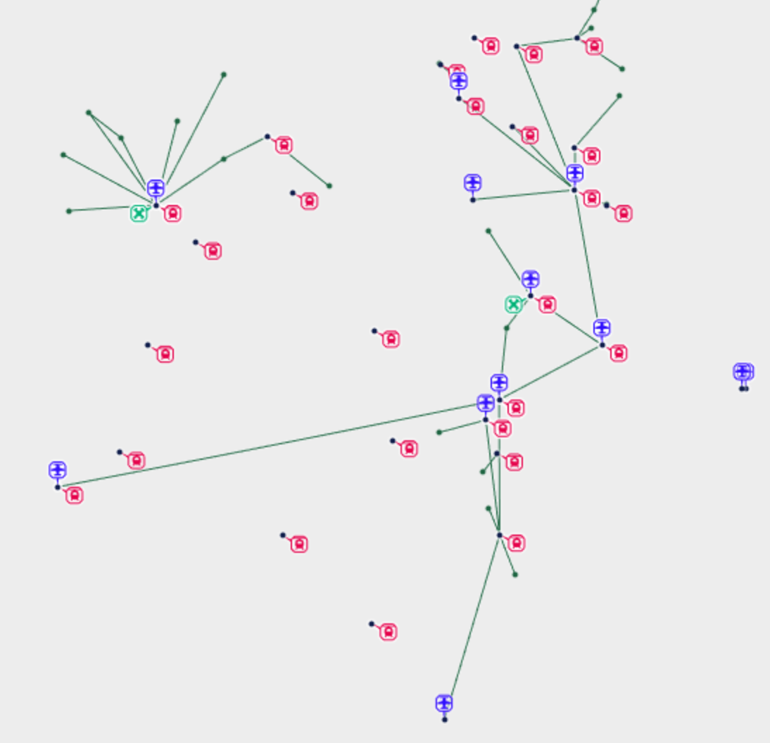
Everything becomes blurry, symbol parts are realigned based on the pixel grid, antialiasing is much worse (and don't get me started on labels).
I understand that for many use cases this might be "good enough", but in my line of work and with visualization getting more and more important for any business, I still don't understand how this is acceptable.
I recently discovered that the ArcGIS Javascript 4 renderer delivers a MUCH BETTER output that looks the same as the original, so there IS the possibility to get a quality result for our services, but so far it's locked out from the Portal/AGO platform altogether.
Sorry for the rant, I guess I just want to know if I am the only one fighting with this and maybe to hear from any ESRI representative if they are planning to do something on this regard or if it is even something they are aware of.
- Mark as New
- Bookmark
- Subscribe
- Mute
- Subscribe to RSS Feed
- Permalink
- Report Inappropriate Content
I assume this never got resolved @Omar ?