Turn on suggestions
Auto-suggest helps you quickly narrow down your search results by suggesting possible matches as you type.
Cancel
- Home
- :
- All Communities
- :
- Products
- :
- ArcGIS Online
- :
- ArcGIS Online Ideas
- :
- Adding maps from the Web (WMTS/WMS) with the optio...
Options
- Subscribe to RSS Feed
- Mark as New
- Mark as Read
- Bookmark
- Follow this Idea
- Printer Friendly Page
- Report Inappropriate Content
Adding maps from the Web (WMTS/WMS) with the option to select the coordinate system and version
Follow this Idea
750
0
03-02-2015 02:44 AM
Status:
Open
- Mark as New
- Bookmark
- Subscribe
- Mute
- Subscribe to RSS Feed
- Permalink
- Report Inappropriate Content
Would be very useful to make possibility choosing coordinate system and version when adding WMS/WMTS layers to WebMap: "Add maps from the Web (WMTS/WMS)" in ArcGIS Online default viewer.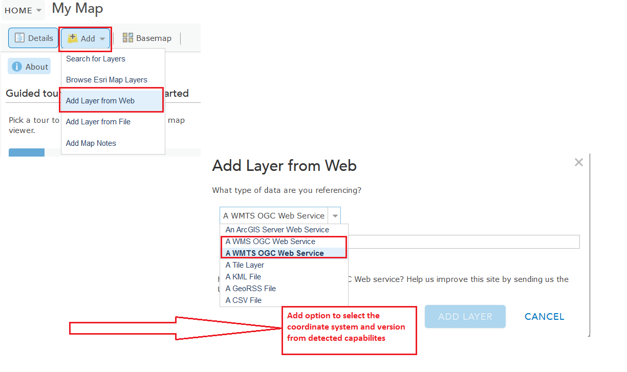
You must be a registered user to add a comment. If you've already registered, sign in. Otherwise, register and sign in.