- Home
- :
- All Communities
- :
- Products
- :
- ArcGIS Online
- :
- ArcGIS Online Ideas
- :
- Add x y coordinates in web map layer
- Subscribe to RSS Feed
- Mark as New
- Mark as Read
- Bookmark
- Follow this Idea
- Printer Friendly Page
- Mark as New
- Bookmark
- Subscribe
- Mute
- Subscribe to RSS Feed
- Permalink
I'd like to see an add x y coordinate tool for feature layers in AGO web maps. X Y cords in lat long decimal degrees would be excellent.
Users using new Esri tools such as trek2there that requires lat and long fields from the attribute table as input https://blogs.esri.com/esri/arcgis/2016/12/22/introducing-trek2there/ would benefit, and AGO users wouldn't have to add x y cords in desktop only to republish a layer with x y cords.
- « Previous
-
- 1
- 2
- Next »
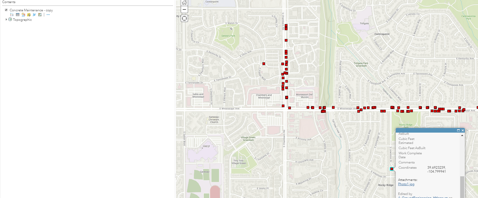
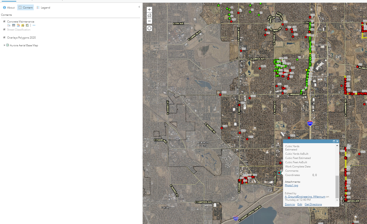
same error here. this is not working. works on a simple scenario when a feature class is published from a desktp file geodatabase but when publishing services as references on an enterprise SDE, the Geometry($feature) object is null and has no members (X, Y, Z) and therefore cannot be used to obtain any values from the geometry of the feature.
Hi Michael,
I used your code, works fine in webmap's popup but when I look it in Collector, doesn't.
I'm doing something wrong?
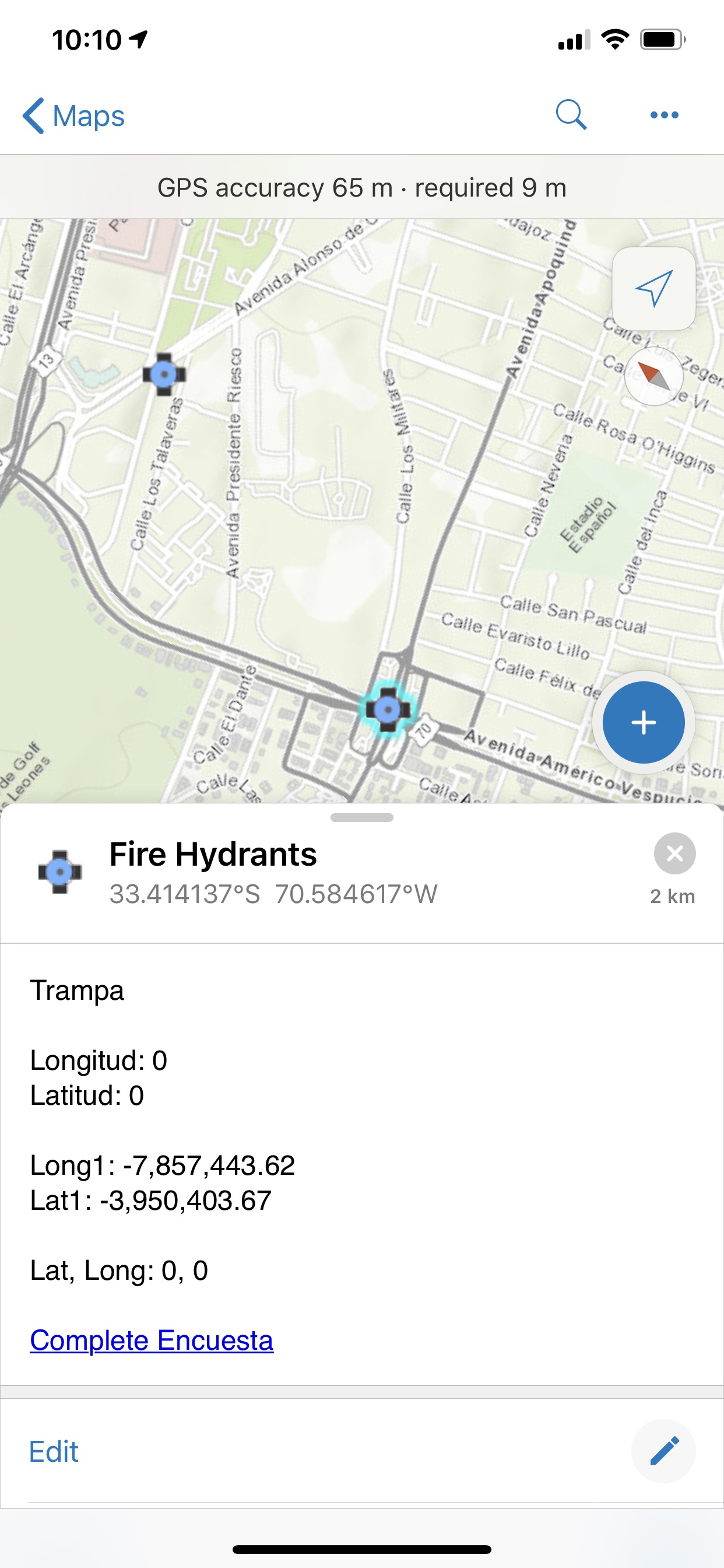
For Long1 and Lat1 I used a simple arcade expression
Geometry($feature)
Please if you can help me with this I'll appreciate it.
Hey Michael,
Thanks for providing this code.
For some reason I am unable to get it to work in the intended hosted feature layer but it works fine when I create a copy of said layer.
-Copied layer
-Original
You mentioned that this will not work in Collector - do you mean that it will not work in layers that are built via Collector or just that it won't be viewable in Collector?
Thanks for any information you can provide.
I am trying to use the "Dynamically create a hyperlink with lat long values in a popup" from github and trying to use the Google Panoramic but when the code and click on the map I get a popup and it's just black, not sure what the issues is?
Also can it be changed to add Bings Birds view, if so how?
I was able to figure it out but my zoom is not working, no matter what I change the lvl to 1-20 nothing ever happens, anyone have any idea as to why the lvl doesn't work?
"https://www.bing.com/maps?&style=o&lvl=20&dir=0&cp=" + text(Latitude) + "~" + text(Longitude);
Any updates if ESRI has added this feature yet or plan to?
Yes, totally agree with this. Our previous web GIS allowed you to manually input an easting/northing or x,y values and snapped the map to it. All it needs is a simple widget to allow this in ArcGIS Online.
To get around this shortcoming I have had to capture a set of points every 100 metres to cover our local authority area and ask users to use the search for a rounded co-ordinate value to match the point e.g. 488100,169100 It works, but only to the nearest 100m and its a waste of point data and storage space. If I had a larger authority area I wouldn't consider it.
Further to this - Expand capability to have automatic updated coordinates in a coordinate system of choice and bonus points to have a map that can do it while offline (in FieldMaps, etc).
Just getting WGS84 is not useful in many cases even if it is close to GDA94/GDA2020.
I understand that it is complicated but many photography apps like Theodolite can do the conversion to a large range of coordsys on mobile devices while offline so not sure what Esri's holdup on this is in a browser connected to the internet using a desktop/laptop.
You must be a registered user to add a comment. If you've already registered, sign in. Otherwise, register and sign in.