- Home
- :
- All Communities
- :
- Products
- :
- ArcGIS Network Analyst
- :
- ArcGIS Network Analyst Questions
- :
- where is network analyst window in pro
- Subscribe to RSS Feed
- Mark Topic as New
- Mark Topic as Read
- Float this Topic for Current User
- Bookmark
- Subscribe
- Mute
- Printer Friendly Page
- Mark as New
- Bookmark
- Subscribe
- Mute
- Subscribe to RSS Feed
- Permalink
We are trying to implement a workflow for the users of our building inspections routing system. I had developed the tools as a geoprocessing workflow with python scripts and model builder tools in ArcMap 10.6 but wanted to deliver to staff so they can use ArcPro because it is more familiar to them.
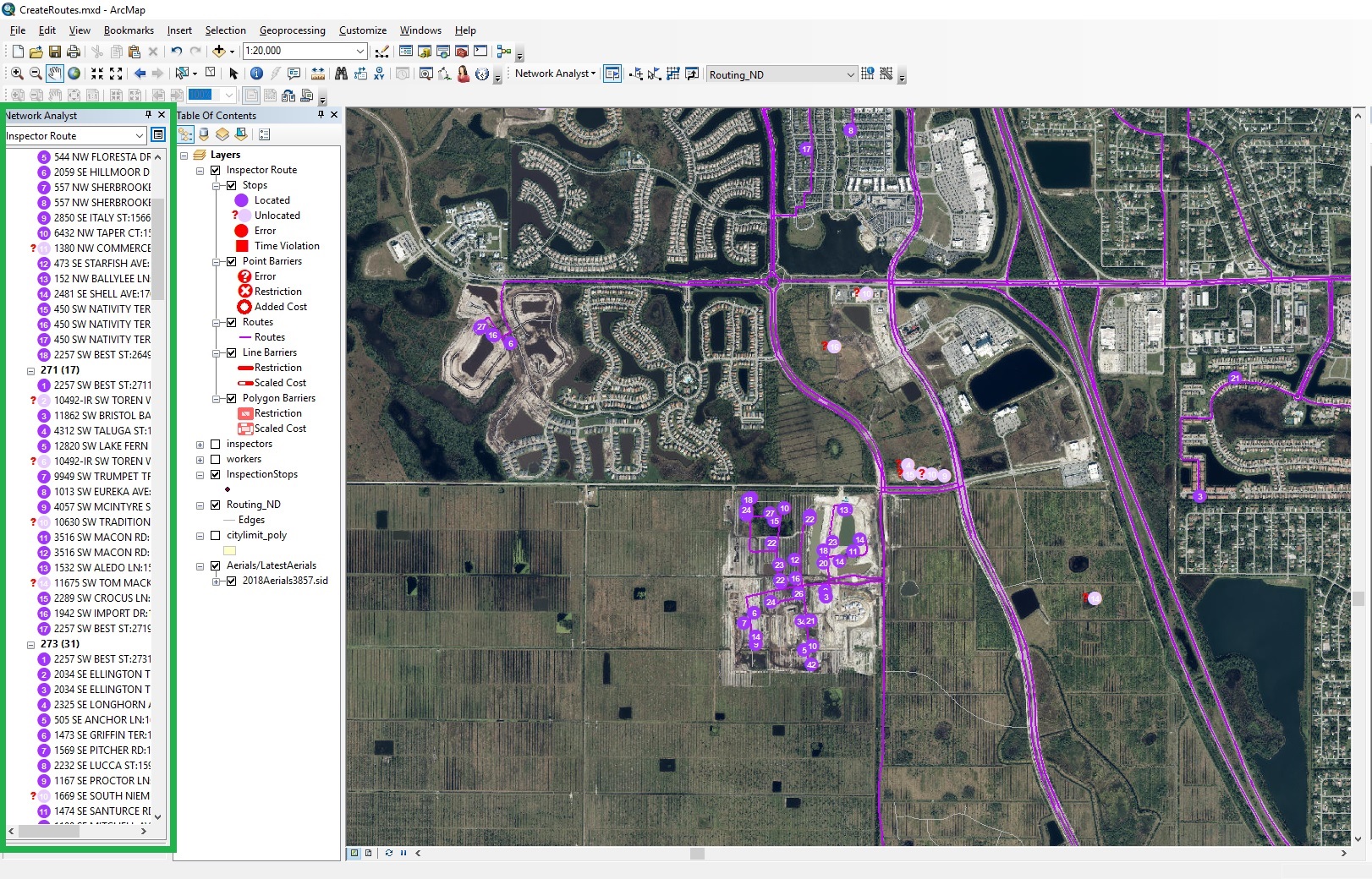
In desktop, there is a Network Analyst Window that provides feedback and tools to fix any unlocated stops. See the attached picture. The user would just scroll down through the list and click on the issue and zoom to the stop. Then they can use the move network location tool to slide the point closer to the network or add a new street to the network. Users would fix the issues and then run the routing again. After all the issues have been fixed, the user then runs a python tool that exports everything to Workforce.
In ArcPro, I can't seem to find the same, or similar, tools to do this workflow. Do they exist?
Additionally, in desktop, you can specify options for the route layer to snap to network or search distance tolerances. I can't seem to figure out how to do this in pro.
Solved! Go to Solution.
Accepted Solutions
- Mark as New
- Bookmark
- Subscribe
- Mute
- Subscribe to RSS Feed
- Permalink
Hi Michael.
The Network Analyst window does not exist in ArcGIS Pro. Instead, the user can use the normal attribute table to examine the Route stops. The Status field should indicate whether or not a stop is located. The user can use the regular editing tools to make edits to stops. The location fields will be updated at Solve time (unlike in ArcMap).
The snap to network and search distance tolerances are not exposed in the UI in ArcGIS Pro but are available on the Add Locations tool in standalone python.
- Mark as New
- Bookmark
- Subscribe
- Mute
- Subscribe to RSS Feed
- Permalink
Ok, guess I will be making an add-in to emulate some of the functionality in desktop. I like that in desktop, you can visually scroll through the list and spot errors. With an average of 450 stops a day, and the inspectors waiting to get their assignments, it needs to be quick and easy.
Thank you very much for the prompt reply.