- Home
- :
- All Communities
- :
- Products
- :
- ArcGIS Network Analyst
- :
- ArcGIS Network Analyst Questions
- :
- Re: I have two road networks from differen countri...
- Subscribe to RSS Feed
- Mark Topic as New
- Mark Topic as Read
- Float this Topic for Current User
- Bookmark
- Subscribe
- Mute
- Printer Friendly Page
I have two road networks from differen countries, how do i make intersections?
- Mark as New
- Bookmark
- Subscribe
- Mute
- Subscribe to RSS Feed
- Permalink
- Report Inappropriate Content
I have street networks for different countries. Each line shape file has 2 fields: (1) Reference End Intersection ID and (2) and Non Reference End Intersection ID, which are used to connect the same roads that cross borders. There are many connections that I need to make. Is there a tool that can automate the process?
- Mark as New
- Bookmark
- Subscribe
- Mute
- Subscribe to RSS Feed
- Permalink
- Report Inappropriate Content
Some questions to help clarify your request:
1. Is the ultimate goal to make a combined Network Dataset for use in Network Analyst? Or to combine the linework for other uses, like a visual display only?
2. Are the source data files shapefile or a feature classes? What data format are they in?
3. Are the source files projected?
4. What version of ArcGIS do you have?
Chris Donohue, GISP
- Mark as New
- Bookmark
- Subscribe
- Mute
- Subscribe to RSS Feed
- Permalink
- Report Inappropriate Content
(1) yes the ultimate goal is to make one single network file for use in network analyst
(2) shape files
(3) yes, as a derivative of WGS 84
(4) 10.2
- Mark as New
- Bookmark
- Subscribe
- Mute
- Subscribe to RSS Feed
- Permalink
- Report Inappropriate Content
sorry, let me clarify (2) it is not project but is a cooridnate system that is a derivative of WGS 84
- Mark as New
- Bookmark
- Subscribe
- Mute
- Subscribe to RSS Feed
- Permalink
- Report Inappropriate Content
Are there physical gaps in the lines where the adjoining lines meet?
Are there many?
If not, a quick edit session would be faster than other solutions
Can you report on the phsical connections and whether you have tried a shortest route on either side of the boundary?
You can worry about the attributes after you have the geometry correct
- Mark as New
- Bookmark
- Subscribe
- Mute
- Subscribe to RSS Feed
- Permalink
- Report Inappropriate Content
no physical gaps. yes there are many connection to make (there are actually over 10 street networks that i need to connect).
on "Can you report on the phsical connections and whether you have tried a shortest route on either side of the boundary?" not sure how to do this. these street networks are meant to be joined as they have adjoing identifier fields than many end segment to end segment
i totally agree, not too concerned about the attributes, want to get the base street network working
- Mark as New
- Bookmark
- Subscribe
- Mute
- Subscribe to RSS Feed
- Permalink
- Report Inappropriate Content
I mean zoom in and look to see if they are connected and try to run a shortest path across the boundary to ensure they are connected even if they look connected.
- Mark as New
- Bookmark
- Subscribe
- Mute
- Subscribe to RSS Feed
- Permalink
- Report Inappropriate Content
gotcha, i did zoom in...they appear connected, but are not
- Mark as New
- Bookmark
- Subscribe
- Mute
- Subscribe to RSS Feed
- Permalink
- Report Inappropriate Content
You could merge the two files together, then edit the boundary to join the lines if you only have a small number to do
- Mark as New
- Bookmark
- Subscribe
- Mute
- Subscribe to RSS Feed
- Permalink
- Report Inappropriate Content
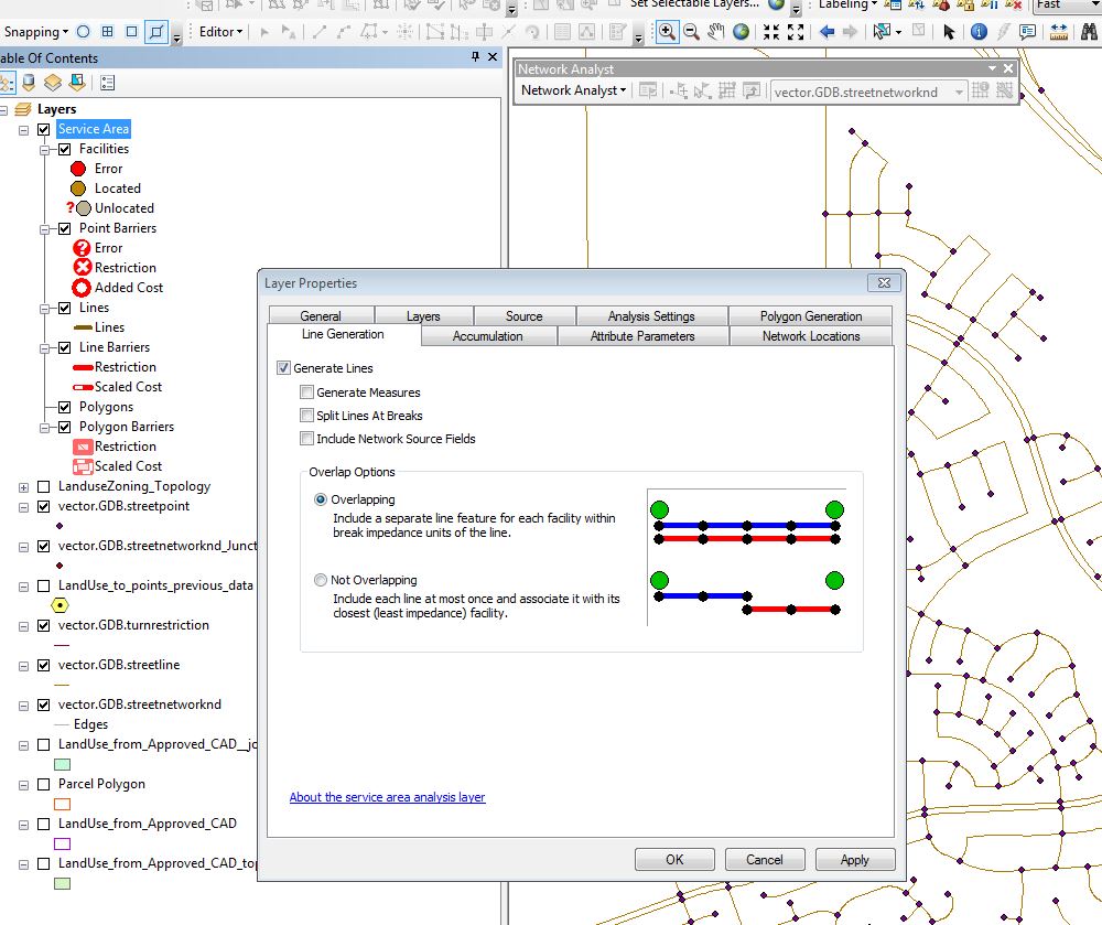
Another trick to determine connectivity is to run a "New Service Area" with Network Analyst, checking on the "Generate Lines" setting in the "Line Options" tab in the Service Area Properties. Use a very large distance for the "Search Tolerance" on the "Network Locations" tab so lines are generated across your whole dataset if possible. Then check the resulting lines to see where there are disconnects.
Chris Donohue, GISP