- Home
- :
- All Communities
- :
- Products
- :
- ArcGIS Maritime
- :
- ArcGIS Maritime Blog
- :
- Custom Nautical Charts as a Service
Custom Nautical Charts as a Service
- Subscribe to RSS Feed
- Mark as New
- Mark as Read
- Bookmark
- Subscribe
- Printer Friendly Page
- Report Inappropriate Content
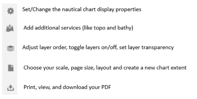
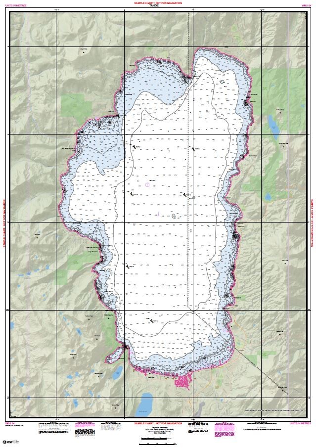
Many of us in the maritime community have already seen NOAA’s recent announcement, outlining their plan to sunset traditional nautical paper chart production. As one of the alternatives, NOAA has provided a service that allows you to print your own custom chart. But did you know, that in addition to making charts directly from S-57 data (Electronic Nautical Charts), this same custom chart application can also be used to combine nautical charts with other data and information services, like bathymetric and topographic content? With the chart on demand web app, creating a custom chart, like the one in the cover image for this article, takes just a few easy steps:
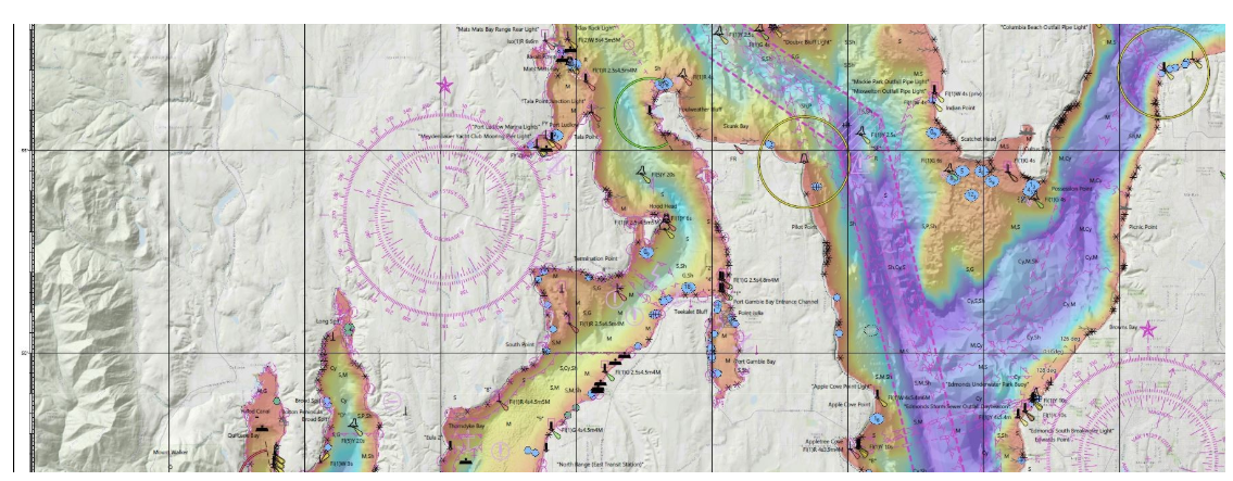
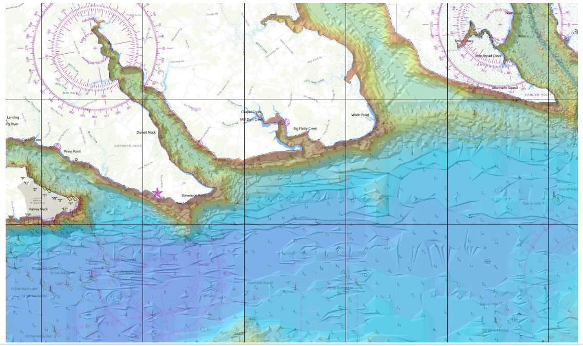
The article's cover image was made by combining a service containing NOAA nautical chart data, the USGS Web Map Service, and a Bathymetric Attributed Grid (BAG) Hillshade. Here are some other examples of custom charts I’ve made, takes less than 5 min. each. NOAA ENCs, NOAA Estuarine Bathymetry, World Hillshade and World Topographic Map Service:
All the services I used are freely available on ArcGIS Online. I hope you enjoy creating your own custom mash-ups. If you want to know more about how you can leverage traditional maritime data formats as web services, please contact us at maritime@esri.com
Cheers!
*Blog taken from Craig Green's LinkedIn post.
- Tags:
- arcgis for maritime
- arcgis for maritime bathymetry
- arcgis for maritime charting
- arcgis for maritime server
- arcgis maritime bathymetry
- arcgis online
- arcgis online sharing
- charts
- electronic navigational charts
- enc
- maritime
- maritime chart service
- maritime charting
- maritime charts
- maritime gis
- maritime operations
- maritime standards
- nautical
- nautical charting
- nautical solutions
- navigation charts
- noaa
- noaa charts
- noaa navigational charts
- oceans & maritime
- oceans and maritime
- online chart
- pod
- pods arcgis
- product on demand
- s57
- usgs
You must be a registered user to add a comment. If you've already registered, sign in. Otherwise, register and sign in.