- Home
- :
- All Communities
- :
- Developers
- :
- Game Engine Maps SDKs
- :
- Unity Maps SDK Questions
- :
- Water Layer as separate layer from Base Layer (and...
- Subscribe to RSS Feed
- Mark Topic as New
- Mark Topic as Read
- Float this Topic for Current User
- Bookmark
- Subscribe
- Mute
- Printer Friendly Page
Water Layer as separate layer from Base Layer (and Bathymetric Data underneath?)
- Mark as New
- Bookmark
- Subscribe
- Mute
- Subscribe to RSS Feed
- Permalink
We have a 3D Unity application that is for a very large coastal facility (50 square miles) that shows 3D models of vessels moving in and out of deep water channels, along coastlines, to and from docking facilities, etc.
In the short term we need a way to display the water so that it looks like water. We cannot use satellite imagery because it includes static imagery of vessels. Additionally it is static and we would ideally like the water to be 3D and animated like the 3D vessel models. Since water is part of the base terrain layer we cannot control it independently. Additionally because our map is a curved surface (to match earth coordinates) traditional game engine solutions of a water plane would not seem to work.
Long term we will be including bathymetric data we have gathered and modeled which will be displayed as the base terrain layer and then we will need / want to display the water as a 3D animated layer on top of that where we can model/display tides, wakes, storm surge, etc.
Any suggestions on how to solve both near and long term goals would be appreciated.
- Mark as New
- Bookmark
- Subscribe
- Mute
- Subscribe to RSS Feed
- Permalink
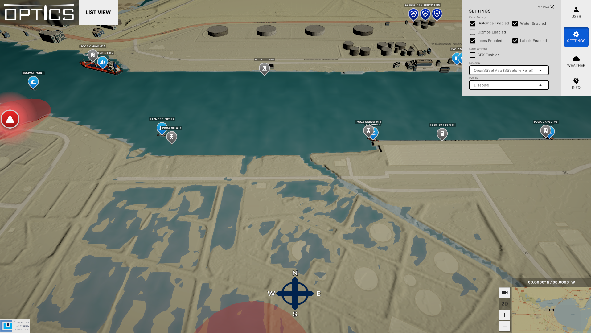
We added a water layer and flattened the local space as an experiment which is progress! The only way to hide the existing "water" in the base map was to put the water 2 feet above zero however that causes all sorts of other anomalies, mainly water in places we don't want it. In other words it makes it look like we are in a flood state. See attached for some example images of results.