- Home
- :
- All Communities
- :
- Products
- :
- Mapping and Charting Solutions
- :
- Mapping and Charting Questions
- :
- Re: Trasform coordinates on raster and las
- Subscribe to RSS Feed
- Mark Topic as New
- Mark Topic as Read
- Float this Topic for Current User
- Bookmark
- Subscribe
- Mute
- Printer Friendly Page
Trasform coordinates on raster and las
- Mark as New
- Bookmark
- Subscribe
- Mute
- Subscribe to RSS Feed
- Permalink
- Report Inappropriate Content
Hello.
I'm trying to transform coordinates on my raster file. I think I have succesfull done the raster conversion. But the base map is still in WGS 84 and I can't see the raster file anywere. I have tried to change the coordinat system on the properties for the map. I have tried to delete the base map but I still can't see the raster file.
Center of the raster file is suppose to be:
34.2100000000
0.0000000000
0.0000000000
-34.2100000000
-690861.5803218026
603704.2691675390
- Mark as New
- Bookmark
- Subscribe
- Mute
- Subscribe to RSS Feed
- Permalink
- Report Inappropriate Content
Or maybe I haven't even made the tranfsormation...
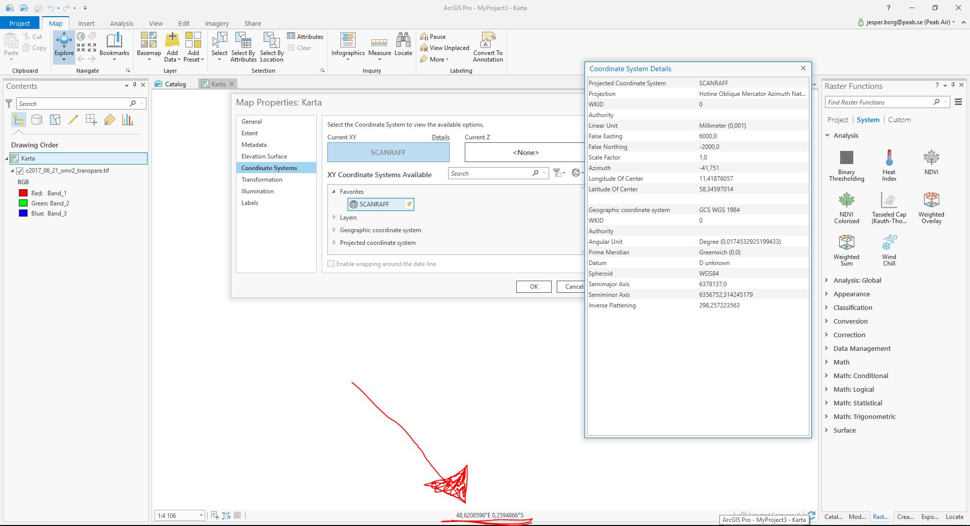
I tried to choose my system, scanraf but I when I choose it on the spacial reference box and klick OK, it dosen't appere an spacial reference to the right.
- Mark as New
- Bookmark
- Subscribe
- Mute
- Subscribe to RSS Feed
- Permalink
- Report Inappropriate Content
your prj is
PROJCS["SCANRAFF",GEOGCS["WGS 84",DATUM["unknown",SPHEROID["WGS84",6378137,298.257223563]],PRIMEM["Greenwich",0],UNIT["degree",0.0174532925199433]],PROJECTION["Hotine_Oblique_Mercator_Azimuth_Center"],PARAMETER["Latitude_Of_Center",58.34597014],PARAMETER["Longitude_Of_Center",11.41876057],PARAMETER["Azimuth",-41.751],PARAMETER["Rectified_Grid_Angle",0.0],PARAMETER["Scale_Factor",1],PARAMETER["False_Easting",6000],PARAMETER["False_Northing",-2000],UNIT["Millimeter",0.001]]
Hotine_Oblique_Mercator_Azimuth_Center"]Hotine_Oblique_Mercator_Azimuth_Center"]
perhaps? The header suggests projected values
-690861.5803218026
603704.2691675390
but I dont know if they are for that one
- Mark as New
- Bookmark
- Subscribe
- Mute
- Subscribe to RSS Feed
- Permalink
- Report Inappropriate Content
I tried to change it to Azimuth Center but no resaults so far 😕
I tried to do a new prj fil from the old one:
PROJCS["PreemRaff_1",GEOGCS["GCS WGS 1984",DATUM["D_WGS_1984",SPHEROID["WGS_1984",6378137.0,298.257223563]],PRIMEM["Greenwich",0.0],UNIT["Degree",0.0174532925199433]],PROJECTION["Hotine_Oblique_Mercator_Azimuth_Center"],PARAMETER["False_Easting",6000.0],PARAMETER["False_Northing",-2000.0],PARAMETER["Scale_Factor",1.0],PARAMETER["Azimuth",-41.751],PARAMETER["Longitude_Of_Center",11.41876057],PARAMETER["Latitude_Of_Center",58.34597014],UNIT["Millimeter",0.001]]But no success there either...
I'm not sure that I'm doning the transformation right...
What's the best way to change coordinates? To Export raster or Reprojection?
- Mark as New
- Bookmark
- Subscribe
- Mute
- Subscribe to RSS Feed
- Permalink
- Report Inappropriate Content
in order to do anything useful with the file it needs to be defined correctly first using the Define Projection tool in arctoolbox