- Home
- :
- All Communities
- :
- Products
- :
- Mapping and Charting Solutions
- :
- Mapping and Charting Questions
- :
- Points to Polygon?
- Subscribe to RSS Feed
- Mark Topic as New
- Mark Topic as Read
- Float this Topic for Current User
- Bookmark
- Subscribe
- Mute
- Printer Friendly Page
Points to Polygon?
- Mark as New
- Bookmark
- Subscribe
- Mute
- Subscribe to RSS Feed
- Permalink
- Report Inappropriate Content
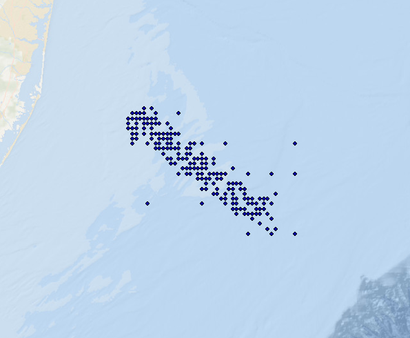
Hi, I'm very new to GIS. Could anyone tell me how I convert these points into a polygon? I am trying to display these ship coordinates as a zone/area, rather than points. I am using ArcMap 10.1 Thank you!
- Mark as New
- Bookmark
- Subscribe
- Mute
- Subscribe to RSS Feed
- Permalink
- Report Inappropriate Content
How about the Minimum Bounding Geometry geoprocessing tool...works with all licensing levels.
- Mark as New
- Bookmark
- Subscribe
- Mute
- Subscribe to RSS Feed
- Permalink
- Report Inappropriate Content
I like this option as well, I was trying to find it in the toolbox, and could not remember what name was.
- Mark as New
- Bookmark
- Subscribe
- Mute
- Subscribe to RSS Feed
- Permalink
- Report Inappropriate Content
Morgan you could go into ArcToolbox>Analysis Tools>Proximity>Create Thiessen Polygons. Once you create the Thiessen Polygon shapefile, go into an edit session, select all of your polygons, then go into the Editor menu on the editor toolbar and choose to dissolve, then you will be left with a polygon representing the outer boundary of all of your points.
- Mark as New
- Bookmark
- Subscribe
- Mute
- Subscribe to RSS Feed
- Permalink
- Report Inappropriate Content
I agree that this would work but does require an Advanced desktop license (not sure what Morgan has access to).
- Mark as New
- Bookmark
- Subscribe
- Mute
- Subscribe to RSS Feed
- Permalink
- Report Inappropriate Content
if you are a developer and you have arcview license you can use my code in ao https://github.com/nicogis/Voronoi
If you need create voronoi diagram on web I have made a PoC with js 4.0 beta1: http://sit5.sistemigis.it/demo/js/3d/voronoi/ (click on map and generate polygons from points clicked). You can edit js and upload your points and see your polygons.
If you have license 3d Analyst and arcview license you can create a tin (z=0) and from ao you can use method GetVoronoiRegion in ITinNode interface http://resources.arcgis.com/EN/HELP/ARCOBJECTS-NET/COMPONENTHELP/index.html#//002500000933000000 (If you need I send you a PoC).
You can use Dan tool python and arcview license http://www.arcgis.com/home/item.html?id=6e9bc6cbf93d4939b2eb04ff8519be47
- Mark as New
- Bookmark
- Subscribe
- Mute
- Subscribe to RSS Feed
- Permalink
- Report Inappropriate Content
If each zone is the same size and you just want a general idea of the area then you could buffer the points and create polygon circles. The resulting layer would be a polygon with the buffer areas.
- Mark as New
- Bookmark
- Subscribe
- Mute
- Subscribe to RSS Feed
- Permalink
- Report Inappropriate Content
You could also use Kernel Density (requires Spatial Analyst) to make a heatmap, then Reclassify (also SA) and convert Raster to Polygon. This would give you a series of concentric rings indicating frequency of observations. It takes a bit to fiddle with the parameters, but this is a very powerful visualization tool.
- V
- Mark as New
- Bookmark
- Subscribe
- Mute
- Subscribe to RSS Feed
- Permalink
- Report Inappropriate Content
Do you want a convex minimum polygons or concave hull (or neither), and what license level do you have?
- Mark as New
- Bookmark
- Subscribe
- Mute
- Subscribe to RSS Feed
- Permalink
- Report Inappropriate Content
If you want to go the triangulation route http://www.arcgis.com/home/item.html?id=6e9bc6cbf93d4939b2eb04ff8519be47 doesn't require an advanced license level and you can produce a Delaunay triangulation and produce a concave hull if your remove the exterior triangles from the triangulation then dissolve union the interior polygons if needed.
For other containers including convex hull and extent or oriented rectangles you can use http://www.arcgis.com/home/item.html?id=564e2949763943e3b9fb4240bab0ca2f