- Home
- :
- All Communities
- :
- Products
- :
- Mapping and Charting Solutions
- :
- Mapping and Charting Questions
- :
- masking polygon layers with holes
- Subscribe to RSS Feed
- Mark Topic as New
- Mark Topic as Read
- Float this Topic for Current User
- Bookmark
- Subscribe
- Mute
- Printer Friendly Page
masking polygon layers with holes
- Mark as New
- Bookmark
- Subscribe
- Mute
- Subscribe to RSS Feed
- Permalink
- Report Inappropriate Content
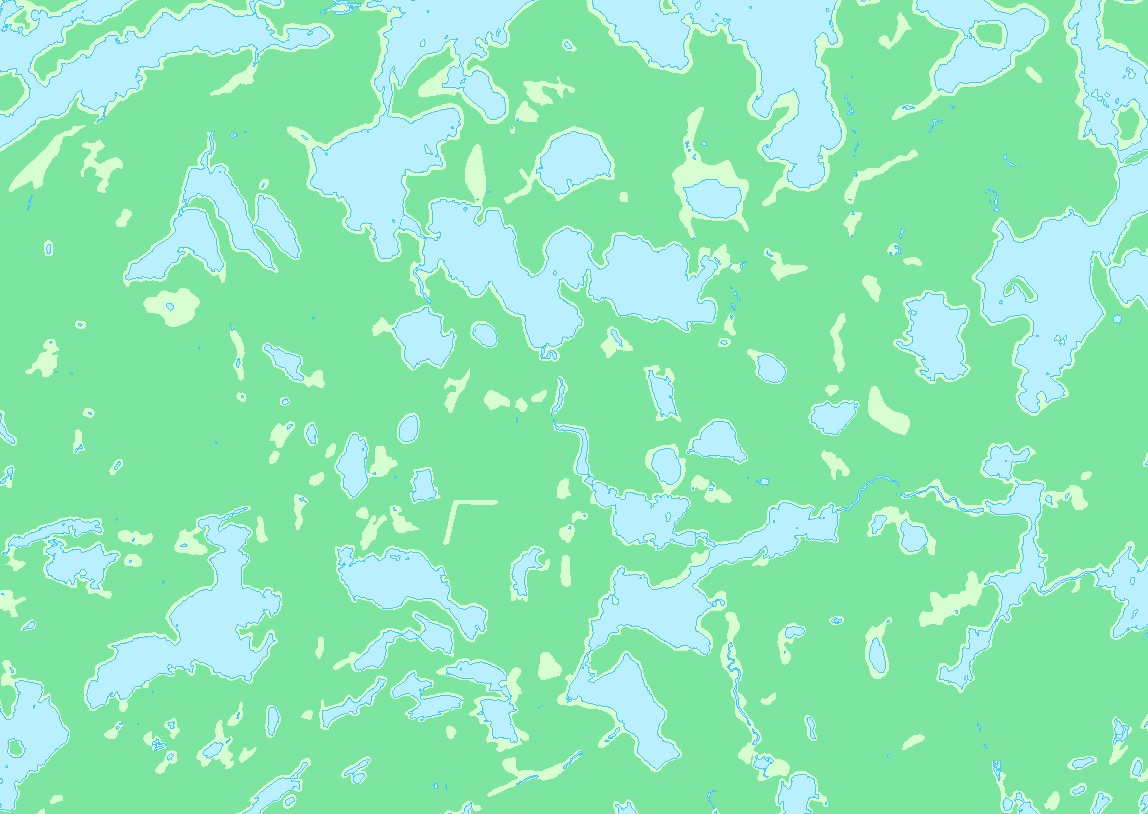
I have a base layer that represents an area that has two layers above it, one layer is lakes, the other layer is wooded area. In the image below the layer with the lakes is blue, the layer representing wooded area is green, the pale green is the base which covers the entire area. The pale green represents lowlands, low elevation.
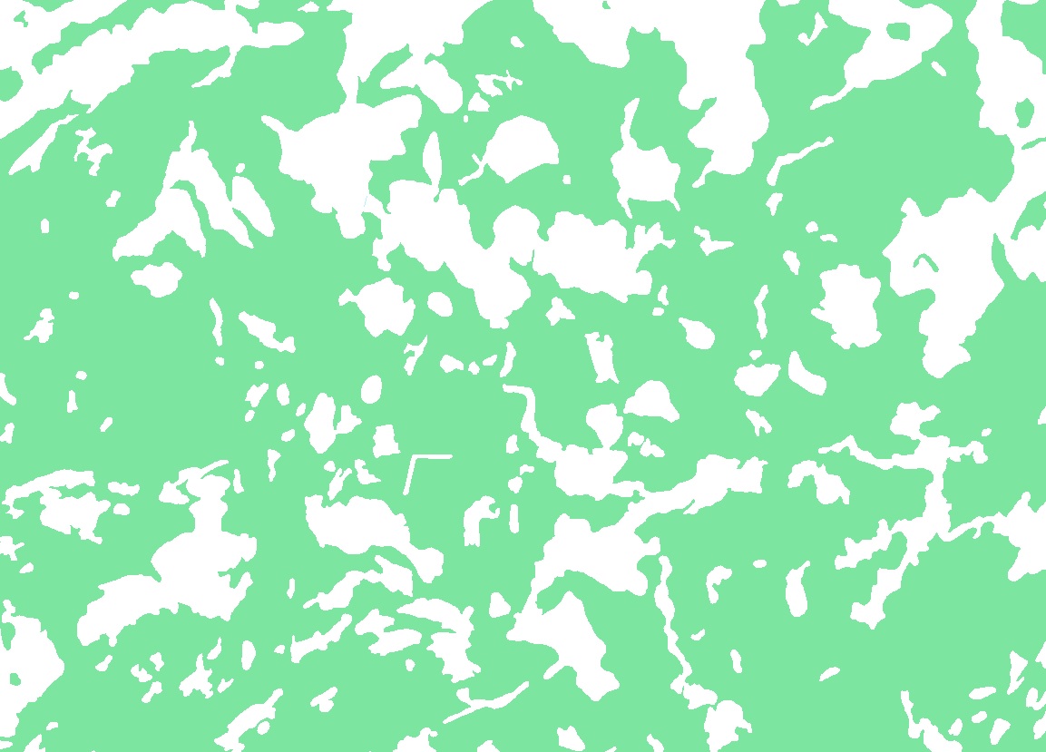
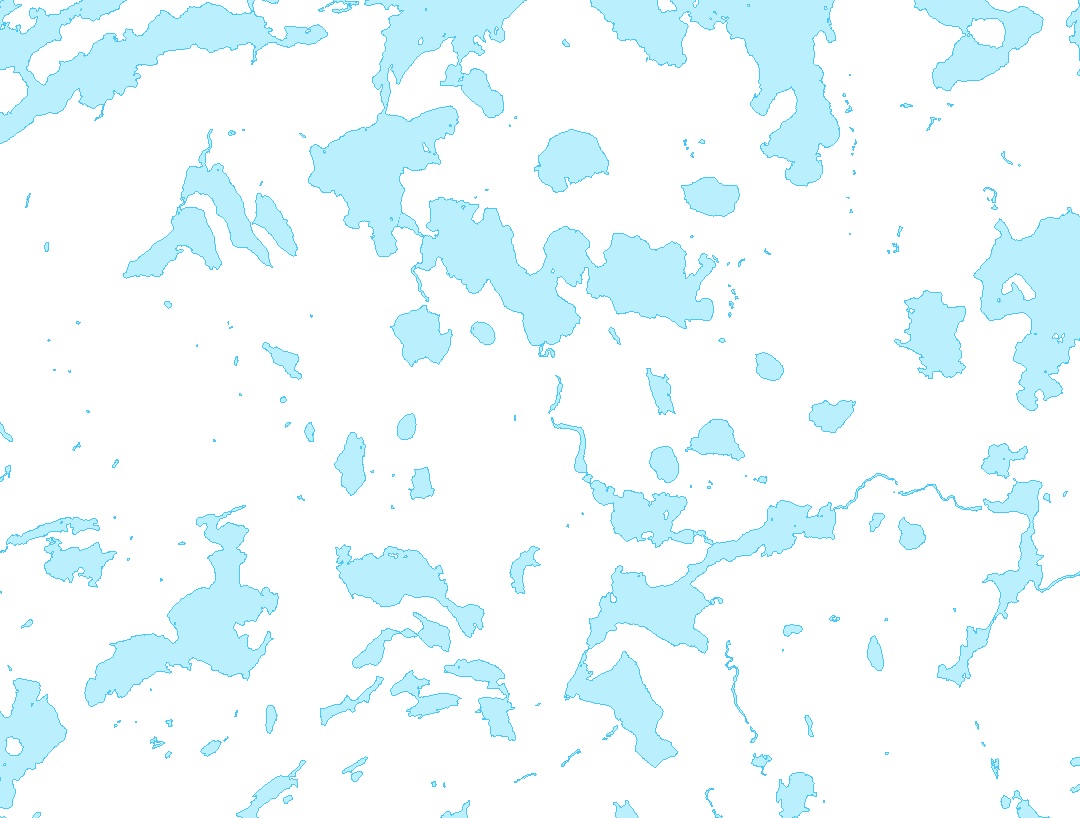
The two images below show the wooded layer and the lakes layer without the pale green base layer. If I set the three layers as shown above the pale green lowlands show through, but, when I add the elevation layer (DEM) the lowlands do not show through. I can add transparency to the DEM but that washes out the colors in the lakes and wooded area.
I would like to use the wooded and lakes layers to create some sort of masked area which represents only the lowlands. Then I will have some options to make the lowlands show through the DEM layer, I might be able to move the lowland layer above the DEM layer or make the color brighter, etc. Any ideas on how to create a layer representing only the pale green areas in the image above? I have used the Feature Outline Masking Tools to mask the contour labels but I don't know if that will work with polygons.
Solved! Go to Solution.
Accepted Solutions
- Mark as New
- Bookmark
- Subscribe
- Mute
- Subscribe to RSS Feed
- Permalink
- Report Inappropriate Content
You need to create a new feature class that is a rectangle or other simple shape covering the maximum extent where you want to have these light green areas occur. Name the feature class appropriately and assign it attributes that identify it as lowlands.
Then if you have an Advance license you can use the Erase tool twice for each of the two layers covering the lakes and forest one at a time. If you don't have an Advanced license you can use the Union tool twice for each of the two layers one at a time where you would use the result of the previous Union for the second Union operation (with an Advanced license you could run all 3 layers at once). The layer with an FID of -1 for the lakes and an FID of -1 for the forest will be the lowlands. You can then extract that selection into a new layer by turning off all of the fields from the lakes and forests in the layer with the selection that are not lowland fields and then using export or Copy Features.
- Mark as New
- Bookmark
- Subscribe
- Mute
- Subscribe to RSS Feed
- Permalink
- Report Inappropriate Content
Thank You! the erase tool worked perfectly and fast.