- Home
- :
- All Communities
- :
- Products
- :
- Mapping and Charting Solutions
- :
- Mapping and Charting Questions
- :
- Re: Help projecting WGS84 to D_North_American_1983...
- Subscribe to RSS Feed
- Mark Topic as New
- Mark Topic as Read
- Float this Topic for Current User
- Bookmark
- Subscribe
- Mute
- Printer Friendly Page
Help projecting WGS84 to D_North_American_1983?
- Mark as New
- Bookmark
- Subscribe
- Mute
- Subscribe to RSS Feed
- Permalink
- Report Inappropriate Content
Hi all,
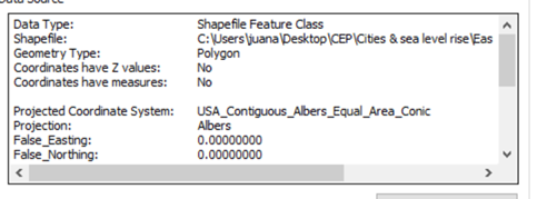
I have been doing some analysis for several US states, all of which have used the standard Albers projection (which as far as I understood uses datum D_North_American_1983):
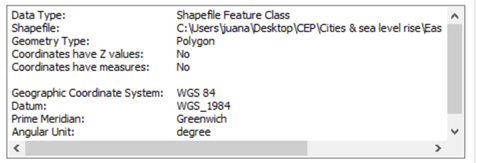
For one of my states, for a reason I'm yet to ascertain, there instead seems to be no projection but instead a Geographic Coordinate System set to "WGS 84":
This is causing me trouble as I can't join this state's data with the other datasets I am also using (and which are also in the same projection).
After some research, I tried to use the project tool and convert this shapefile to the same projection. However, I am getting the following message:
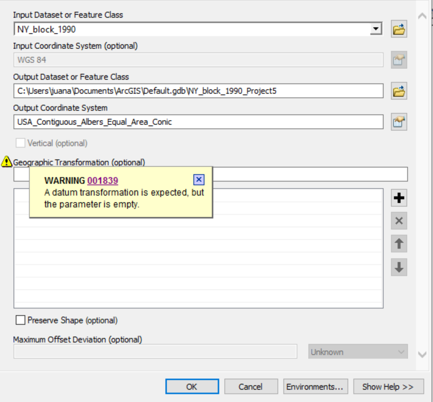
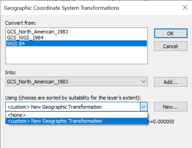
When I try to carry out a "datum transformation" (In data framework > transformations), however, the options for this transformation specification are blank:
Does anybody have any suggestion as to what I could try? My goal is to have this state projected on Albers so that I can combine with other datasets as I have done with a number of other states.
Thank you,
Juan
projecttowebmercator coordinate transformation projection transformation #projection
- Mark as New
- Bookmark
- Subscribe
- Mute
- Subscribe to RSS Feed
- Permalink
- Report Inappropriate Content
What version of ArcMap are you using? Something seems fishy with the coordinate system being 'wgs 84'.
If you go into the dataframe properties and coordinate systems you should be able to see the coordinate system details of your layers. Mine reads as Geographic coordinate system GCS_WGS_1984. It could be a funky custom GCS.
The default transformation that pops up is WGS_1984_(ITRF00)_To_NAD_1983 but I believe NAD_1983_To_WGS_1984_5
would be best suited (but i'm not from North America so don't hold me to it).